
Clan Associations in Singapore: How Migrants Built New Communities
Key Takeaways
Singapore’s clan associations grew from practical needs among migrants, then became places where identity, welfare and memory could take root.
- They connected people through surnames, dialects and ancestral districts.
- They helped newcomers find work, lodging, advice and mutual support.
- Their halls supported education, worship, ceremonies and social life.
- Cooperation gradually linked separate Chinese communities across the colony.
- Today, many associations preserve language, archives, buildings and living traditions.
What Singapore clan associations are and why they mattered
Singapore clan associations were community organisations formed around shared ancestry, locality or dialect. For migrants arriving without close family nearby, they offered a familiar name and a practical point of contact. They were neither simply social clubs nor replacements for the family home. Their importance lay in bringing several kinds of support together under one roof.
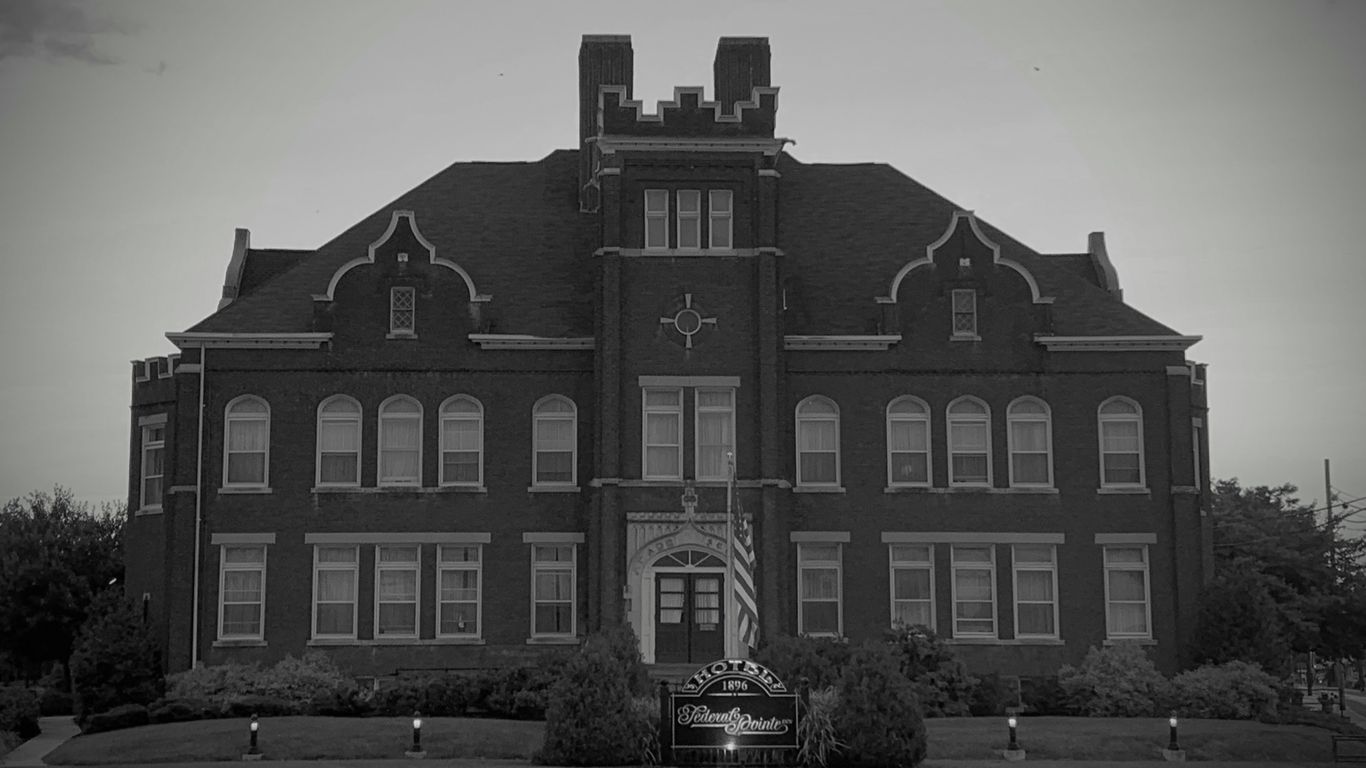
Their story belongs to the wider history of ordinary people who made lives in the port, from shopkeepers and traders to labourers and teachers. The everyday lives of Singapore communities reveal why these organisations mattered: migration was not only a movement of people, but also a careful rebuilding of routines, obligations and trust.
From shared surnames to regional and dialect identities
Some associations gathered people who shared a surname or belonged to an extended lineage. Others were organised around a district, county, village or wider region in southern China. Dialect communities could also form powerful networks, allowing people who spoke Hokkien, Teochew, Cantonese or Hakka to recognise one another in a busy and unfamiliar town.
The boundaries were not always neat. A person might belong through a family name, an ancestral place and a dialect connection at the same time. This layered identity is central to understanding the diverse nature of clan associations, which included both bloodline-based and locality-based organisations.
How associations differed from temples, guilds and secret societies
A temple centred on religious observance, while a guild usually brought together people working in the same trade. A clan association was more closely tied to kinship or place of origin, although its activities could overlap with worship, commerce and ceremony. It might manage a hall, support a school, organise a funeral or mediate a disagreement.
Secret societies operated under very different conditions and carried different legal and social meanings. Clan associations, by contrast, developed as recognisable community bodies and were subject to colonial regulation. Their public role rested on mutual aid rather than secrecy, even when everyday life brought them into contact with temples, merchants and other organisations.
The role of trust in a migrant society
Trust had a practical value in a port where newcomers often arrived with little money, few documents and no established reputation. A recommendation from someone known to an association could open a door to work or a bed in a crowded lodging house. Shared speech and remembered places gave strangers a reason to take one another seriously.
That trust was never automatic, and it could be unevenly distributed. Associations had rules, elders and expectations, but they also created ways for people to be seen and vouched for. Trust became a form of infrastructure: less visible than a road or quay, yet essential to moving through the city.
Why these organisations became centres of belonging
Belonging was made through repeated small encounters. Members met to discuss family matters, settle practical questions, mark festivals and remember those who had died. A hall could feel administrative in the morning and warmly domestic by evening, filled with conversation, tea, incense or the sound of rehearsals.
For migrants whose families remained in China, the association offered continuity without pretending that Singapore was merely temporary. It made room for inherited customs while allowing a new local life to develop. That balance would become more complicated as the colony changed and later became an independent nation.
The migrant networks that shaped early Singapore
Early Singapore was tied to the sea routes of Southeast Asia and to the towns, villages and districts of southern China. New arrivals followed relatives, employers, boat crews and business contacts rather than travelling into a blank landscape. They entered networks already shaped by trade, language and obligation.
These connections influenced where people stayed, how they found work and whom they trusted. They also explain why the history of Singapore cannot be told only through governors, buildings or commercial statistics. The Singapore River’s working history brings the movement of goods and labour into view, including the human effort behind the port’s growth.
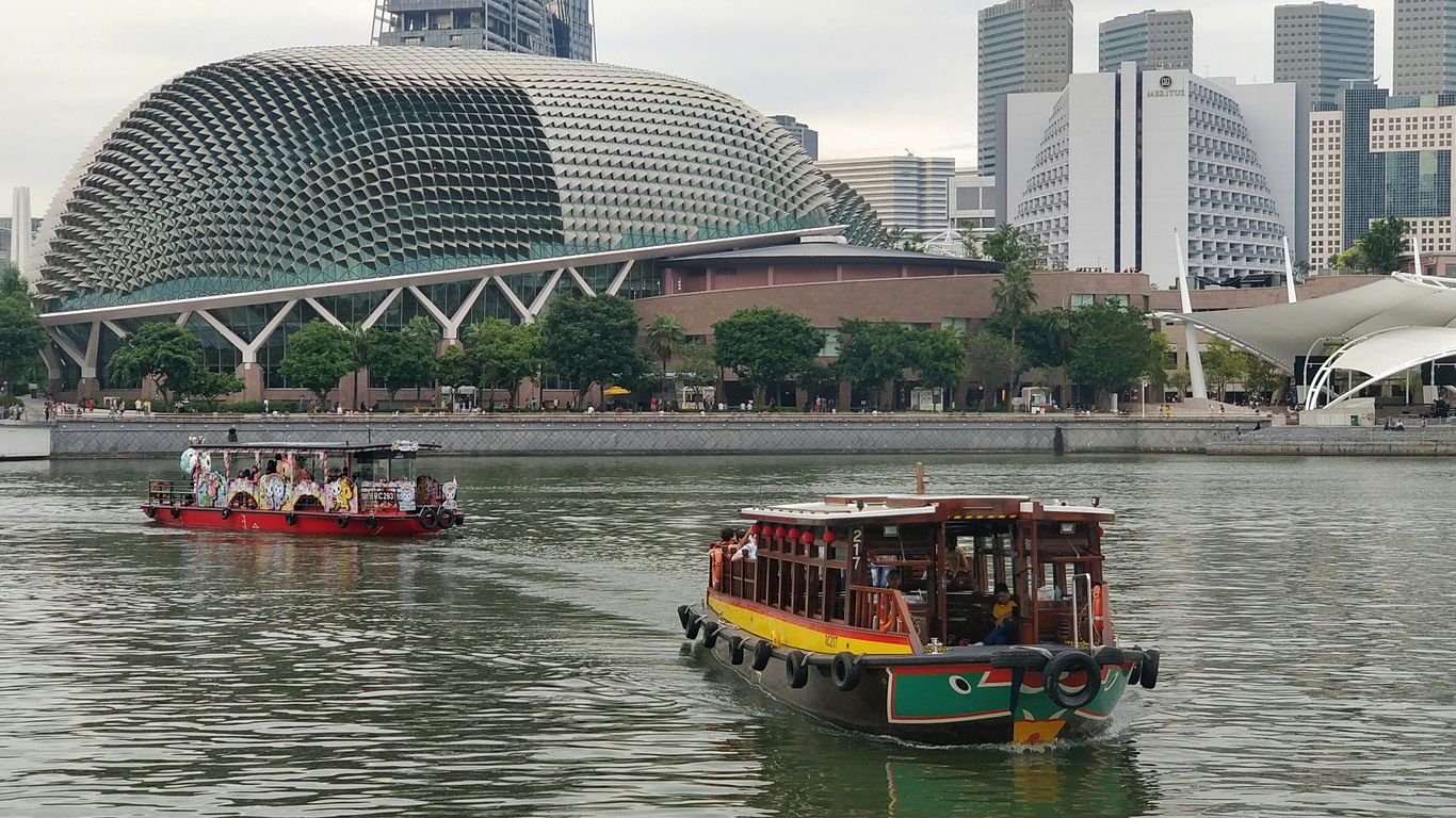
Southern China, maritime trade and the flow of newcomers
Many Chinese migrants came from coastal and river-connected parts of southern China, where maritime trade had already created links with ports across the region. Singapore’s position made it a place of arrival, transfer and opportunity. Some newcomers intended to earn money and return home; others gradually brought relatives over and settled more permanently.
The passage was not a single experience. Merchants, artisans, domestic workers and labourers encountered different risks and prospects. Yet most benefited from some form of prior connection, whether a village contact, a dialect association or a business partner who had arrived earlier.
Hokkien, Teochew, Cantonese and Hakka community ties
Dialect identity shaped social life as well as speech. Hokkien networks were influential in commerce and community organisation; Teochew ties supported trading and food businesses; Cantonese communities included artisans, workers and merchants; and Hakka associations maintained connections among people from several related districts. These descriptions are broad, and individual lives frequently crossed them.
The associations gave such identities an institutional form. They could collect subscriptions, maintain records and organise assistance, turning a shared background into something more durable than a spoken accent heard in a crowded street. At the same time, no dialect group was isolated from the others: markets, workplaces and neighbourhoods brought people into daily contact.
How regional origins influenced settlement patterns
People often clustered near relatives, employers or others who could help them settle. Such patterns shaped shophouse rooms, boarding houses, places of worship, markets and streets of specialised work. They were not fixed ethnic enclaves in the modern sense, but practical concentrations that made information and support easier to reach.
Chinatown’s old shophouses still help readers imagine this relationship between arrival and daily life. The early immigrant life of Chinatown can be read through shared living spaces, trade connections and the close relationship between lodging and employment. The built environment was part of the network, not merely its backdrop.
The importance of kinship when families were far away
Kinship could be literal, remembered through a genealogy, or created through shared obligation. An older member might guide a younger arrival, introduce him to a shop owner or explain which customs mattered at a funeral. These relationships could soften loneliness, though they also placed duties on the newcomer to contribute in turn.
Letters, remittances and ancestral rites kept distant families present in everyday decisions. An association helped hold those distant ties in a local setting. It was a place where someone could speak of home while learning how to live somewhere else.
How associations supported everyday life
The value of clan associations was often clearest in ordinary situations: a person needed a room, a job, a loan, a translator or help with a burial. Their work did not always appear in official histories because it took place through conversations, introductions and modest subscriptions. Still, those practical acts shaped whether newcomers could establish themselves.
Support varied between organisations and over time. Some had greater resources, stronger buildings or wealthier patrons than others. Across the network, however, the principle was recognisable: members contributed when able so that assistance could be available when circumstances turned difficult.
Finding work, accommodation and business contacts
A new arrival rarely knew which employer was reliable or which lodging house would accept him. Association members could offer introductions and warnings, sometimes helping someone enter a trade already familiar to the group. Business contacts extended beyond formal employment, linking suppliers, shopkeepers, boatmen and customers.
The arrangement was reciprocal. A newcomer gained access to knowledge, while the association gained another member who might later contribute money, labour or expertise. In a dense port city, a recommendation could be more useful than a general advertisement because it carried personal accountability.
Providing welfare, loans and support during hardship
Welfare could include emergency money, food, help with illness or support for a member’s dependants. Loans were especially significant for people who lacked access to formal banking or had no property to offer as security. Associations could also collect funds after a death, fire or business failure.
The forms of support were shaped by the resources of each body, but several recurring needs stand out. They show why the organisations were more than ceremonial institutions:
- short-term help for illness, injury or unemployment;
- introductions to employers, landlords and trusted traders;
- contributions towards funerals and transport of remains;
- assistance for widows, orphans and elderly members.
Such help did not remove hardship. It made hardship less isolating, which was often the difference between a temporary crisis and a permanent collapse. Mutual aid worked because members saw contribution as a future responsibility, not simply a present benefit.
Helping newcomers navigate language and local customs
Language shaped every encounter, from negotiating wages to speaking with officials. A dialect-speaking association could explain unfamiliar procedures and make a newcomer’s needs intelligible to people outside his immediate circle. Members also learned the customs of a multilingual colonial town through one another.
This guidance was informal and practical. It might involve explaining how a market worked, where to find a particular kind of medicine or how to arrange a religious ceremony. The association translated not only words, but expectations.
Arranging burials, ancestral rites and care for the vulnerable
Death exposed the insecurity of migration. Someone who died far from home still needed a funeral, a grave and the observances expected by family. Associations could help arrange these matters, maintain cemetery connections and communicate with relatives across the sea.
Care for vulnerable members continued beyond the funeral. Elderly people without close family, widows and children could receive attention through association funds or personal networks. These responsibilities joined the practical and spiritual sides of community life, reminding members that belonging included obligations at the beginning, middle and end of a life.
The buildings and institutions behind community life
A clan association became visible through its premises. The hall, school, cemetery or charitable institution gave community ties a physical address, often in streets crowded with businesses and homes. These places stored registers and ancestral tablets, but they also held meetings, lessons, performances and meals.
Their significance can be easy to miss when a city is viewed only through preserved façades. A building’s value lies partly in what happened inside it: who was welcomed, who made decisions and which families returned year after year. Heritage is often found in these accumulated uses.
Clan association halls as social and administrative spaces
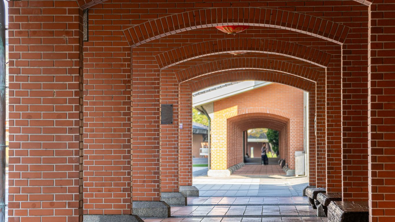
The hall was a meeting place, office, reception room and ceremonial setting. Committee members discussed subscriptions and welfare cases, while elders handled introductions or disputes. During festivals, the same rooms could become bright with banners, music and visiting relatives.
A hall also created a sense of permanence. Migrants might change jobs or move between rented rooms, but the association’s address endured as a shared point of reference. Its registers and minutes made community history legible, even when individual stories were never recorded elsewhere.
Schools, scholarships and the expansion of education
Education became one of the most lasting ways associations invested in the future. Schools taught literacy, languages and cultural knowledge, while scholarships helped capable students continue their studies. Such efforts reflected a shift from supporting immediate survival to preparing younger generations for wider opportunities.
The schools were not separate from migration history. They were responses to families trying to give children choices that the first generation had lacked. Later, formal education expanded through public systems, but association support continued to express a commitment to language, learning and communal responsibility.
Hospitals, cemeteries and other shared services
Some associations helped establish or finance services that individual households could not easily provide. Medical care, burial grounds and charitable facilities addressed risks that followed migrants through every stage of life. They also made community responsibility visible to the wider city.
The scale of provision differed greatly, so no single model describes every association. A small surname group might concentrate on rites and welfare, while a larger regional body could support schools or substantial charitable work. The table below shows how these institutions complemented one another.
| Institution | Immediate need | Wider community effect |
|---|---|---|
| Association hall | Meetings, records and ceremonies | A stable public home for members |
| School or scholarship fund | Learning and advancement | Greater opportunities for younger generations |
| Cemetery or burial network | Rites and care after death | Continuity with family and ancestral practice |
| Hospital or charitable service | Treatment and relief | Shared protection during serious hardship |
Together, these places formed a loose social infrastructure. They connected a person’s working life to education, illness, family duty and remembrance rather than treating each need as separate.
Festivals, opera and rituals that reinforced identity
Culture made membership felt. Opera, festivals, ancestor rites, dinners and language activities brought people together in ways that were not reducible to welfare. They offered younger members a way to encounter inherited traditions through sound, food, movement and participation.
Ritual also helped communities adapt. A ceremony carried memories from an ancestral district, yet took place in Singapore among neighbours and friends. Over time, these repeated occasions turned migration into a local history with its own calendar.
How associations built bridges across migrant communities
Separate associations could protect particular identities, but the city required cooperation as well. People traded across dialect lines, lived beside one another and faced common colonial regulations. Community leaders therefore had to hold two ideas together: preserving a distinct inheritance and participating in a shared Singapore.
This bridge-building was gradual and sometimes uneasy. It involved formal federations, public events, schools and negotiations over language and cultural expression. It also reflected the changing political meaning of being Chinese in a multilingual colony.
Cooperation between surname, dialect and regional organisations
Associations collaborated when a problem exceeded the capacity of one group. They might coordinate charitable work, support public celebrations or speak collectively about community concerns. Surname organisations brought intimate kinship ties, while regional and dialect bodies often had wider membership and stronger institutional resources.
Cooperation did not erase difference. It allowed groups to exchange knowledge and present a more connected civic presence. The result was a network made from many small loyalties rather than a single organisation that replaced them all.
The Singapore Federation of Chinese Clan Associations
The Singapore Federation of Chinese Clan Associations emerged from efforts to give the wider network a common platform. Its formation in the 1980s reflected concern about ageing and declining membership, as well as a wish to revitalise the associations’ cultural and educational roles. The federation continues to represent and support Chinese clan associations in Singapore, as described in this account of the Singapore Federation.
Its importance is organisational as much as symbolic. An umbrella body can share programmes, encourage cooperation and help smaller associations remain visible. It also gives the public a way to understand clan associations as part of Singapore’s civic and cultural history rather than as isolated private clubs.
Negotiating cultural identity in a multilingual colony
Colonial Singapore contained several major language communities, and public life required constant negotiation between them. Chinese associations sought to maintain language and customs while operating within institutions shaped by British administration and a diverse population. Their schools, newspapers, ceremonies and meetings all took part in that negotiation.
Identity was therefore not a sealed inheritance. It was spoken, taught and adjusted in response to neighbours, workplaces and changing political conditions. The associations helped people retain a sense of origin while making that origin intelligible in a shared urban setting.
Tensions between local belonging and ties to China
Many members retained strong emotional and family connections to ancestral places in China. Yet their children might be born in Singapore, attend local schools and imagine their future on the island. The association had to accommodate both attachments without assuming that one cancelled the other.
These tensions became sharper as ideas of citizenship and nationhood developed. A community could honour ancestral rites while participating fully in Singapore’s civic life. The eventual direction was not simple severance, but a gradual rebalancing of where belonging was felt and practised.
Change after independence
Independence altered the setting in which clan associations worked. A developing state began to provide services that associations had once supplied through subscriptions and personal networks. Housing, schools, healthcare and welfare became increasingly organised on a national scale.
That change reduced some older pressures, but it also weakened the everyday necessity of belonging to a clan association. Members moved more often, married across community lines and used common institutions. Associations had to ask what their role could be when survival no longer depended on the same forms of mutual aid.
The decline of traditional clan networks
The decline was uneven rather than absolute. Some associations retained active committees and substantial programmes, while others faced ageing memberships, fewer volunteers and difficulty attracting younger people. The loss of older welfare functions made the difference particularly visible.
Decline also reflected success in the wider society. When people could find housing, education and assistance through public systems, a clan association no longer needed to carry every burden. Its challenge became proving the continuing value of connection, memory and cultural practice.
Housing policy, mass education and a more mobile population
Mass public housing changed the geography of daily life. Families moved into planned estates with schools, markets and community facilities, often far from the shophouses and halls associated with earlier migrant districts. Shared routines became less dependent on dialect neighbourhoods.
Education encouraged communication across language communities and opened paths beyond inherited occupations. Mobility brought freedom and opportunity, but it also loosened the dense local networks that had once made an association an almost unavoidable part of adult life.
From welfare providers to cultural and heritage organisations
As public services expanded, many associations placed greater emphasis on culture, education and heritage. Language classes, scholarships, exhibitions and celebrations became ways to keep membership meaningful. Some also preserved genealogies, photographs, meeting records and buildings that might otherwise have disappeared.
This shift did not make the organisations merely decorative. Cultural work can carry relationships across generations, especially when it is linked to real family histories and community responsibilities. The history of Singapore’s transformation shows how quickly the city’s institutions and routines changed, giving preservation a clear social purpose.
Adapting activities for younger Singaporeans
Younger members may not speak the ancestral dialect fluently or recognise the names in an old register. They may still be curious about a great-grandparent’s village, a family association or the reason a festival is observed in a particular way. Associations that begin with those questions can make tradition feel open rather than compulsory.
Some have responded through talks, performances, educational activities and collaborations. Singapore Heritage’s storytelling experiences take a related approach by connecting visitors and residents with community stories in the places where those stories unfolded. The emphasis is on conversation and lived detail, not on treating heritage as a distant display.
Why Singapore clan associations still matter today
Singapore clan associations remain valuable because they hold forms of knowledge that are difficult to replace. A government record may show a date, while an association archive can reveal a family connection, a meeting practice or the names of people who quietly supported one another. A building can hold the atmosphere of repeated gatherings as well as its formal architectural features.
Their future depends on remaining useful to people who live differently from earlier generations. That may mean welcoming members without the old dialect fluency, making archives easier to access or connecting historic places with thoughtful public programmes. The wider community memory work in Singapore demonstrates how residents can help keep local stories active through photographs, recollections and shared research.
Preserving language, genealogy and family histories
Language classes and dialect activities can preserve more than vocabulary. They keep open a route into jokes, names, songs and family stories that may not translate neatly into English or Mandarin. Genealogies likewise give individuals a way to place themselves within a much longer chain of migration and settlement.
These records need careful interpretation. A surname does not explain an entire life, and family histories often include movement between dialect groups, religions and neighbourhoods. Associations can preserve complexity by recording personal memories alongside formal lineage documents.
Maintaining historic buildings and community archives
Historic halls are vulnerable to rising land values, expensive repairs and changing patterns of use. Their survival depends on more than preserving a façade. The rooms, furniture, plaques, registers and ceremonial objects all help explain how the organisation functioned.
Archives require similar care. Digitisation can improve access, but handling old photographs and documents also demands consent, context and credit. Singapore Heritage’s researched gifts reflect a related principle: objects are intentionally limited, researched with the community, credited to their makers and designed to keep a story alive.
Supporting cultural events in a changing city
Festivals, performances and talks give an association a public life. They allow neighbours and visitors to encounter traditions without requiring prior family membership, while giving older members a reason to pass on knowledge. Food, music and ritual can make an historical subject immediate and generous.
The strongest events avoid presenting culture as frozen. They show how a practice has travelled, changed and found a place in Singapore. Singapore Heritage’s heritage walks similarly connect people with neighbourhoods, foodways, objects and everyday practices through small-group experiences led by storytellers familiar with the streets.
What their survival reveals about migration and belonging
The survival of clan associations suggests that modern citizenship does not remove the need for smaller circles of belonging. People still want to know where their families came from, who cared for earlier generations and how a neighbourhood acquired its habits. At the same time, those circles must remain porous enough to welcome people whose lives no longer fit older categories.
Their history is therefore neither a story of disappearance nor a simple revival. It is a record of adaptation: from mutual aid to cultural work, from private membership to public heritage, and from distant ancestral ties to a rooted Singaporean identity.
CTA: Walk the Stories
Readers can explore these layers on a Singapore Heritage small-group heritage walk, where local storytellers connect streets, places and community memories. Book a walk to encounter Singapore’s history at walking pace.
Conclusion
Singapore clan associations helped migrants turn uncertainty into community, using shared names, places and obligations to build a life in a new port. Their halls and institutions supported work, welfare, education, ritual and memory, while their later adaptations show that belonging can change without becoming empty. Their stories remain close to the streets, buildings and everyday practices that continue to make Singapore feel like home.
Frequently Asked Questions
What were Singapore clan associations?
They were community organisations formed around shared surnames, ancestral districts, regional origins or dialect identities, providing mutual support and cultural connection.
Why did migrants join clan associations?
Migrants joined to find practical help such as work contacts, accommodation advice, welfare, loans, language assistance and support with funerals or family matters.
Were clan associations the same as temples?
No. Temples centred on religious worship, while clan associations focused more directly on kinship, locality, welfare, education and community administration, though the two could work closely together.
Which communities formed clan associations in Singapore?
Hokkien, Teochew, Cantonese and Hakka communities formed many associations, alongside groups based on particular surnames, villages, counties and regions.
What happened to clan associations after independence?
Many traditional welfare functions shifted to the state, and housing, education and greater mobility loosened older networks. Associations increasingly focused on culture, heritage, scholarships and community events.
Why are clan association buildings historically important?
Their halls preserve evidence of meetings, ceremonies, education, welfare and social life. Their records and objects can also reveal family and community histories that are absent from official accounts.
Do clan associations still matter today?
Yes. They continue to preserve language, genealogy, archives, buildings and cultural practices, while offering younger generations ways to explore migration and belonging.
Key Takeaways
Singapore’s disappearing places are remembered not only for their buildings, but for the routines, friendships and ordinary encounters that happened around them.
- Rochor Centre, Dakota Crescent and Tanglin Halt show how public housing became part of family memory.
- Sungei Road, Pearl Centre and Golden Mile Complex reflect older forms of shopping, trading and social life.
- The National Stadium and Jurong Drive-In Cinema held shared experiences that are difficult to recreate.
- Paya Lebar Airport and the KTM line shaped neighbourhoods far beyond their gates and tracks.
- Remembering these places means listening to residents and noticing the everyday details behind the landmarks.
1. Rochor Centre and its brightly coloured housing blocks
Rochor Centre was easy to recognise from a distance. Its blocks, painted in strong bands of red, yellow, blue and green, brought a cheerful rhythm to a dense part of the city. For many Singaporeans, the sight was tied to bus rides, school journeys and the first glimpse of town after coming in from the north.
The estate was more than a colourful façade. Shops and services at ground level gave residents reasons to linger, while the corridors above held the quieter sounds of daily life: doors opening, neighbours chatting and meals being carried home. The blocks made public housing feel unusually theatrical without losing its practical, lived-in character.
Its disappearance showed how quickly a familiar urban landmark can become a memory. A photograph preserves the colours, but not the coolness of the void deck or the small social ease of meeting someone downstairs. The wider heritage stories of Singapore often become clearest through such details, where architecture and routine are inseparable.
2. Sungei Road Thieves’ Market and its jumble of old treasures
Sungei Road Thieves’ Market had a rough, improvised energy that no polished retail complex could quite reproduce. Sellers laid out old radios, tools, watches, household objects and curious odds and ends, while buyers sifted through the jumble with patience. The pleasure was partly in the search and partly in the conversations that grew around an item’s possible use or history.
The market’s name carried a complicated past, but its later life was also a record of reuse and informal enterprise. A battered object could still have a second life, and a buyer might find something useful beside something simply strange. That mixture made the place feel less like a shop than a temporary theatre of things.
![Old objects arranged at a Singapore street market]
Its closure left behind more than nostalgia for bargains. It marked the fading of a kind of open-ended public space where people could browse without a plan, talk to strangers and spend very little. The market survives in remembered gestures: crouching beside a display, turning an object over, and asking whether it still works.
3. The old National Stadium and its unforgettable match-day atmosphere
The old National Stadium was a gathering place on a grand scale, but its strongest memories are often tactile. Fans remember the long approach, the crush at the entrances, the concrete terraces and the roar rising as players appeared. On match days, the stadium seemed to gather the whole country into one noisy, expectant bowl.
Football mattered there because it was shared. Families arrived early, school groups filled sections, and supporters carried their loyalties through the gates. The atmosphere was not polished or quiet; it was made from drums, flags, hawkers, shouted opinions and the collective reaction to every near miss.
When the stadium was demolished, the city lost a setting that had held several generations of public emotion. Modern venues may offer clearer views and better facilities, but memory is stubborn about atmosphere. For former spectators, the old place remains in the echo of a crowd and the feeling that, for a few hours, everyone was watching the same thing.
4. Jurong Drive-In Cinema, Singapore’s open-air movie theatre
Jurong Drive-In Cinema offered a very different kind of outing. Families and couples could arrive by car, tune in to the film through a speaker and watch beneath the open sky. The experience carried the small freedoms of a night out: snacks passed between seats, windows lowered to catch the air and children trying to stay awake until the final scene.
It was also a marker of a changing western Singapore. Jurong was being built as an industrial and residential town, and the cinema gave the new landscape a place for leisure and spectacle. The large screen stood apart from the enclosed theatres that later became the norm, making the journey itself part of the occasion.
The drive-in has vanished, but the idea remains vivid because it joined technology with simple sociability. People were not merely watching a film; they were arranging themselves around it, with the car becoming a little private room inside a much larger public event. That is why old cinema memories often include the parking area, the food and the weather as much as the plot.
5. Golden Mile Complex and the lost glamour of Beach Road
Golden Mile Complex once looked like a vision of the future. Its stepped terraces, crowded balconies and deep bands of concrete gave Beach Road a distinctive profile, while the building brought shops, offices, food and community life into one unusually ambitious structure. It was sometimes called a vertical city, a description that made sense once visitors moved through its layered interior.
Inside, the complex developed its own atmosphere. Travel agencies, restaurants, grocery shops and informal meeting points made it especially familiar to Thai and Southeast Asian communities, but its appeal extended well beyond them. The building’s importance came from that mixture: modernist design shaped by the people who occupied it.
Golden Mile’s story is a reminder that architectural heritage is not only about clean lines or famous designers. It also belongs to the shopkeepers, diners, workers and travellers who gave the building its tone. A useful way to read such places is through Singapore’s street names, since roads often preserve layers of commerce and movement even when the buildings around them change.
![Golden Mile Complex against an evening city sky]
For many observers, the building’s future has felt like a question about what kind of urban character can survive redevelopment. The lost glamour of Beach Road is not simply a longing for old concrete. It is a longing for a city where a building can be distinctive, imperfect and socially specific at the same time.
6. Dakota Crescent and the everyday life of a beloved estate
Dakota Crescent became beloved through its modest scale and familiar shape. Built in the early years of Singapore’s public-housing programme, the estate was known for low-rise blocks, open spaces and a strong sense of neighbourliness. Its courtyards and walkways encouraged people to see one another in passing rather than disappear straight behind a lift lobby.
Residents remember the estate through ordinary scenes: children playing downstairs, older neighbours sitting near the block and meals bought from nearby stalls. The architecture mattered, but so did the pauses it allowed. Small daily encounters gave the estate its identity more powerfully than any single landmark.
As redevelopment reshaped the area, memories of Dakota Crescent became part of a larger conversation about housing and belonging. A new flat can be comfortable and well planned, yet still produce a different social rhythm. The affection for Dakota comes from the feeling that its spaces had room for unplanned life.
7. Tanglin Halt and the changing face of Singapore’s public housing
Tanglin Halt was one of Singapore’s earliest public-housing estates and, for decades, one of its most recognisable communities. Its blocks, market and food centre formed a familiar daily circuit for residents from Queenstown and beyond. The estate was never just a collection of flats; it was a web of routes, greetings, errands and dependable faces.
The market was especially important because it brought together food, work and memory. A visit might involve buying vegetables, collecting breakfast and exchanging news with a stallholder known for years. The older estate’s value lay in this closeness, where a practical errand could also be a social visit.
The replacement of older blocks with newer housing has made Tanglin Halt a vivid example of urban transition. The physical changes are visible, but the deeper question concerns continuity: which relationships, businesses and habits can move with residents? Singapore Heritage approaches this kind of living history through neighbourhood walks and story-led experiences, helping people look beyond façades to the communities that made them meaningful.
The estate also shows why memories should be recorded before a move becomes complete. Residents may recall a particular staircase, coffee-shop table or shortcut more clearly than an official plan ever could. Those details help explain how public housing functioned as a social world, not merely as an answer to a housing shortage.
8. Pearl Centre and the old shopping culture around People’s Park
Pearl Centre stood within a part of Chinatown shaped by movement, trade and constant foot traffic. Its shops offered clothing, jewellery, services and everyday goods, while the surrounding People’s Park area made shopping feel like a full afternoon rather than a quick transaction. Visitors wandered, compared prices and returned to familiar counters.
The old shopping culture depended on repetition. Customers knew which shop carried a particular item, which stallholder would explain a repair and which corridor led most quickly to a favourite food stop. It was personal in a practical way, built through recognition rather than formal customer service.
As retail habits shifted towards air-conditioned malls and online buying, places like Pearl Centre came to represent a slower form of urban commerce. Their value was not that every shop was unchanged, but that the surrounding environment encouraged browsing and conversation. The building’s memory sits comfortably beside the old kopitiam objects and routines documented in everyday coffee-shop culture, where ordinary purchases also became social rituals.
9. Paya Lebar Airport and the neighbourhood shaped by its runways
Before the airport moved to Changi, Paya Lebar Airport occupied a much larger place in the imagination of the surrounding neighbourhood. Aircraft approached low over the eastern suburbs, and residents learned the sound and timing of arrivals. For children especially, the sight of a plane passing overhead could interrupt an afternoon completely.
An airport changes more than the land inside its fences. Roads, shops, housing and work patterns develop around the movement it generates, while flight paths become part of the local soundscape. Paya Lebar’s old presence therefore survives in stories about watching aircraft, travelling to the terminal and living with a landmark that was always in motion.
The airport’s relocation altered that relationship, leaving behind a landscape with different possibilities and fewer dramatic arrivals overhead. Yet the neighbourhood still carries traces of its former role. The memory is not only about aviation; it is about how infrastructure can quietly organise the habits and imagination of an entire district.
10. The old Bukit Timah Railway Station and memories of the KTM line
The old Bukit Timah Railway Station was a small, evocative part of the former KTM line through Singapore. Its platform, station building and trackside setting suggested a slower journey across the island, far removed from the speed and scale of present-day transport. For passengers, railway workers and nearby residents, it was a practical place before it became a heritage image.
The line connected Singapore to the peninsula and carried more than trains. It was part of family trips, commuting memories and a wider sense of movement between communities. Even people who rarely travelled by rail often knew the crossings, heard the trains or treated the tracks as a familiar boundary in the landscape.
When the railway land returned to Singapore, the tracks fell silent and the old route entered a new phase. The station remains a useful reminder that infrastructure has emotional weight. A line can be measured in kilometres, but remembered through a wave from a carriage, a level crossing at dusk or the particular sound of a train passing behind a row of homes.
The ten places in this list also show why disappearing places singapore are never only a collection of vanished structures. They are records of how people met, shopped, travelled, watched films and made ordinary life feel shared. For readers tracing those layers, the vanishing landmarks guide offers another way into the city’s changing physical memory.
Walk Through Living Memory
A Singapore Heritage walk offers a gentle way to meet these stories in the places and neighbourhoods where they still have echoes. Readers can plan a walk with local context in mind, treating each route as an invitation to listen rather than simply tick off landmarks.
Conclusion
Singapore changes quickly, but memory gives its older places a continuing life. Rochor Centre’s colours, Tanglin Halt’s market and the quiet railway station at Bukit Timah remain meaningful because people attached routines and relationships to them. To remember them well is to notice the human texture behind the buildings, and to carry that attention into the neighbourhoods that are still here.
Frequently Asked Questions
What makes a place a disappearing place in Singapore?
A disappearing place may be demolished, redeveloped, relocated or simply transformed until its former character is no longer recognisable. Its disappearance can be physical, social or both.
Why do former public-housing estates inspire such strong memories?
Estates were often complete daily worlds, with markets, playgrounds, corridors, schools and familiar neighbours close together. People remember the repeated encounters as much as the buildings themselves.
Is Golden Mile Complex important only because of its architecture?
No. Its stepped modernist form matters, but so do the businesses, communities and regional connections that gave the building its particular life.
What happened to the old National Stadium?
The old stadium was demolished and replaced as Singapore’s sporting facilities evolved. Its match-day atmosphere, however, remains strongly remembered by former spectators.
Can the former KTM railway route still be explored?
Parts of the former railway corridor and station area can be encountered as heritage landscapes, although access and conditions vary. Visitors should check current arrangements and respect surrounding communities.
Why is Paya Lebar Airport part of neighbourhood history?
The airport influenced local sounds, views, roads, travel patterns and the imagination of nearby residents. Its role extended beyond the terminal boundary.
How can people record memories of changing neighbourhoods?
They can speak with residents, label old photographs, note everyday details and share stories with proper consent and attribution. Small recollections often preserve the most personal history.
Key Takeaways
Singapore’s public housing story is also a story about ordinary routines: cooking, greeting neighbours, raising children and sharing space.
- The HDB reshaped a severe housing shortage into a long-term national programme.
- High-rise flats brought private kitchens and bathrooms to many households.
- Corridors and void decks created in-between spaces for social life.
- Estate planning connected homes with schools, markets, transport and community facilities.
- HDB living remains successful and deeply familiar, while affordability, ageing and memory raise fresh questions.
The origins of Singapore’s public housing transformation
The story of Singapore’s public housing history begins with a shortage of safe, affordable homes and a city under intense pressure to modernise. Housing was never treated as a matter of shelter alone; it became part of planning, public health and nation-building. The result was a built environment that changed where people lived, but also how they encountered one another each day.
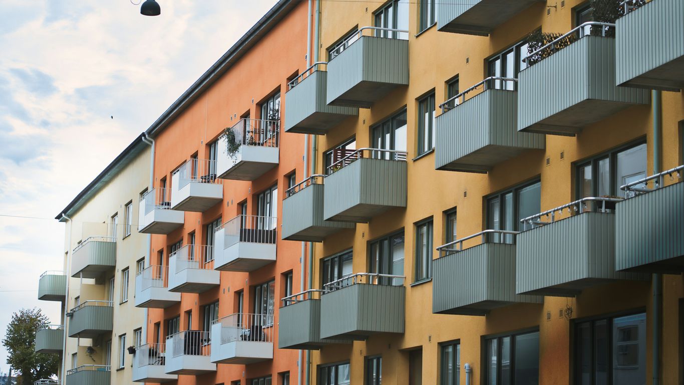
From housing shortage to national priority
In the years after the Second World War, many families lived in crowded rooms, kampongs or informal settlements. Conditions varied, but overcrowding, poor sanitation and insecure tenure made housing a pressing public concern. Clearing land and rehousing residents could improve physical conditions, yet it also disturbed established livelihoods and close-knit networks.
The scale of the problem made small, piecemeal improvements insufficient. Housing had to be produced quickly, in large numbers and alongside roads, schools and utilities. That practical urgency gave public housing a central place in Singapore’s early development.
The creation of the Housing and Development Board
The Housing and Development Board was established in 1960, taking over responsibilities from the Singapore Improvement Trust. Its early work focused on emergency housing and the resettlement of kampong residents, before the programme developed into a broader system of flats for sale and long-term estate planning.
This institutional shift mattered because housing became coordinated at an island-wide level. The HDB could plan blocks, transport routes and neighbourhood facilities as parts of one system rather than as isolated building projects. Queenstown’s early housing story shows how the first satellite town model combined high-rise flats with essential services and everyday community life.
Why high-rise estates suited a growing city
Land scarcity made the vertical estate a practical answer to rapid population growth. Building upwards allowed more households to live near roads, workplaces and public facilities, while leaving room for parks, playgrounds and shared ground-level spaces. It was an ambitious change from the dispersed patterns of kampongs and the tightly packed urbanity of shophouses.
High-rise living also introduced a new rhythm. Residents moved through lifts, stairwells, corridors and void decks, meeting people who might previously have lived in a different village or district. The block became both a building and a small social geography.
How home ownership became part of the social contract
Public housing gradually moved beyond emergency accommodation towards an ownership model. Flats for sale gave households a stake in the places where they lived, while the state continued to shape eligibility, lease arrangements and the wider supply of homes. This linked housing with family security and national belonging.
The arrangement was never simply private property in the conventional sense. It combined public provision, regulated access and the possibility of household wealth, producing a distinctive social contract. The model is often discussed as a policy achievement, but its meaning was also intimate: a key, a doorway and a room that a family could call its own.
Designing a new kind of everyday home
The HDB flat was a carefully repeated idea, but repetition did not make every home feel the same. Families brought different habits, languages, furniture and memories into broadly standardised spaces. Over time, the flat became a canvas on which residents adapted official plans to the untidy needs of daily life.
The shift from kampongs and shophouses to flats
Moving into a flat changed the relationship between household and street. A kampong family might have known the ground, drains, lanes and neighbours as one continuous setting. Shophouse residents often lived above or behind workplaces, with domestic and commercial life layered into the same narrow building.
The flat separated rooms more clearly and placed the household within a larger vertical structure. That separation brought privacy and improved facilities, but it also required residents to learn new forms of neighbourliness. Reading Singapore’s shophouses helps explain what was being left behind: five-foot ways, shared thresholds and buildings that held homes, trades and social life together.
Standardised layouts with room for adaptation
Standardisation made construction faster and helped public agencies provide homes at scale. Yet the plan was only the beginning of a flat’s life. Residents enclosed balconies, rearranged furniture, built storage and selected tiles, curtains or paint colours that made a generic interior more legible as home.
The tension between a repeated plan and individual adaptation is part of the architecture’s interest. A corridor may look uniform from a distance, while each doorway tells a slightly different story. Inside, domestic arrangements reveal what a plan could accommodate and what it could not.
How flat sizes reflected changing family life
Different flat sizes responded to changing expectations about household life. Early units were often compact and plainly finished, suited to the urgent task of rehousing large numbers of people. Later homes offered more rooms, greater comfort and layouts that recognised the needs of growing families and older residents.
The number of rooms was never the whole story. A living room could become a study, bedroom or dining area; a service yard could hold laundry, plants or improvised storage. Flat size reflected policy, income and family structure, but use revealed the more flexible reality.
The practical logic behind lifts, blocks and estate planning
Blocks, lifts and paths were arranged to make a large population manageable. Lift access reduced the burden of height, while block spacing allowed light and air to reach homes. At estate level, shops, schools, playgrounds and transport stops made daily errands possible without long journeys.
The design encouraged movement through shared areas rather than directly from private door to car. That mattered socially. A child walking to school, a resident buying breakfast or an older neighbour resting downstairs could encounter the same estate from a different pace and perspective.
Why the kitchen became a symbol of modern living
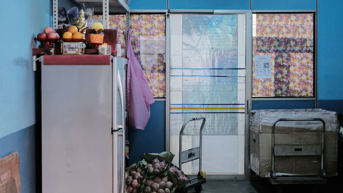
The kitchen may be one of the smallest rooms in a flat, but it carries an unusually large part of the housing story. It marks the move from shared or improvised facilities towards domestic privacy, reliable utilities and planned household work. It also exposes the expectations placed on families, especially on the people who cooked, cleaned and organised meals.
From shared facilities to private cooking spaces
A private kitchen offered control over when and how food was prepared. It made storage, washing and cooking part of the household’s own territory, rather than activities negotiated through a shared yard or communal facility. For families accustomed to crowded arrangements, that privacy could feel as significant as the extra room itself.
The kitchen also held cultural continuity. Familiar ingredients and cooking methods travelled into the new flat, even when the setting changed. A wok, spice jar or rice cooker could make a modern room feel connected to an older home.
The kitchen as a site of family routines and expectations
Meals organise time. Someone buys vegetables, someone prepares breakfast, someone washes plates, and children learn when to keep clear of the stove. In a compact flat, these routines become visible and audible to the rest of the household.
The kitchen therefore became a measure of modern comfort, but also a place where family expectations were repeated. Its tiled surfaces and fitted counters suggested order; everyday life supplied the spills, interruptions and compromises. The room was practical, symbolic and often emotionally charged.
How ventilation, appliances and flat layouts changed domestic work
Windows, exhaust fans and service yards helped manage heat, smoke and laundry in a tropical climate. Appliances reduced some forms of manual work and introduced others, as households learned to budget for electricity, maintain equipment and fit new objects into limited cupboards.
The layout shaped the labour as much as the appliance did. A kitchen close to the dining space made serving easier, while a narrow passage could turn several people preparing food into a slow dance of elbows and bowls. Small design decisions mattered because they were repeated thousands of times in ordinary homes.
What the kitchen reveals about gender and household labour
Domestic modernisation did not automatically distribute labour equally. Cooking and cleaning remained associated with gendered expectations, even as appliances and improved facilities changed the manner of the work. The private kitchen could offer dignity and efficiency while keeping unpaid labour largely out of public view.
Looking closely at the room makes those contradictions harder to overlook. Its history includes technological change, family affection and the invisible effort required to keep a household running. A kitchen is not only evidence of better housing; it is evidence of who was expected to make that housing function.
Corridors as thresholds between private and public life
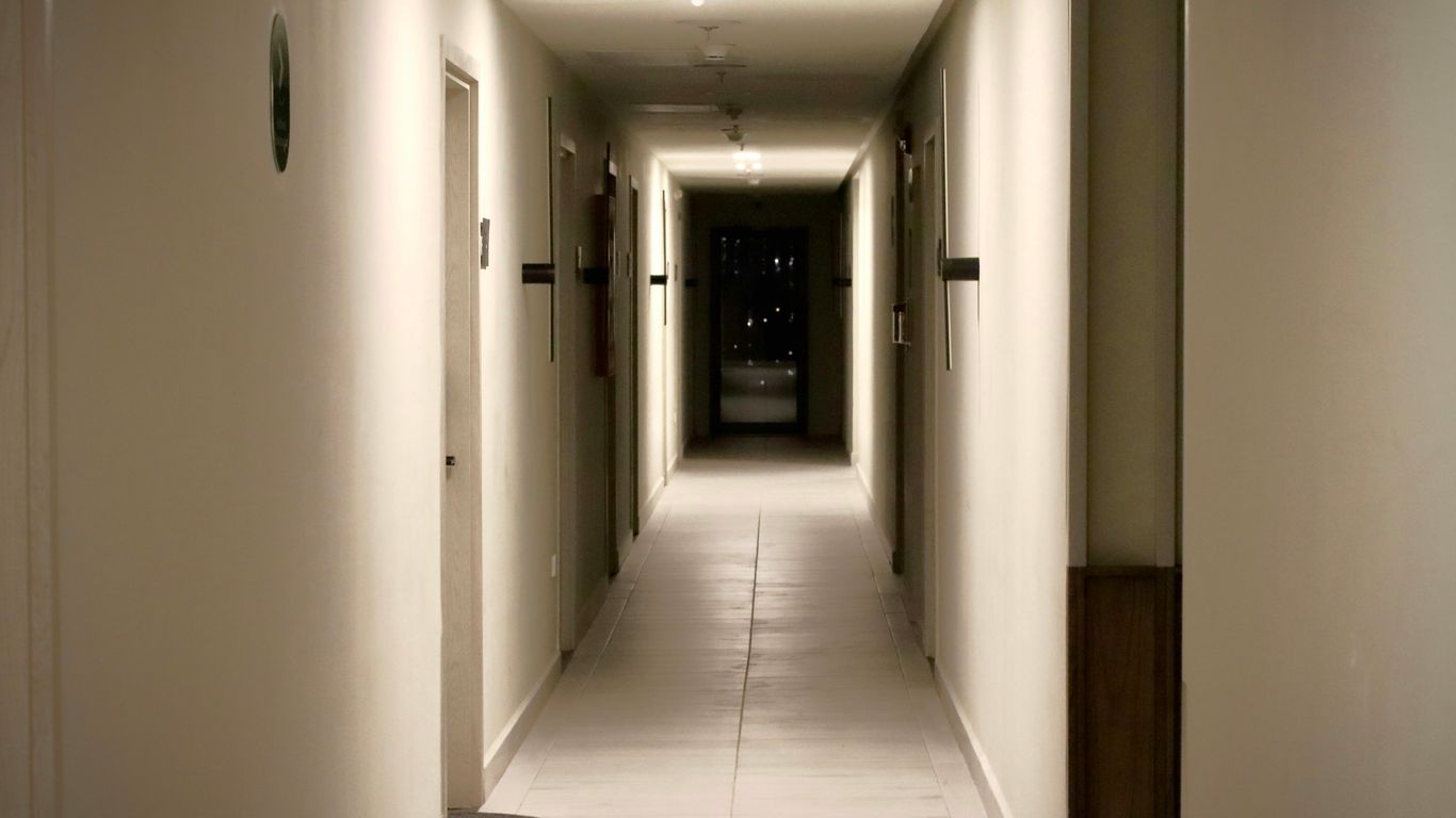
The corridor is where the HDB flat stops being an entirely private idea. It is a route to the lift, a place for a brief conversation and, at certain hours, an extension of the home. Its social life depends on small acts of accommodation: a neighbour moving aside, a child lowering their voice or a resident recognising a familiar pair of slippers.
The corridor as access route, meeting place and play space
At its most basic, the corridor allows residents to reach their doors. In practice, it can hold greetings, deliveries, bicycles, school bags and children’s games. The sounds of footsteps, cooking and conversation travel through it, giving residents an impression of lives beyond their own walls.
That openness is especially important in a high-rise setting. The corridor offers contact without requiring a formal invitation. People can remain neighbours rather than friends, yet still develop a quiet familiarity over repeated encounters.
Doors, shoes and plants: making a standard flat feel personal
Residents personalise thresholds with objects that are useful, decorative or both. Shoes outside a door, potted plants, festive ornaments and small shelves announce a household’s habits without revealing everything inside. These details make a repeated architectural plan feel inhabited.
They also create a visual record of change. A new plant may signal a new interest; a child’s shoes may appear beside an older relative’s walking stick. The corridor gathers these small signs of family life, though always within the limits of shared access and building rules.
Neighbours, noise and the everyday negotiation of privacy
Proximity brings both companionship and friction. Voices, renovations, footsteps and smells can cross boundaries that walls appear to define. Residents negotiate these intrusions through timing, courtesy and sometimes direct conversation, learning how much of communal life they can comfortably share.
The corridor’s lesson is not that privacy disappears in a flat. Rather, privacy becomes a practice. It is made through doors, habits and mutual restraint, not simply delivered by a floor plan.
How corridor culture has evolved in newer estates
Newer estates often provide a wider range of shared facilities, landscaped routes and formal gathering points. Digital communication has also changed how neighbours organise, complain and offer help. A corridor may be quieter in one sense, yet connected to a much larger network through residents’ groups and messaging apps.
Even so, the threshold remains important. People still leave things outside doors, pause by lifts and recognise neighbours by routine. The materials change, but the social question remains: how can many households live close together without becoming strangers?
The void deck and the invention of shared space
The void deck is one of the most recognisable features of the HDB estate. It is neither a street nor a living room, neither fully programmed nor entirely empty. By lifting blocks above an open ground level, planners created a sheltered space that could absorb the unpredictable uses of community life.
Why HDB blocks were raised above an open ground level
An open ground floor allowed air to move through the block and gave residents a shaded place to pass beneath it. It also made room for circulation, access and communal activities without assigning every corner a single purpose. In a dense estate, that flexibility was valuable.
The void deck connected the block to its surroundings. Residents could cross it on the way to a shop, wait there during rain or sit near the entrance while keeping an eye on children. It was architecture designed to remain available.
Funerals, weddings and community events beneath the block
Because the space was sheltered and close to homes, the void deck could host ceremonies and gatherings that needed room beyond an individual flat. Funeral wakes, wedding celebrations and community events brought different households into a shared setting, often with practical support from neighbours.
These occasions made the estate feel more than a collection of units. Tables, chairs, flowers and food temporarily transformed an ordinary passage into a place of collective attention. When the event ended, the space returned to its everyday openness, carrying a little of the memory with it.
Children’s play and informal social encounters
Children used the void deck as a meeting point before playgrounds, phones and organised activities became central to childhood. Adults sat nearby, chatted while waiting for meals or watched the movement around the block. Such encounters were often incidental, which was part of their strength.
The history of playgrounds captures this quality particularly well. Old dragon playgrounds were not merely recreational structures; they became visual markers of estates and shared memories. A child’s route to play could therefore become part of a neighbourhood’s identity.
How regulations and redevelopment have reshaped the void deck
The void deck has never been entirely free from rules. Safety, access, noise and the needs of residents all affect what can happen there. Redevelopment and upgrading may introduce new facilities or alter familiar sightlines, sometimes improving comfort while making older uses less possible.
That tension is unavoidable in a living estate. Shared space must remain safe and workable, but too much control can remove the informality that gave it meaning. The challenge is to improve the setting without erasing the habits that made residents claim it as their own.
Building communities through estate design
A successful estate depends on more than the quality of its flats. It needs places to buy food, learn, worship, wait, play and meet people at different stages of life. Planning these uses within reach turned housing into a neighbourhood system rather than a set of isolated towers.
Schools, markets and transport within walking distance
Walking routes gave the estate its daily pulse. Children travelled to school, older residents visited markets, and workers passed through transport interchanges on the way to other parts of the island. The proximity of services reduced travel time and created repeated encounters.
Markets were especially important because shopping was social as well as practical. The sounds of bargaining, chopping and conversation made food provision part of neighbourhood life. A wet market’s daily rituals show how trust and familiarity can grow through repeated, ordinary transactions.
Neighbourhood planning across generations and backgrounds
New towns brought together households with different origins, occupations and ages. Planning could not erase those differences, but shared facilities gave residents opportunities to encounter one another. Paths, playgrounds and seating areas supported contact without requiring everyone to participate in the same way.
This approach also allowed families to remain near schools, relatives and services as their circumstances changed. An estate could be a first home for young parents, a workplace-adjacent base for adults and a familiar landscape for older residents.
Community clubs, hawker centres and shared routines
Community clubs provided organised activities, while hawker centres supplied affordable meals and a setting for unplanned conversation. Together with coffee shops, clinics and shops, they created routines that were both functional and cultural. The places mattered because people returned to them repeatedly.
The food landscape is especially revealing. Hawker centres as civic spaces traces how purpose-built dining rooms grew from street vending and became shared places shaped by Chinese, Malay, Indian and Peranakan influences. Eating there is an everyday act, but it also connects residents to migration, work and adaptation.
The role of HDB estates in shaping social cohesion
Estate design can encourage social cohesion, though it cannot manufacture trust on its own. Shared spaces work when residents use them, care for them and recognise one another within them. Community is built through repetition: the same lift, the same stall, the same bench and the same faces encountered over years.
For that reason, an estate should be read as a social archive. Singapore Heritage’s storytelling experiences take a similarly attentive approach, using neighbourhoods, objects and everyday practices to connect people with local memory rather than treating architecture as a backdrop.
The lasting legacy and unfinished questions of HDB living
The HDB estate is now part of the mental map of Singapore. Its blocks, kitchens, corridors and void decks hold memories of resettlement, family growth, work and ageing. Yet the system is not frozen: homes are upgraded, estates are rebuilt, and expectations about space, ownership and comfort continue to change.
How public housing became part of Singaporean identity
For many Singaporeans, the flat is the setting of childhood, marriage, caregiving and return. Its familiarity carries emotional weight, even when residents notice its limitations. Public housing became a visible expression of collective progress and a material part of belonging.
That identity is also made from ordinary details. A lift lobby remembered after school, a corridor decorated for a festival or a kitchen table used for homework can matter as much as a landmark. The nation’s story is present in these repeated domestic scenes.
Ageing estates, upgrading and the preservation of memory
Older estates require repairs, accessibility improvements and new infrastructure. Upgrading can make homes safer and more comfortable, but it may also replace surfaces, playgrounds and informal corners that residents associate with earlier life. Physical renewal can therefore feel like both care and loss.
Preserving memory does not always mean preserving every structure unchanged. It may involve recording residents’ stories, retaining distinctive details or interpreting how a place developed. Tiong Bahru before its cafés offers one example of how an estate’s earlier housing experiment and everyday routines remain part of its present character.
Affordability, inequality and changing expectations
The public housing system has provided security for many households, but it also faces difficult questions about cost, access and uneven advantage. A flat can be a home, a long-term lease and a financial asset, and those meanings do not always sit comfortably together. Younger households may measure success against expectations shaped by earlier generations.
Household sizes, work patterns and care responsibilities have changed as well. A layout that once seemed generous may feel constrained when several generations share it, while a well-located flat may carry pressures that are not visible from the outside. The next phase of public housing will have to address both material affordability and the emotional value of staying rooted.
What Singapore’s public housing history means for future estates
Future estates will inherit the basic questions that shaped the early programme: how to house people fairly, how to connect homes with services and how to make density liveable. They will also need to respond to climate, ageing, changing family forms and the desire for more varied spaces. Technology may assist, but it cannot replace thoughtful planning or resident knowledge.
A useful lesson is that housing succeeds through relationships between buildings and routines. Singapore Heritage’s researched gifts follow a related principle on a smaller scale: an object can carry a neighbourhood story when it is made thoughtfully, rooted in research and connected to the people behind it. For residents and visitors, explore local heritage stories is one way to keep looking beyond the familiar façade.
Experience Singapore’s Living Heritage
Singapore’s housing story is best encountered at walking pace, where a block’s ground floor, a market’s morning trade and a corridor’s small signs of life can be noticed together. Singapore Heritage’s small-group heritage walks bring residents and visitors into neighbourhood stories led by people familiar with the streets. Readers can book a heritage walk to explore these living layers with greater context.
Conclusion
HDB changed Singaporean life by making housing a shared national project and by giving everyday activities new settings: the private kitchen, the in-between corridor and the open void deck. Those spaces made modern living possible while preserving room for habit, adaptation and community. Their continuing story shows that public housing is not only about buildings; it is about how people turn planned space into home.
Frequently Asked Questions
What does HDB stand for?
HDB stands for the Housing and Development Board, Singapore’s statutory board responsible for public housing. It was established in 1960 and succeeded the Singapore Improvement Trust in this role.
Why did Singapore build high-rise public housing?
High-rise construction allowed a land-scarce city to house many people at relatively high density while making room for roads, schools, parks and other shared facilities.
What is a void deck?
A void deck is the open or partly open ground-level space beneath an HDB block. It can support circulation, seating, play, ceremonies and community events.
Why are corridors important in HDB estates?
Corridors connect private flats with lifts and shared areas. They also become informal places for brief conversations, children’s play and the personal display of household objects.
How did HDB flats change kitchen life?
They brought private cooking areas, more reliable utilities and planned spaces for storage, washing and food preparation. These changes affected household routines and domestic labour.
Did public housing replace kampong communities completely?
Resettlement moved many residents from kampongs into flats, improving access to services for many households but also disrupting established social networks and livelihoods. New forms of community developed through estates and shared facilities.
What challenges face Singapore’s public housing system today?
Key questions include affordability, ageing estates, changing household needs, inequality and how to renew buildings without losing the memories and social practices attached to them.
Key Takeaways
Singapore’s traditional coffee shops are more than places to buy breakfast: they are living records of migration, work and neighbourhood life.
- Hainanese coffee-shop workers helped shape Singapore’s early kopitiam trade.
- The word “kopi” reflects the region’s layered linguistic and cultural history.
- Familiar orders, cups and breakfast foods form a shared social ritual.
- Redevelopment, rents and changing tastes have altered the traditional coffee shop.
- Kopitiams survive when skills, stories and everyday relationships are carried forward.
Where Singapore’s kopitiams began
The story of Singapore’s kopitiams begins with movement: migrants arriving at a busy port, workers seeking affordable meals and small businesses taking root along crowded streets. These coffee shops were practical enterprises, but they also became places where languages, recipes and habits met. To understand kopitiam history singapore, it helps to look beyond the drink itself and towards the people who made the trade part of ordinary life.
The Hainanese origins of the coffee-shop trade
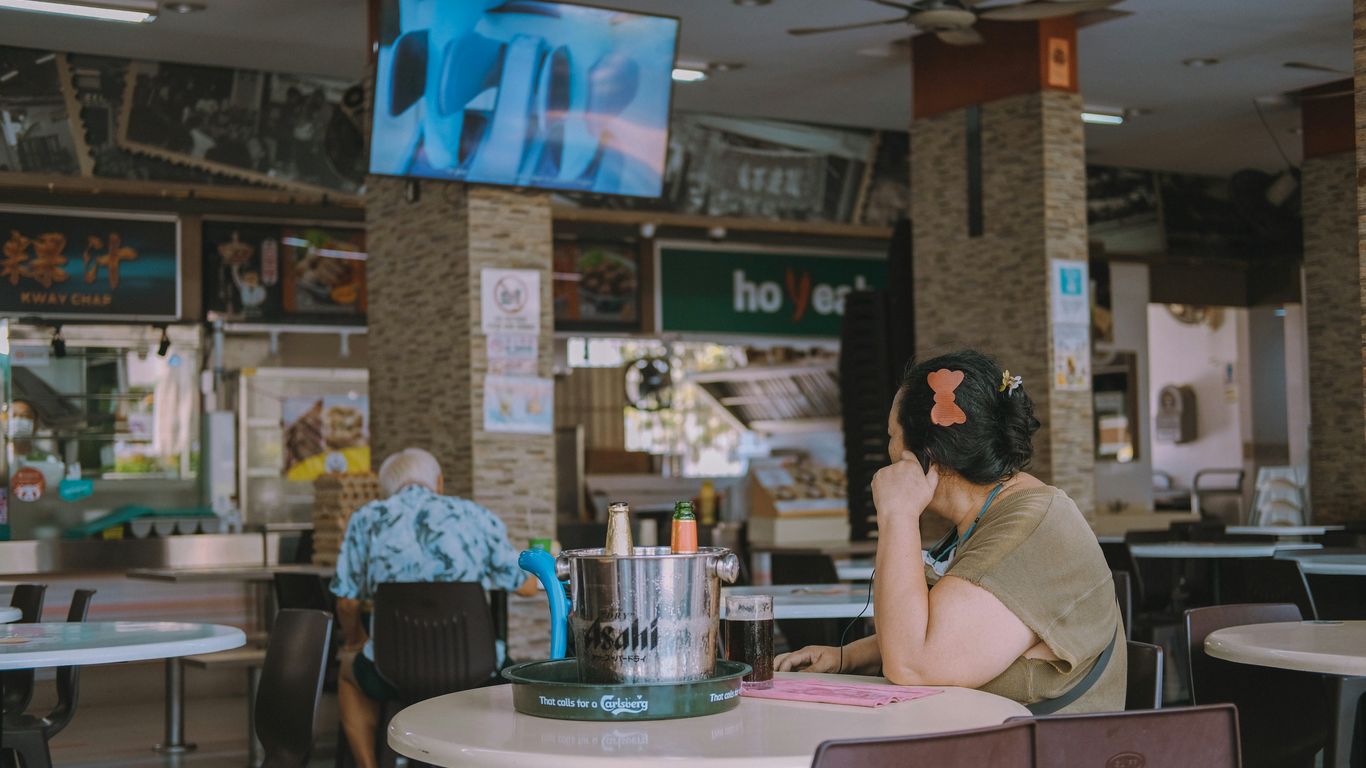
Hainanese migrants became closely associated with Singapore’s coffee-shop trade, particularly through their work as coffee brewers, cooks and service workers. Many had experience in domestic service or hotel kitchens, where they encountered European-style bread, butter and preserves alongside Chinese cooking methods. The resulting coffee shop was neither wholly imported nor wholly traditional; it was a useful, improvised meeting point between different food cultures.
The trade depended on close practical knowledge. Brewing, preparing kaya, grilling bread and remembering regular customers were skills learnt through observation and repetition rather than formal instruction. In this way, the Hainanese contribution became part of a wider Singaporean breakfast culture.
Chinese migration and the making of a new food culture
Chinese migration brought dialect groups, cooking traditions and systems of mutual support into the growing port city. Coffee shops often served food that reflected this mixture, with familiar rice, noodle and snack dishes appearing alongside toast and hot drinks. Their menus changed according to neighbourhood, available ingredients and the preferences of the people who gathered there.
This was food culture made in close quarters. A stallholder might adapt a recipe for local tastes, while a customer carried a habit from one district to another. The kopitiam therefore recorded migration not through grand declarations, but through small adjustments in flavour, language and service.
How the Malay word “kopi” shaped everyday language
“Kopi” is the Malay and Indonesian word for coffee, while “tiam” comes from Hokkien and means shop. Together, the word describes a coffee shop, but it also captures the region’s habit of borrowing and reshaping language through daily contact. Kopitiam orders developed in a practical mixture of Malay, Chinese dialects and English, allowing customers and servers to communicate quickly across linguistic boundaries.
The vocabulary remains one of the most distinctive parts of the experience. A short order can specify the coffee’s milk, sugar and strength, turning a drink into a compact piece of local knowledge. It is language used not for display, but to get breakfast right.
From home brewing to neighbourhood businesses
As Singapore’s population grew, coffee shops became dependable neighbourhood businesses rather than occasional household conveniences. Their open fronts, shared tables and steady morning hours suited a city where workers, families and small traders lived close together. A kopitiam could be modest in appearance and still hold an important place in the local economy.
Its value lay partly in repetition. The same brewer might recognise a customer’s order, a stall might open before the first shift began, and a table might host different groups over the course of one day. That dependable rhythm helped turn a commercial space into a familiar part of home territory.
The kopitiam during Singapore’s colonial and early post-war years
During the colonial period and the difficult years after the Second World War, coffee shops offered inexpensive food, shade and company in a city changing quickly. They stood near workplaces, markets, transport routes and housing, making them accessible to people with little time or money to spare. Their history sits alongside the wider story of Singapore’s port, including the labour and trade described in accounts of the Singapore River’s working life.
Coffee shops as gathering places for workers and residents
For dockworkers, clerks, artisans and residents, the coffee shop was often the first public room of the day. It offered a place to pause before work, exchange news or wait for someone without needing to spend much. The sounds were ordinary but memorable: cups touching saucers, ceiling fans turning, orders called across a busy counter.
These spaces were especially useful because they did not demand a formal invitation. A person could arrive alone, share a table when necessary and still feel part of the surrounding life. The kopitiam’s openness made it a natural social institution.
Affordable meals in a rapidly changing city
Low-cost meals mattered in a city where many households were managing uncertain wages, crowded housing and long working hours. Coffee shops provided simple breakfasts and filling dishes that could be eaten quickly or stretched into a longer conversation. The food was shaped by thrift as much as taste, making use of familiar ingredients and efficient cooking methods.
Affordability also widened the social reach of the kopitiam. Students, labourers, shop assistants and older residents might occupy the same room, even if their lives outside it were very different. Shared tables created a modest form of equality: everyone had to make space for the next customer.
The role of hawkers, provision shops and adjoining trades
Traditional coffee shops were rarely isolated businesses. Around them, provision shops, market sellers, repairers and hawkers formed an everyday network of goods and services. Customers could drink coffee, buy household essentials, collect a parcel or speak with a neighbour within the same short walk.
This relationship between food and work remains visible in places where a food centre sits beside workshops and small enterprises. A study of Alexandra Village’s foodways shows how eating places can function as practical community dining rooms for workers and residents, rather than as destinations separated from local working life.
How social class and community life met around shared tables
A kopitiam did not erase differences in income, occupation or status, but it brought people into physical proximity. The shared table was both a convenience and a social arrangement, particularly during busy hours. Conversations could remain within a family group, yet the room itself was collective.
That mixture of privacy and openness helped coffee shops become trusted places for informal exchange. Someone might hear about a job, a landlord, a shipment or a family matter simply by being present. Community knowledge travelled through these small, busy rooms.
The rituals and language of traditional kopi
Traditional kopi is a system of small choices, remembered by servers and learnt by customers through use. Milk, sugar, strength and preparation are expressed in familiar terms, while breakfast arrives as a set of textures: strong coffee, crisp toast, cool butter and soft eggs. The ritual is simple enough for a hurried worker and rich enough to reward attention.
The material details matter too. A cup, saucer, metal kettle or coffee sock can carry years of handling, making the ordinary feel unusually personal. Singapore Heritage’s kopitiam objects archive explores how such things preserve evidence of daily routines, migration and shared use.
Kopi, kopi-o and kopi-c: understanding the classic orders
A classic kopi is commonly understood as coffee served with condensed milk and sugar. Kopi-o is black coffee with sugar, while kopi-c is coffee with evaporated milk and sugar. The vocabulary can include further changes in sweetness, strength or temperature, so an order often functions as a brief set of instructions.
The terms are not merely culinary shorthand. They show how a multilingual society made a practical language of food, using words that were clear at the counter even when customers came from different backgrounds. A newcomer may need help at first, but the pattern becomes intuitive with time.
Kaya toast, soft-boiled eggs and the enduring breakfast set
Kaya toast pairs grilled bread with coconut-and-egg jam, usually with butter melting into the warm centre. Soft-boiled eggs add a savoury, delicate contrast, and the coffee completes a breakfast designed around speed without feeling hurried. The set has endured because it is inexpensive, recognisable and satisfying.
Its colonial-era influences do not make it foreign to Singapore. Local cooks and customers adapted bread, preserves and coffee to their own tastes, turning borrowed ingredients into a firmly rooted habit. The breakfast table is therefore a record of exchange rather than a single origin story.
The significance of the enamel cup and saucer
The enamel or ceramic cup and saucer are small objects, but their appearance and use help define the traditional coffee-shop atmosphere. They are durable, easy to replace and shaped for a drink that is served hot and consumed in company. Some customers cool their coffee in the saucer, a familiar gesture that also reveals how people make the setting their own.
Objects become meaningful through repeated handling. The everyday heritage archive places cups, kettles and tables alongside food traditions, showing how material evidence can illuminate the people and practices behind a neighbourhood.
To see why the details remain useful, it helps to distinguish the object from the habit attached to it:
| Object or practice | What it makes possible | What it can reveal |
|---|---|---|
| Cup and saucer | Quick, durable service | Shared ideas of comfort and routine |
| Coffee sock | Filtered brewing in batches | Practical knowledge passed between workers |
| Tiled or marble table | Easy cleaning and shared seating | The communal design of the coffee shop |
| Handwritten tab | Informal payment and trust | Relationships between regulars and stallholders |
These details are not decorations added after the fact. They explain how a kopitiam worked, and why its atmosphere cannot be recreated by appearance alone.
Unwritten etiquette at the kopitiam table
Kopitiam etiquette is mostly learned by watching others. Customers make room, keep belongings close during busy periods and understand that a table may serve several groups in one morning. They also learn to listen for their order and to treat stallholders as part of the social fabric rather than as invisible service providers.
The rules are flexible, but they protect the shared nature of the space. A person can linger over coffee, yet the table remains available to others. That balance between welcome and consideration is one of the reasons the traditional coffee shop feels communal without being ceremonious.
How kopitiams became anchors of neighbourhood life
The kopitiam became a neighbourhood anchor through repetition rather than formal planning. It was where residents began the day, where workers returned between tasks and where people encountered news that had not yet travelled through official channels. Over time, the coffee shop gathered memories in layers.
Its role also changed with the city. Older establishments served one generation, then another, while newer customers brought different languages, schedules and expectations. The result was not a frozen tradition, but a public habit capable of absorbing change.
Morning routines and multigenerational regulars
Morning regulars gave the coffee shop its strongest sense of continuity. Grandparents might arrive early, parents stop by before work and younger family members learn the familiar orders at the same table. The routine offered an everyday form of inheritance, passed through gestures rather than instruction.
A regular customer’s presence could also reassure others. Stallholders noticed absences, neighbours exchanged brief updates and a person living alone had somewhere recognisable to go. Such small acts made the kopitiam part of the social infrastructure of a district.
News, debate and informal community networks
Coffee shops have long been places for conversation, from practical matters such as rent and employment to arguments about sport, politics and local change. The talk could be serious, playful or simply repetitive, but it helped residents interpret what was happening around them.
This informal network mattered before digital communication became so immediate, and it still matters where trust is built face to face. A notice, recommendation or warning carried through familiar voices can have a different weight from a message encountered alone on a screen.
Coffee shops as spaces for migrant workers and local families
As Singapore changed, kopitiams continued to bring together people with different origins and working lives. Migrant workers, local families, older residents and students could use the same place for different purposes, whether for a meal, a rest or a conversation. The room’s meaning was shaped by whoever needed it that day.
That layered use reflects the wider movement of people through Singapore’s neighbourhoods. It also complicates nostalgia: the traditional coffee shop belongs not only to memories of the past, but to the people who continue to make use of it now.
Why the kopitiam offered more than food and drink
A kopitiam offered familiarity at a modest price. It could be a waiting room, a meeting place, a source of local information and a brief refuge from heat or work. Its social value was ordinary—and precisely because it was ordinary, it was easy to overlook.
The coffee shop also gave residents a sense of belonging without requiring membership. Someone could be known by a usual order, a preferred seat or the time they arrived. Those repeated recognitions turned a business into a local relationship.
The pressures that changed Singapore’s traditional coffee shops
Traditional coffee shops have never been static, but the pressures around them have intensified. Land values, redevelopment, labour costs and changing consumer habits all affect whether a small operator can continue. The atmosphere of a kopitiam may look timeless while the economics beneath it are changing quickly.
Some changes have improved comfort or widened access. Others have made it harder for family businesses and independent stallholders to preserve the pace, price and informal character that customers associate with the form.
Rising rents and redevelopment
Redevelopment can remove the physical setting in which a coffee shop’s relationships were built. When shophouses, markets or older estates are altered, regulars may be dispersed and operators may face higher rents or new lease conditions. Even when a business reopens elsewhere, its old network may not travel with it.
The loss is therefore more than architectural. A kopitiam’s value lies in the combination of place, people and routine, and that combination is difficult to relocate intact. Neighbourhood change must be understood through those everyday connections as well as through buildings.
Competition from fast-food chains and speciality cafés
Fast-food outlets and speciality cafés have changed what customers expect from speed, comfort, branding and choice. They may offer air-conditioning, consistent menus or a setting designed for work and leisure. Traditional coffee shops, by contrast, often rely on narrower menus, shared seating and the personal knowledge of long-serving staff.
Neither model fully replaces the other. A café can provide a different experience, while the kopitiam continues to offer quick, affordable food with a strong sense of local continuity. The pressure arises when the latter is judged only by the standards of the former.
Changing tastes, health concerns and younger customers
Younger customers may seek less sugar, different drinks, clearer information about ingredients or more comfortable places to sit. Health concerns can also alter how people think about condensed milk, butter and sweetened beverages. Traditional operators therefore face the delicate task of responding without making the old menu unrecognisable.
Adaptation can be gradual. Smaller portions, revised recipes, new payment methods or clearer explanations may help a shop welcome new customers while retaining its established character. What matters is whether change grows from the business’s own knowledge rather than being imposed as a costume.
The impact of franchising and commercial standardisation
Franchising can make a familiar name available in more locations, but scale may also change the relationship between a coffee shop and its neighbourhood. Standardised menus, interiors and procedures offer predictability, while reducing the small variations that once reflected local staff and regular customers.
The distinction is not simply between old and new. A larger operation may preserve recipes and create work, while a small shop may still lose its character if skills are not passed on. The central question is whether the practice remains connected to people who understand its meaning.
Operators often adapt through a handful of practical decisions:
- Keeping a few established drinks and dishes at the centre of the menu.
- Training younger staff in brewing, service and ingredient preparation.
- Introducing modern payment or ordering methods without removing conversation.
- Explaining the origins of recipes instead of relying only on nostalgic decoration.
These choices do not guarantee survival, but they show that continuity can involve sensible change. A living tradition needs room to respond to the people who use it.
Preserving the kopitiam in modern Singapore
Preservation is most useful when it supports working businesses and the people who hold their knowledge. A recipe written down is valuable, but so is the hand movement that controls a pour, the judgement used to toast bread or the memory of which customers prefer less sugar. Heritage exists in these relationships as much as in the shopfront.
Singapore Heritage approaches local history through neighbourhoods, foodways, objects and community memory. Its work includes story-led walks and researched gifts, offering ways for residents and visitors to encounter everyday heritage rather than treating it as a display detached from daily life.
Family-run stalls and recipes passed between generations
Family-run stalls often preserve knowledge through long apprenticeships within the household. A younger relative learns not only a recipe, but also how to judge heat, manage a rush and speak with regulars. Such learning can be difficult to record because much of it is embodied and situational.
Passing skills on also depends on whether the next generation can make a viable living. Respect for tradition must therefore include attention to working conditions, fair recognition and the practical future of the people who keep the stall open.
Hawker centres, food courts and the evolution of the coffee shop
The kopitiam form has evolved alongside hawker centres and food courts. Shared seating and multiple stalls remain, but the architecture, management and customer expectations may differ. These spaces continue the idea of a common dining room while adapting it to high-density housing, transport links and contemporary schedules.
Singapore’s hawker culture shows how food traditions can survive through movement and adjustment. Its story is also one of multicultural exchange, with Chinese, Malay, Indian and Peranakan influences appearing across menus and neighbourhoods. A useful account of Singapore’s food heritage places individual dishes within those wider histories.
Heritage branding and the question of authenticity
Nostalgic signs, old-style cups and tiled interiors can make a new venue resemble a traditional kopitiam, but visual resemblance alone is not authenticity. The deeper questions concern who prepares the food, whose knowledge is credited, how workers are treated and whether the place serves a real community.
That does not mean a newer business cannot be meaningful. Authenticity can include careful adaptation, provided the story is researched honestly and not reduced to a decorative mood. Context gives nostalgia its weight.
How traditional operators are adapting without losing their identity
Operators are finding ways to accommodate digital payments, delivery, changing diets and younger customers while keeping familiar brewing methods and service habits. Some update seating or menus; others make their history more visible through conversation and explanation. The strongest adaptations tend to feel like extensions of the business rather than a replacement for it.
Visitors can support this continuity by ordering thoughtfully, allowing staff time to work, asking respectful questions and returning to places that rely on regular custom. Singapore Heritage’s local heritage walks similarly invite people to encounter neighbourhood stories through guided, place-based experiences rather than through landmarks alone.
Why kopitiam history still matters today
Kopitiam history matters because it gives scale to the story of Singapore. National change can be seen in ports, housing estates and infrastructure, but it can also be tasted in a breakfast set and heard in an order called across a counter. The coffee shop brings large histories down to the level of ordinary decisions.
It also reminds people that heritage is not limited to monuments. It can be a table shared with strangers, a recipe adjusted over decades or a shopkeeper who remembers how a street once worked. Those details make the past recognisable without making it simple.
Coffee shops as living records of Singapore’s past
A traditional coffee shop records layers of migration, labour and urban change. Its menu may reveal movement between regions, its language may show everyday multilingualism and its objects may preserve habits no longer visible elsewhere. The evidence is modest, but it is remarkably close to lived experience.
Such records need care because memory is selective. A responsible history listens to stallholders, workers, residents and customers, acknowledging both affection and difficulty. The result is richer than a polished story of unbroken continuity.
The value of affordable, accessible communal spaces
An affordable coffee shop gives people access to public life without the cost of a formal venue. It welcomes a person who comes for ten minutes, a family sharing breakfast and an older resident who wants familiar company. In a dense city, that openness is a meaningful civic resource.
When such places disappear, residents lose more than a cheap meal. They lose one of the settings in which casual trust is built. Protecting communal spaces therefore involves social and economic questions, not only questions of taste.
What younger Singaporeans are rediscovering
Younger Singaporeans are returning to traditional coffee shops with curiosity, sometimes bringing cameras, family members or questions about words they have heard since childhood. Many are discovering that kopi is not simply an old-fashioned drink but a compact way of understanding work, migration and belonging.
The renewed interest can be thoughtful when it leaves room for the people who use these places every day. A visitor who listens, pays fairly and notices the working rhythm sees more than a nostalgic backdrop. They encounter a culture still in use.
From everyday necessity to cultural heritage
The kopitiam’s journey from ordinary necessity to recognised cultural heritage is not a change from unimportant to important. It is a reminder that ordinary things were always carrying meaning. Their significance became clearer only when rapid development made their survival uncertain.
Singapore Heritage’s community stories and heritage experiences reflect this wider principle: lived heritage is gathered through people, places, objects and practices, then shared with care. The future of the kopitiam will depend on whether that care remains connected to everyday use.
Experience Singapore’s Living Heritage
A heritage walk can turn a familiar street, food stall or coffee shop into a richer conversation about the people who shaped it. Explore Singapore Heritage’s story-led routes to meet neighbourhood histories through local storytellers and place-based memories, then book a heritage walk for a closer look at the city beyond its most photographed landmarks.
Conclusion
Singapore’s traditional coffee shops endure because they hold several kinds of life at once: food and work, language and migration, habit and friendship. Their future will not be secured by preserving appearances alone, but by supporting the people, skills and affordable communal routines that make a kopitiam meaningful.
Frequently Asked Questions
What does “kopitiam” mean?
“Kopitiam” combines “kopi”, the Malay and Indonesian word for coffee, with “tiam”, a Hokkien word meaning shop. It commonly refers to a traditional coffee shop in Singapore and parts of Southeast Asia.
What is the difference between kopi, kopi-o and kopi-c?
Kopi is generally coffee with condensed milk and sugar, kopi-o is black coffee with sugar, and kopi-c is coffee with evaporated milk and sugar. Customers can also request changes to sweetness, strength or temperature.
Why are Hainanese communities associated with Singapore’s coffee shops?
Hainanese migrants became strongly associated with the trade through work as coffee brewers, cooks and service workers. Their knowledge helped shape the combination of coffee, toast, kaya and other dishes now linked with the traditional kopitiam.
What is usually included in a traditional kopitiam breakfast?
A familiar breakfast set may include kopi, kaya toast and soft-boiled eggs. The combination is popular because it is quick, affordable and built around contrasting textures and flavours.
Why are kopitiams important to neighbourhood life?
Kopitiams provide accessible places for eating, conversation and informal exchange. Their shared tables allow residents, workers, families and visitors to occupy the same everyday public space.
Are modern coffee shops still kopitiams?
Some modern coffee shops retain the communal layout, local drinks and food traditions associated with kopitiams, while others mainly borrow the name or visual style. Whether they carry the tradition forward depends on their practices, people and relationship with the surrounding community.
How can people help preserve traditional coffee shops?
People can support independent operators, learn about the labour behind familiar dishes, treat staff respectfully and return regularly when possible. Listening to local memories and documenting recipes and objects with permission can also help keep the history connected to its communities.
Key Takeaways
Singapore’s shophouses are best read as working buildings, not frozen decorations. Their plans, materials and street relationships reveal changing patterns of trade, migration, domestic life and conservation.
- A shophouse usually combines commercial space, living quarters and a narrow, deep plan.
- The five-foot way is both an architectural feature and a shared social threshold.
- Tiles, windows and ornament offer clues, but rarely provide a complete date on their own.
- Streetscape, neighbouring buildings and later alterations matter as much as one façade.
- Good interpretation separates visible evidence from attractive but unproven stories.
Start with the shophouse as a layered historical record
A Singapore shophouse can look wonderfully settled from across the road: a neat row, a shaded walkway, perhaps a vivid band of tiles beneath tall windows. Up close, though, it is less a single style than a record of decisions made over decades. The building may carry traces of an early plot, a later owner’s ambitions, changing building rules and the practical needs of people who worked and lived there. That layered quality is at the heart of singapore shophouse history.
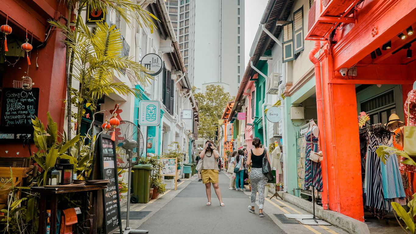
How trade, migration and urban growth shaped the shophouse
The shophouse developed as a compact answer to a growing port city. A narrow frontage made it possible for many plots to line a commercial street, while the depth allowed rooms, stairs, service spaces and sometimes a courtyard to extend behind the shop. The lower level faced customers and goods; upper floors accommodated family life, workers or tenants. This arrangement was economical, but it was never merely practical: it brought business, household routines and neighbourhood observation into one vertical structure.
Migration gave the building type much of its social energy. Merchants, artisans, labourers and families arrived with building traditions, materials and expectations that met local climate and colonial regulation. Southern Chinese precedents, Malay and regional practices, European details and later mass-produced imports all entered the urban mix. The history of shophouses is therefore not a tidy story of one community inventing one style, but a story of adaptation in a busy, connected city.
The main architectural periods to recognise
Broad periods are useful as a first orientation, provided they remain broad. Early buildings tend to be more restrained and may show simpler openings, modest decoration and less elaborate upper façades. Later nineteenth- and early twentieth-century examples often became taller, more ornamental and more confident in their use of plasterwork, tiles and coloured details. Transitional and Art Deco-influenced façades may simplify the composition again, favouring stronger lines, geometric motifs and a cleaner vertical emphasis.
These categories overlap. A façade could be rebuilt while retaining an older structural footprint, or a modest building could receive fashionable details during a later renovation. Architectural groupings help a viewer ask better questions; they should not be treated as a substitute for an archive, a measured survey or a dated document.
Why neighbouring façades can look similar but tell different stories
Terraced buildings share party walls, plot widths and rules governing the street edge, so visual resemblance is expected. Yet similar façades may have held very different businesses and households. One might have been a provision shop, another a workshop, lodging rooms, a religious association or a family enterprise. Even within a single row, owners could replace doors, repaint plaster, alter signs or renew tiles at different moments.
The most revealing differences are sometimes quiet ones: a blocked side passage, a patched threshold, a stair location visible through an opening, or a variation in the depth of the five-foot way. A viewer who compares several buildings rather than admiring one in isolation begins to see the row as a negotiation between shared urban form and individual histories.
What conservation status can—and cannot—tell you
Conservation status signals that a building or area has recognised heritage value and that alterations may be guided by particular controls. It does not mean every visible element is original, nor does it guarantee that the building’s social history is fully known. A conserved façade can still contain modern services, replacement joinery and new interior arrangements.
That distinction matters because architectural protection and lived continuity are related but not identical. Singapore Heritage approaches neighbourhood stories through streets, foodways, objects and everyday practices as well as formal buildings; its story-led heritage walks encourage attention to the people and routines around a place. A shophouse becomes more legible when its appearance is considered alongside the work, movement and memory that made the street useful.
Read the façade from the ground up
The façade is easiest to understand when treated as a sequence rather than a picture. Start with the pavement and threshold, then move through the columns, openings, windows and parapet. Each level answers a slightly different need, from sheltering customers to admitting air and light. The result is a vertical conversation between public commerce below and more private life above.
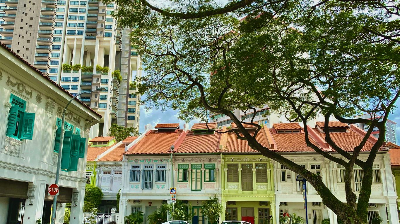
The proportions that reveal a shophouse’s original function
Many shophouses are narrow at the front and deep in plan, a shape that maximised street access while preserving usable interior space. The ground floor was commonly more open and commercially oriented, while upper floors offered rooms for living, storage or tenants. High ceilings and tall openings could support ventilation and display, although later partitions may make the original arrangement difficult to see.
Proportion is suggestive rather than conclusive. A particularly broad opening may reflect a shopfront, but it might also be a later alteration. A run of upper windows may suggest a sequence of rooms, yet it cannot by itself reveal who occupied them. The shophouse building type is best read through several clues working together: depth, stairs, courtyards, openings and the relationship to neighbouring plots.
How the five-foot way connects private life with the street
The five-foot way is the covered passage at the front of many shophouses, named for its approximate width in common descriptions. It protects pedestrians from intense sun and sudden rain, but its importance goes beyond weather. Shopkeepers could receive customers there, residents could pass through, deliveries could be sorted, and neighbours could encounter one another without entering the building proper.
It is a shared threshold, neither wholly public nor wholly private. Its columns and floor levels also establish a rhythm across the row, making separate properties feel like one street room. When a business places goods, tables or signs in this zone, it is negotiating that shared space; when a resident crosses it carrying groceries, the same architecture becomes part of ordinary domestic life.
Pilasters, party walls and thresholds as clues to plot and ownership
Vertical pilasters often mark the edges of a façade and can hint at the narrow plot divisions behind it. They may be structural, decorative or both. Party walls separate adjoining buildings, though the street-facing composition can make a whole terrace appear like one continuous block. At ground level, changes in floor height, paving, door width or material may reveal separate thresholds even where shopfronts have been visually unified.
A careful observer can therefore map a building’s likely boundaries before learning anything about its former occupants. This is useful for understanding ownership and subdivision, but it should remain a working hypothesis. Later combinations of units, new entrances and shared services can blur the original arrangement.
What later renovations may conceal or alter
Renovation is part of a shophouse’s history, not automatically a flaw. New plumbing, electrical systems, fire requirements and accessibility needs have allowed old buildings to remain useful. Yet alterations can also cover transoms, remove shutters, replace timber with aluminium, smooth over plasterwork or conceal a courtyard beneath a roof.
The façade may be the most carefully retained part because it carries the public identity of the row. Inside, the plan may have changed substantially. This is why a polished frontage should not be read as proof of an untouched interior. Visible age is not complete evidence; seams, repairs and inconsistencies often tell a more honest story.
Understand the language of shophouse tiles
Tiles catch the eye because they combine colour, pattern and small-scale craft with the larger geometry of the façade. They appear around doorways, along dadoes, beneath windows and across floors, where they have had to withstand feet, rain and repeated cleaning. Their presence is meaningful, but a tile is not a label for ethnicity or a guaranteed date. It is a material clue shaped by trade, taste, availability and maintenance.

Encaustic tiles, geometric borders and imported influences
Encaustic tiles create patterns by placing differently coloured clays into the body of the tile, rather than simply painting a surface. Other decorative tiles may be glazed, relief-moulded or printed. Geometric borders helped frame entrances and walls, while repeated floral or linear motifs made a narrow frontage feel more finished and substantial.
Such materials travelled through commercial networks. A pattern may reflect European manufacture, regional interpretation or local preference, and the same design language could be adapted in different districts. The Joo Chiat heritage story is a useful reminder that decorative tiles can speak about trade and changing taste, not only about the identity a later viewer associates with them.
How colour, pattern and repetition reflect changing tastes
Colour changes the apparent scale of a building. A dark border can anchor a pale wall; a bright floral panel can draw attention to an entrance; small repeated motifs can make a long terrace feel rhythmic rather than monotonous. Owners chose such details within the limits of cost, fashion and what suppliers could provide.
Patterns also interacted with plasterwork, shutters and signage. A façade with restrained geometry may belong to a period when cleaner lines were fashionable, while a densely ornamented frontage suggests a different appetite for display. These are tendencies, not rules, and repainting can distort the original balance of colour.
Distinguishing original tiles from replacements and reproductions
A replacement may be almost indistinguishable from an old tile when seen from the pavement. Close inspection can reveal differences in wear, glaze, grout width, colour consistency and the way a pattern aligns at corners. But even these observations are provisional: a sheltered tile may remain bright, while an exposed replacement may age quickly.
The strongest reading compares repeated sections. If one panel has a different scale or sharper edges, it may be newer, although a patch from another period is also possible. A conservation record, renovation account or material assessment can settle questions that visual inspection cannot. The aim is not to identify an “authentic” tile at any cost, but to understand how the surface has changed.
Where to look for tile details beyond the main façade
Tiles are often overlooked when they sit below eye level. They may line the inside of a five-foot way, frame a rear courtyard, protect a kitchen wall or survive around a less prominent entrance. Floors can preserve patterns that the upper façade no longer carries, though they may be partly covered by mats, furniture or modern finishes.
A respectful walk keeps a little distance from doorways and avoids photographing private interiors. The best details are often found by comparing public surfaces across a row. In a kopitiam or old shop, everyday objects and finishes can extend this material story: kopitiam objects and memories show how practical things can hold evidence of suppliers, habits and shared routines.
Decode windows, shutters and ventilation
Windows are where a shophouse negotiates climate, privacy and display. In a hot, humid environment, a sealed glass frontage can be uncomfortable, while open timber shutters can make a room lively but exposed. Openings therefore carry practical information as well as stylistic character. Their height, depth and fittings deserve the same attention as decorative details.
Timber shutters, louvres and the demands of a tropical climate
Timber shutters could be folded, opened or adjusted to manage light and air. Louvres offered ventilation while limiting direct views, and solid panels could provide security or shade when a shop closed. The condition of surviving shutters varies widely, since timber is vulnerable to moisture, insects and repeated repainting.
A closed shutter is not a dead façade. Its hinges, catches and divisions may show how the opening worked, while gaps between boards suggest how air once moved through the room. Modern glazing can preserve the shape of an older opening while changing its environmental performance and daily use.
Fanlights, vents and the balance between privacy and airflow
Fanlights above doors and windows admit air and borrowed light without opening the main room completely to the street. Small vents, perforated panels and high-level openings perform a similar task. Their position can reveal an effort to ventilate deep interiors where side windows were limited by adjoining party walls.
These details also moderated social visibility. A household could hear the street and benefit from air movement without presenting the whole room to passers-by. When a vent is blocked or a fanlight covered, the change may reflect new expectations of privacy, air-conditioning or security rather than a loss of decorative interest alone.
French doors, timber frames and changing domestic arrangements
Tall timber-framed openings and French doors could make upper rooms flexible, allowing them to open towards a balcony or façade while retaining shutters for shade. They suited rooms that shifted between domestic use, office work, display and informal socialising. The opening’s width and the hardware around it may be more informative than its paint colour.
Later occupants may divide one large room into several smaller spaces, install air-conditioning or replace a balcony railing. Those changes alter how the upper storey relates to the street. Reading the window as part of a plan, rather than as an isolated ornament, keeps the interpretation grounded in use.
How window proportions can help date a building
Window proportions can support a likely stylistic period when combined with other evidence. A façade with small, regularly spaced openings may feel earlier or more austere; tall openings with elaborate surrounds may indicate a later taste for display; strongly horizontal or geometric compositions can suggest Art Deco influence. None of these observations is a date stamp.
The most reliable clues are clusters: window shape, pilaster treatment, parapet design, tiles, mouldings and construction technique pointing in the same direction. A single replacement window can mislead, especially where a building has been repaired more than once. Good observation records uncertainty instead of hiding it.
Place ornament in its historical context
Ornament is often the first thing a visitor notices, yet it becomes more interesting when it is not treated as decoration alone. A ceramic panel, moulded column or painted frieze may express aspiration, advertise prosperity or make a business recognisable. It may also be a catalogue choice, a repair or a later interpretation. The question is not simply what looks beautiful, but what the detail was doing in its setting.
Malay, Chinese, European and regional design influences
Singapore’s façades draw from overlapping traditions rather than isolated cultural boxes. Chinese and southern Chinese building ideas met Malay and Southeast Asian climate responses; European classical vocabulary arrived through colonial urban systems; regional trade brought materials and motifs from across the seas. Peranakan expression, in particular, is often discussed as a meeting of Chinese and Malay heritage, but no single façade can stand for all of it.
Influence travels through people, goods and imitation. A motif might be selected because it was fashionable, available or associated with prestige, not because it carried one fixed communal meaning. The many neighbourhood histories across Chinatown, Kampong Glam, Little India, Joo Chiat and elsewhere make that variety visible.
Plasterwork, ceramic details and symbols of status
Plasterwork can frame windows, soften corners and turn a plain wall into a carefully composed surface. Ceramic panels and imported tiles add colour and durability, while columns and parapets give a building a more formal presence. Together, these details could signal that an owner had the means and inclination to invest in the public face of a property.
Status, however, was only one part of the picture. Ornament could help a business attract attention, make a family home feel dignified or express an attachment to a fashionable style. A modest building might be richly finished in one area and plain in another because money, material or labour was concentrated at the entrance.
Art Deco restraint versus earlier decorative exuberance
Art Deco-influenced façades often favour geometric lines, stepped forms, repeated bands and a more disciplined composition. Earlier façades may use denser mouldings, floral motifs, pilasters and a stronger sense of layered display. The contrast is useful, but real streets contain hybrids: an older structure may receive a later parapet, or an Art Deco frontage may retain traditional proportions.
A useful comparison is to ask where the eye is directed. Exuberant façades distribute attention across many details, while more restrained compositions may concentrate it in a central stair, signboard or vertical axis. Paint and signage can either sharpen or obscure that original hierarchy.
Why façade styles travelled across Singapore’s neighbourhoods
Builders, owners, craftsmen and suppliers moved between districts. Pattern books, catalogues and shared construction practices helped styles travel, while competition encouraged businesses to adopt details that customers recognised as prosperous or modern. A motif found in one neighbourhood therefore need not have originated there.
The street itself accelerated imitation. A successful shopfront could influence its neighbours, and a row might gradually acquire a visual family without being built all at once. This is why comparison across districts is more useful than assigning a single style to a single community.
Use the streetscape to read the building in context
A shophouse makes most sense as part of a street, not as a detached object. Its neighbours reveal repeated plot widths, shared shade, changes in building height and the movement of businesses along the block. Lanes, courtyards, markets and religious buildings extend the story beyond the front elevation. The everyday geography around the façade often explains more than an isolated decorative flourish.
How rows of shophouses reveal historic commercial networks
A long row could support a network of related trades: wholesalers, food sellers, repairers, lodging houses and services clustered near one another. Goods moved through front doors, lanes and rear spaces, while information travelled with customers and workers. The river and port connected these local economies to wider maritime routes; the Singapore River’s trading past helps explain why commercial streets could grow so quickly around movement and exchange.
Signs, loading points and the width of entrances can hint at the scale of that activity. Yet a building’s former trade should not be inferred from a surviving sign alone. Businesses change, and a sign may be retained for memory, branding or convenience.
The relationship between five-foot ways, lanes and courtyards
The front passage handled public movement, but the life of a deep shophouse depended on what happened behind it. Lanes carried deliveries and refuse, while courtyards admitted light and air into rooms that could not open sideways. Stairs and service areas often created a second circulation system, linking shop, home and back-of-house work.
This arrangement made the building porous. Sounds, smells and people moved between layers, even when rooms were divided by walls. It also meant that improvements to the front façade could leave more ordinary rear spaces overlooked, although those spaces may preserve the clearest evidence of daily work.
Comparing districts such as Chinatown, Little India and Kampong Glam
District comparison should begin with questions rather than a hunt for the “most authentic” street. Chinatown may prompt attention to immigrant associations, shop-house living and dense commercial networks; Little India can open discussion of trade, food and changing urban rhythms; Kampong Glam brings regional commerce, Malay and Muslim networks and the presence of Sultan Mosque into view. Each district contains variety within itself.
The Kampong Glam neighbourhood story shows how royal influence, maritime connections and everyday commerce can overlap in one area. Comparison becomes richer when it includes businesses, residents, religious sites and food routes, rather than treating façades as scenery detached from people.
Reading signs of adaptation, neglect and careful conservation
Cracked plaster, patched tiles, mismatched windows and faded paint can indicate maintenance cycles rather than a simple decline. A carefully repaired façade may still show older scars, while an active shop may alter its frontage to meet present needs. Neglect, adaptation and conservation can exist on the same building at different levels.
For a walk, the following compact sequence keeps attention on evidence and context:
- Begin with the public edge, noting paving, columns and thresholds.
- Compare at least three adjoining façades before assigning a style.
- Look above eye level for vents, fanlights, parapets and repairs.
- Notice present-day work without treating it as an interruption to history.
This approach slows the gaze down. It also respects residents and workers, whose daily use of the street is part of what keeps heritage alive.
Interpret a shophouse without overclaiming
Close looking is rewarding precisely because it leaves room for uncertainty. A façade can suggest a period, a building function or a pattern of repair, but it rarely provides a complete biography. The interpreter’s task is to assemble clues, test them against one another and say clearly where the evidence ends. That restraint does not make the story colder; it makes it more trustworthy.
Which clues can support a likely date or style
A likely date becomes more plausible when several features agree: structural proportions, window form, decorative vocabulary, tile type, construction material and relationship to the adjoining row. A later signboard or replacement door should be separated from older elements rather than allowed to define the whole building. Photographs from different decades can reveal which features have persisted.
The most useful language is measured: “suggests”, “may indicate” and “appears consistent with”. Such phrasing is not evasive. It distinguishes a visual reading from a documented fact and leaves space for new evidence.
Why archival research and site observation should work together
Site observation captures texture that records may omit: a repaired threshold, an awkwardly blocked vent or the way a shop still uses its five-foot way. Archives can supply names, dates, plans, photographs, ownership changes and planning decisions that cannot be recovered from the street. Used together, they prevent both kinds of error: a dry account without lived detail and a vivid story built on guesswork.
Singapore Heritage’s small-group heritage walks are rooted in neighbourhood stories and led by storytellers familiar with the streets. That kind of experience can add local context to what a visitor sees, while careful research keeps the interpretation accountable to available evidence.
How to distinguish historical evidence from romantic assumptions
A worn surface is not automatically evidence of a famous past. A colourful tile is not proof of one community’s ownership. Nor does an old-looking sign establish that the same business has operated continuously. Romantic assumptions usually arise when a visually appealing detail is asked to carry an entire story.
A better habit is to separate observation from interpretation. “Three blue tiles remain beneath the window” is observation. “The original owner chose these to express a particular identity” is interpretation requiring support. The gap between the two is where responsible heritage writing does its work.
A practical checklist for looking closely on your next walk
A short checklist can help a walker remain curious without turning the street into a survey exercise. It is best used lightly, with pauses for sounds, shade, smells and the ordinary activity that surrounds the buildings.
- What is the relationship between the entrance and the five-foot way?
- Which elements repeat across the row, and which appear unique?
- Where do tiles, vents, shutters or plasterwork show repair?
- What present-day work or domestic activity continues at the address?
- Which part of the interpretation is certain, and which part is only likely?
Afterwards, a resident or visitor might check a library source, conservation guide, museum or local walk. The heritage walk options can also help turn a solitary architectural reading into a slower conversation about neighbourhood memory, provided the street and its people remain at the centre.
A Way to Keep Looking
A shophouse rewards a second glance: first for its colours and rhythm, then for the practical choices beneath them. Singapore Heritage offers small-group walks that connect buildings with neighbourhood stories, everyday practices and the people who continue to shape these places. For readers who want to experience that context on foot, book a heritage walk and let the street reveal more than its façade.
Conclusion
Singapore’s shophouses are layered records of commerce, migration, climate, aspiration and ordinary domestic life. Tiles, windows and five-foot ways provide a generous starting point, but the fullest reading comes from comparing buildings, noticing later changes and listening for the human activity around them. A careful observer does not need to solve every mystery; it is enough to leave the street seeing more, and claiming only what the evidence can bear.
Frequently Asked Questions
What is a Singapore shophouse?
A Singapore shophouse is generally a narrow, deep terraced building that combines commercial space with living or working accommodation, often with a covered passage along the street.
Why is it called a five-foot way?
The name refers to the approximate width traditionally associated with the covered pedestrian passage at the front of many shophouses. The measurement varies, but the shared walkway remains the defining idea.
Were shophouses originally homes or shops?
They were commonly both. Shops, workshops or offices occupied the street-facing portion, while upper or rear spaces could accommodate families, workers, storage and household activities.
Do shophouse tiles reveal the owner’s ethnicity?
Not reliably. Tiles reflect overlapping influences from trade, manufacture, fashion, local taste and repair, so they should not be used as a single proof of identity or ownership.
Can windows provide an exact construction date?
Windows can support a likely period when considered with the whole façade, but replacements and renovations are common. Exact dating usually requires documentary or professional architectural evidence.
Why do neighbouring shophouses look so alike?
Shared party walls, narrow plots, street regulations and common building practices created a repeated urban rhythm. Similarity does not mean the buildings had identical owners, uses or histories.
How should visitors behave around conserved shophouses?
Visitors should keep entrances clear, avoid photographing private interiors without permission, respect residents and workers, and observe active businesses as living places rather than museum displays.
Key Takeaways
Singapore’s wet markets are places where food, memory and neighbourhood life meet. Their history is best understood through the people and everyday routines that keep them active.
- Wet markets grew from informal trading into planned neighbourhood spaces.
- Their sights, sounds and smells reflect practical food preparation.
- Trust between stallholders and customers is built over repeated visits.
- Markets connect shopping with breakfast, conversation and local belonging.
- Their future depends on supporting people as well as preserving buildings.
How Singapore’s wet markets came to be
The history of Singapore’s wet markets is not only a story of buildings and regulations. It is also a story of movement: vendors moving from streets into planned centres, families settling into new estates, and shoppers carrying familiar habits into changing surroundings. A market can look ordinary from the outside while holding several generations of local memory within its counters and passageways.
From street hawkers and informal trading to purpose-built markets
Before the familiar market halls of modern estates, fresh food was often sold through informal street trading and itinerant hawking. Vendors followed customers, worked near homes and transport routes, and relied on knowledge of where demand would appear each day. These arrangements were lively but difficult to regulate, particularly when perishable food, drainage and waste were involved.
The move towards purpose-built markets brought stalls under one roof and made services such as water supply and cleaning easier to organise. It did not erase the old habits. The calls, personal recommendations and practical bargaining of street commerce continued inside the new spaces, giving planned markets a distinctly human rhythm.
Post-war urban planning and the relocation of neighbourhood stalls
Post-war Singapore required housing, sanitation and reliable access to food on a much larger scale. As new estates took shape, market stalls were relocated alongside homes, transport links and food centres. This arrangement made fresh shopping part of the daily architecture of neighbourhood life rather than a separate trip into the city centre.
The relocation could be disruptive for traders and customers, yet it also created new communities. A stallholder might gain a more permanent base, while a family moving into a new estate could quickly find familiar ingredients, breakfast tables and people who knew the area. The story of organised hawker centres, explored in hawker culture, helps explain this wider shift from itinerant trade towards shared civic spaces.
What “wet market” means in the Singaporean context
In Singapore, “wet market” generally refers to a market selling fresh and perishable food such as fish, meat, poultry, fruit and vegetables. The term distinguishes these stalls from “dry” goods sellers, although the boundary can feel less rigid in a real neighbourhood market. Cooked-food stalls, provision shops and coffee shops often sit close by, creating a wider food ecosystem.
The word can sound stark to visitors unfamiliar with it. In practice, it points to the water used for washing, cleaning and keeping floors workable as fresh produce is handled. The term should not be treated as shorthand for wildlife trading: ordinary Singaporean wet markets are primarily places for everyday food shopping.
Why markets remain part of Singapore’s living heritage
A market remains living heritage because it is still used, adapted and argued over. Its value lies not only in old tiles or a distinctive roof but in the knowledge exchanged across the counter: how to choose a fish, which greens are best for soup, or when a particular stall receives its delivery. These details are rarely captured by a monument plaque.
For Singapore Heritage, this kind of everyday knowledge belongs beside formal landmarks in the island’s heritage story. A market records migration, work, cooking and family life in motion. Its history is carried by routines that may seem small but are repeated thousands of times.
Reading a market through its sights, sounds and smells
A wet market is read with the whole body. The floor may be damp, the air cool near a mound of ice, and the passage suddenly crowded when a delivery arrives. These sensory details are not decoration; they reveal how the market works and why different halls develop such strong identities.

The choreography of deliveries, chopping and haggling
The day begins with movement before many shoppers arrive. Crates are shifted, plastic sheets are pulled back, knives strike boards in quick, practised rhythms, and vendors arrange produce so that freshness is visible from the aisle. Each action has a place in a compact choreography shaped by limited space and long experience.
Conversation moves through it all. A customer asks for a portion, a stallholder weighs it, another worker calls out a price, and someone pauses to greet a neighbour. Bargaining is not always dramatic; often it is a shorthand between people who already understand one another.
Ice, water and the practical origins of the name
Water has always been central to the practical work of a fresh-food market. It helps sellers clean surfaces and produce, while ice slows the warming of seafood and other perishables. The wet floor is therefore less an aesthetic feature than a trace of the work taking place around it.
Modern hygiene expectations have changed how markets are maintained, but the basic relationship between water, freshness and labour remains visible. A shopper who notices the drains, hoses and melting ice is seeing part of the market’s infrastructure rather than an incidental inconvenience.
The aromas of seafood, herbs, spices and cooked breakfasts
The smell of a wet market changes from one aisle to the next. Seafood brings a clean, briny sharpness; leafy vegetables add a green freshness; herbs and spices gather in warmer, sweeter layers. Nearby cooked-food stalls contribute coffee, toast, noodles or rice, so the market’s morning often smells like both a kitchen and a store room.
These aromas also speak of Singapore’s mixed food traditions. Ingredients associated with Chinese, Malay, Indian and other culinary practices may sit within a few steps of one another. The market lets those traditions meet before they become a finished dish.
How each market develops its own sensory character
No two neighbourhood markets sound exactly alike. One may be known for the brisk calls of seafood sellers, another for the clatter of breakfast tables or the gentle pace of an established estate. The shape of the building, the age of its traders and the surrounding community all influence the atmosphere.
The result is a kind of local accent. Visitors may remember a market by its damp concrete, its particular coffee aroma or the sound of trolleys over the floor. Residents often recognise it without thinking, as one recognises a familiar voice.
The daily rituals of neighbourhood shopping
Shopping at a wet market is usually less anonymous than buying food from a shelf. The trip has a beginning, a sequence and often a small closing ritual: a coffee, a greeting, or a return home with bags balanced carefully in both hands. The Singapore wet market history becomes tangible through these repeated mornings.
The early-morning trip for fish, meat and vegetables
Early morning is when the market feels most purposeful. Deliveries are fresh, popular items have not yet thinned out, and shoppers can ask questions without holding up a long queue. Some arrive with a precise list; others decide dinner while looking at what has come in.
The trip also fits the practical demands of domestic life. A shopper may buy fish for lunch, vegetables for soup and herbs for a family recipe in one circuit. The market is efficient, but never entirely transactional because each purchase may involve a small exchange of advice.
Stallholder recommendations and the language of trust
Trust grows from useful knowledge rather than grand promises. A stallholder might suggest a smaller fish for one person, point out which vegetables will keep, or explain how a cut of meat should be prepared. Customers return because the advice has proved dependable over time.
This language is often economical. A few words, a glance at the produce and a familiar way of packing the order can communicate more than a long explanation. Trust is built in small acts, repeated until a transaction feels like part of a relationship.
Choosing produce through touch, sight and conversation
Fresh shopping asks the customer to look closely. Colour, firmness, weight and smell all offer clues, while conversation provides the knowledge that cannot be seen. A shopper learns which fruit is ready today, which greens suit a particular dish and how much is enough for a household.
The process is tactile without being careless. Produce is handled with purpose, and experienced shoppers often make a decision quickly because they have learnt what to notice. That practical literacy is one of the skills markets quietly teach.
How regular visits turn shopping into a social routine
Repeated visits create recognition. The same customer may meet the same fishmonger, queue beside a neighbour and sit near familiar faces after shopping. These encounters can be brief, yet they give the morning a dependable social shape.
A compact list of what the routine can hold includes:
- A greeting before the first purchase.
- Advice about ingredients or preparation.
- News about a neighbour or family member.
- Breakfast and conversation after the shopping is done.
The list is simple because the value is cumulative. A market becomes part of a person’s week through ordinary contact, not through one spectacular event.
The people behind the counters
The character of a wet market rests with its stallholders. Their work combines physical effort, purchasing knowledge, food skills and emotional attentiveness. Behind every display is someone managing stock, weather, costs, customers and the uncertain question of who will take over next.
Family businesses and knowledge passed between generations
Many stalls depend on family labour, whether relatives work side by side or pass knowledge informally over years. Children may learn how to judge quality, speak with suppliers, clean a workspace or remember the preferences of regulars before they decide whether market work will be their future.
Knowledge is rarely written down in full. It lives in gestures and timing: how a knife is held, how fish is wrapped, or how much to set aside for a long-time customer. When that knowledge moves between generations, the stall carries more than a name.
Fishmongers, butchers, vegetable sellers and specialist vendors
Each kind of stall has its own expertise. Fishmongers work with freshness, cutting and speed; butchers understand texture, portion and preparation; vegetable sellers track seasonality, storage and changing supply. Specialist vendors may know particular herbs, preserved foods or ingredients tied to regional cooking.
These trades are part of a wider pattern of old work in Singapore. The old trades guide places stallholders alongside repairers, bakers and craftsmen, showing how accumulated practical knowledge survives through use rather than display.
The relationships that sustain long-term customers
A long-term customer is not simply a repeat sale. The relationship may involve remembering a family’s preferences, adjusting a portion, putting aside a hard-to-find ingredient or asking after someone who has not appeared for a while. Such gestures are modest, but they can make a large market feel local.
Customers also sustain the relationship through behaviour. They return, recommend a stall, wait patiently during busy periods and sometimes bring younger relatives into the same routine. A market’s social life is built by both sides of the counter.
The pressures facing ageing stallholders and small traders
Market work is demanding and often begins before dawn. Older stallholders may face rising rents, heavier compliance requirements, unpredictable supply costs and the physical strain of standing, lifting and cleaning. Even when customers remain loyal, loyalty alone cannot resolve every pressure.
Succession is especially difficult when younger family members have other work available. If a stall closes, the loss is not only a food option. It can mean the disappearance of a particular technique, supplier relationship and archive of local memory.
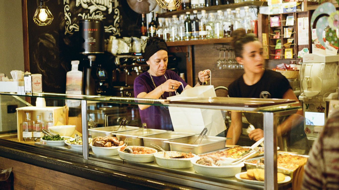
Wet markets as social spaces
The market’s importance extends beyond the stalls. Its surrounding coffee shop, food centre, benches and walkways create a setting where people meet without needing a formal invitation. Shopping gives those encounters a practical reason to happen.
Shared tables, coffee shops and the market’s wider ecosystem
Many markets sit beside or within larger food centres, so a basket of vegetables may lead naturally to breakfast. Shared tables encourage strangers to sit near one another, while coffee shops provide a slower pause after the briskness of shopping. The market and the kopitiam work as connected spaces.
The objects of that setting matter too: cups, saucers, tiled tables, trays and handwritten orders carry traces of repeated use. A thoughtful account of kopitiam objects shows how ordinary things can preserve social history when people continue to use them.
Encounters between generations, cultures and communities
A market brings together residents who might otherwise pass one another on separate schedules. Older shoppers, young parents, workers, students and visitors share the same narrow aisles, each bringing different food habits and memories. The encounter is often quiet, but it is still a form of civic life.
The mix is also cultural. Ingredients, languages and cooking traditions overlap without needing to be arranged into a single story. The market’s strength lies partly in allowing difference to remain visible and practical.
Markets as places of care, gossip and local belonging
Care often appears as information. Someone notices that a regular is unwell, a vendor explains how to cook an unfamiliar vegetable, or a neighbour passes on news about a lift repair or a family event. Gossip can be affectionate, irritating or both, but it keeps people connected to the place around them.
This is why a market can matter to people who buy only a little. The visit offers recognition and orientation. It tells residents that they are part of a living neighbourhood rather than merely occupants of a block.
The role of hawker centres and wet markets in neighbourhood identity
Wet markets and hawker centres are often remembered together because they combine food preparation, eating and conversation. A neighbourhood may be identified through the market’s breakfast, the hawker centre’s signature dishes or the vendors who have stayed through several changes of tenancy.
That shared identity is not frozen. As described in neighbourhood stories, heritage is found in evolving communities and the layers of daily use, not only in preserved façades. The market remains meaningful when residents continue to shape what it becomes.
Landmark markets and their distinctive characters
Singapore’s landmark markets are often discussed as destinations, but their deeper interest comes from the neighbourhoods around them. Each has a different relationship with housing, migration, food businesses and redevelopment. Comparing them reveals how a common market form can produce very different local personalities.
Tekka Centre and the multicultural texture of Little India
Tekka Centre is closely associated with Little India’s busy mixture of food, trade and community life. Its market offers ingredients and cooking traditions that sit within a wider district of spice sellers, eateries, temples and family-run businesses. The building is therefore best understood as part of an active neighbourhood rather than an isolated attraction.
Its character comes from proximity. A shopper can move from fresh produce to cooked food, from a market conversation to the streets beyond, and encounter several cultural registers within a short walk. Little India’s wider food and trade history is explored in this Little India guide.
Tiong Bahru Market between heritage and gentrification
Tiong Bahru Market sits within one of Singapore’s most recognisable housing estates, where modern cafés and older everyday businesses share the same broad setting. Its significance lies partly in this tension. The market remains a place for regular shopping and breakfast even as the surrounding area attracts new residents and visitors.
The estate’s history adds depth to the experience. Planning, public housing, food traditions and small provision shops have all shaped its identity over time. A closer Tiong Bahru history helps place the market within those longer routines rather than treating it as a fashionable backdrop.
Ghim Moh Market and the rhythms of an established estate
Ghim Moh Market and Food Centre has served an established residential community since the early 1970s. Its atmosphere is grounded in repetition: familiar queues, regular breakfast orders, and the steady exchange between a wet market and food centre. The surrounding estate gives the market a sense of daily continuity.
Its appeal is not based on novelty. It is the kind of place where a visitor can learn by observing how residents move, wait, choose and eat. The market’s history and present-day food culture are captured in this account of Ghim Moh Market, which reflects its place in Singapore’s evolving urban life.
Chinatown Complex and the evolution of a central-city market
Chinatown Complex brings market shopping into a district shaped by early migrant life, trade networks and changing patterns of residence. Its significance comes from the way old commercial functions meet a busy central-city environment. Nearby streets, shophouses, temples and food businesses add further layers to the market experience.
The market is also a reminder that central neighbourhoods are not museum pieces. Their communities change, businesses adapt and old spatial arrangements acquire new uses. The story of Chinatown shophouses offers useful context for understanding how homes, workplaces and community hubs once worked together.
Change, resilience and the future of Singapore’s wet markets
Wet markets have always changed. Regulation, redevelopment, housing policy and consumer habits have altered their form, while stallholders have adjusted their work to survive. The future question is not whether markets should remain exactly as they were, but what must be protected when their surroundings and business conditions shift.
Hygiene regulation, redevelopment and modern market design
Hygiene regulation has brought clearer expectations around cleaning, drainage, storage and food handling. Redevelopment can improve facilities and accessibility, yet it may also change the scale, atmosphere or affordability of a market. A cleaner or newer building does not automatically reproduce the relationships that made the old one valuable.
Good design needs to support actual work. Stallholders require usable storage, practical washing areas, sensible delivery routes and spaces where customers can move safely. Modernisation works best when it listens to the people who understand the market’s daily pressures.
Supermarkets, online groceries and shifting shopping habits
Supermarkets offer convenience, predictable hours and easy comparison. Online groceries reduce the need to travel and can suit households managing work, children or limited mobility. Wet markets therefore compete not only on price but on freshness, advice and the human experience of choosing food.
Some households divide their shopping between several formats. A supermarket may cover staples, while a market visit supplies fish, herbs or a conversation with a trusted vendor. The future is likely to involve overlap rather than a simple victory of one system over another.
Rising costs, disappearing trades and the challenge of succession
Small traders face costs that customers may not see: rent, utilities, transport, refrigeration, packaging, labour and unsold stock. A stall can be well loved and still be difficult to hand on. The loss of a specialist vendor may leave a gap that no larger retailer can quite fill.
Succession requires more than encouraging young people to admire traditional work. It requires viable conditions, training, respect for skill and room for new approaches. The wider old trades of Singapore show why adaptation is part of continuity, not a betrayal of tradition.
Why preservation must include people, not only buildings
A preserved market building can become strangely empty if the people who gave it meaning cannot afford to remain. Preservation should therefore include stallholders, customers, recipes, working methods, memories and the right of communities to describe their own places. This is a more demanding form of care, but it is also more honest.
For Singapore Heritage, community memory is shaped through stories, photographs, profiles and participation. A walk or a carefully researched object can help a familiar place be seen again, but it should never replace the people who live and work there. Markets endure when heritage remains connected to ordinary use.
Walk the Neighbourhood
Readers who want to encounter Singapore through markets, foodways and the people behind local places can book a heritage walk. Small-group, story-led experiences offer a slower way to notice the streets, trades and everyday memories that a hurried visit can miss.
Conclusion
Singapore’s wet markets endure because they make history practical: it is carried in a fishmonger’s knife, a vendor’s advice, a shared table and the route home with fresh ingredients. Their future will depend on allowing these everyday relationships to continue, so that preservation serves living communities rather than only remembered buildings.
Frequently Asked Questions
What is a wet market in Singapore?
A wet market is a neighbourhood market selling fresh and perishable foods such as fish, meat, poultry, fruit and vegetables, often alongside cooked-food stalls or a coffee shop.
Why are Singapore markets called wet markets?
The name refers to the water used for cleaning produce, washing work surfaces and managing the practical mess associated with handling fresh food. Ice and melting water around seafood stalls also contribute to the familiar description.
When is the best time to visit a wet market?
Early morning is usually the busiest and most characteristic time, when deliveries are fresh, stalls are fully stocked and regular shoppers are carrying out their daily routines.
Are wet markets only for older residents?
No. Older residents may be especially regular customers, but wet markets also serve families, cooks, workers, younger residents and visitors interested in fresh food and neighbourhood life.
What can shoppers buy at a Singapore wet market?
Common purchases include seafood, meat, poultry, vegetables, fruit, herbs, spices and other fresh ingredients. The exact range varies from one market and neighbourhood to another.
How are wet markets different from supermarkets?
Wet markets offer direct conversation with stallholders, visible preparation and advice about freshness or cooking. Supermarkets generally offer longer opening hours, packaged goods and a more standardised shopping process.
Why are wet markets important to Singapore’s heritage?
They bring together food traditions, family businesses, migration histories and repeated social routines. Their heritage value comes from continuing use and relationships, not simply from the age of the building.
Key Takeaways
Singapore’s street names preserve traces of plantations, rivers, migration, colonial administration and ordinary work. Read together, they form a compact history of how the island changed.
- Orchard Road began as a rural plantation track before becoming a shopping boulevard.
- Names such as Stamford, Victoria and Waterloo reflect the colonial period and its habits of commemoration.
- North Bridge Road, South Bridge Road and Beach Road retain clues about an older shoreline and river crossing.
- Malay, Chinese, Arab and Indian communities shaped the names and character of many streets.
- A walk through these roads can reveal living heritage beyond the buildings normally found in guidebooks.
1. Orchard Road: From nutmeg plantations to Singapore’s shopping spine
Orchard Road sounds as though it was always made for department stores, bright signs and weekend crowds. Its earlier landscape was much quieter: a rural lane bordered by nutmeg and pepper plantations, with orchards giving the road its enduring name. The area lay beyond the early town, reached through a landscape of gardens, slopes and scattered estates.
The plantations did not prosper forever. Disease damaged the nutmeg crop in the nineteenth century, while the expanding settlement gradually pushed north and west. Country houses, cemeteries and later shops replaced much of the agricultural land, and the road became part of the city’s growing suburban edge. Its transformation shows how a place name can outlive the activity that first made it meaningful.
Today, Orchard Road is associated with retail and entertainment, but the old name keeps a rural memory beneath the polished surface. That contrast is one reason the stories behind Singapore’s streets reward a slower look: names often preserve landscapes that development has erased.
2. Stamford Road: The colonial official remembered in the city centre
Stamford Road commemorates Sir Stamford Raffles, the British official most closely associated with the establishment of Singapore as a British trading post in 1819. The name sits in the Civic District, close to institutions and public spaces that grew around the early colonial town. It therefore feels less like a private memorial and more like part of an official map of power.
Raffles was not the only person involved in the settlement’s early history, and the name should not flatten the many communities already connected to the island and its harbour. Malay seafarers, regional traders, labourers and established local networks all belonged to the story. A road named for one administrator can still open a wider question about whose work made the town function.
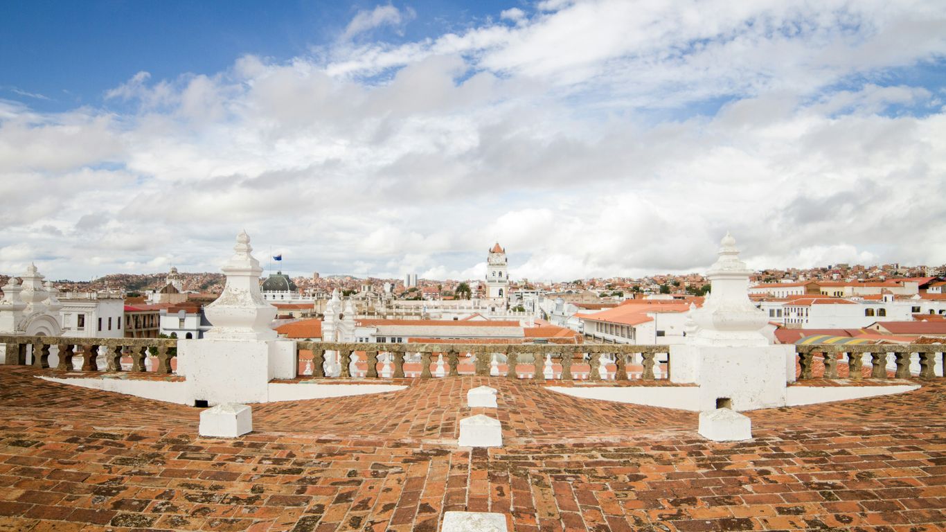
Walking along Stamford Road today brings together museums, performance spaces, schools and older civic buildings. The surroundings make the name legible as part of a colonial urban plan, while the people moving through the district keep giving the road meanings beyond its commemorative origin.
3. Raffles Place: How Commercial Square became a financial landmark
Raffles Place was first known as Commercial Square, a practical name for the business quarter developing beside the Singapore River. Warehouses, offices, counting houses and trading firms gathered there because the river connected the town to ships, lighters and regional commerce. The later name placed the district within the same commemorative tradition as Stamford Road.
The square changed as the port grew and business became more formally organised. Its location made it a natural centre for banks, exchanges and corporate offices, but the financial skyline rests on older layers of cargo handling and migrant labour. Coolies, lightermen, clerks and shopkeepers all helped turn the waterfront into a working commercial landscape.
A modern visitor may see towers first, yet the river remains the key to understanding the district. The Singapore River’s working history explains why this small area became so important: it was not simply chosen as a business address, but grew from the movement of goods, people and credit along the water.
4. Coleman Street: The architect behind Singapore’s early civic buildings
Coleman Street is named after George Drumgoole Coleman, an architect and surveyor whose work helped shape early Singapore’s civic appearance. He arrived during the formative years of the colonial settlement and became associated with buildings that gave the town a more permanent institutional character. The street preserves the memory of a professional whose influence can still be read in the city centre.
Coleman’s architecture responded to a tropical climate as well as European ideas of order and symmetry. Verandas, high ceilings, shaded openings and generous proportions were practical features, not merely decorative choices. His work belongs to a period when surveyors, builders, craftsmen and labourers were translating plans into structures suited to heat, rain and daily use.
Coleman Street now passes through a dense urban setting, so its name can be easy to skim over. Yet the surrounding civic buildings encourage a useful habit: connect a person on a sign with the materials, skills and institutions that made the city visible. Architectural history becomes more human when the buildings are considered as workplaces and public rooms rather than façades alone.
5. Waterloo Street: A European battle name in the heart of Bras Basah
Waterloo Street takes its name from the Battle of Waterloo, the 1815 European conflict in which the Duke of Wellington defeated Napoleon. Like several colonial-era names, it imported a distant event into Singapore’s local map. The name may seem out of place until it is read beside the churches, schools and civic institutions that marked the Bras Basah area.
The district developed as a meeting ground for education, religion and public life. Waterloo Street itself has long been associated with places of worship and communities whose daily routines gave the road a much richer local identity than its European reference suggests. A commemorative name became attached to processions, meals, lessons, prayers and passing generations.
That layering is typical of Singapore’s colonial street names history. The official label may point overseas, while the lived meaning grows here, through repeated use. A road can carry an imperial reference and still become thoroughly local through the people who walk, work and gather along it.
6. Victoria Street: Naming a road for a long-reigning queen
Victoria Street honours Queen Victoria, who ruled the United Kingdom from 1837 to 1901. The road was named in a period when British imperial authority was often expressed through public buildings, ceremonies and place names. Its position near the Civic District places it among several roads whose names reflect the hierarchy of the colonial administration.
Yet Victoria Street was never only a symbolic line on an official plan. It connected neighbourhoods, schools, shops and religious institutions, and its everyday traffic included people whose lives had little to do with the British court. The road’s history is therefore double-sided: its name announces imperial power, while its use records Singapore’s ordinary diversity.
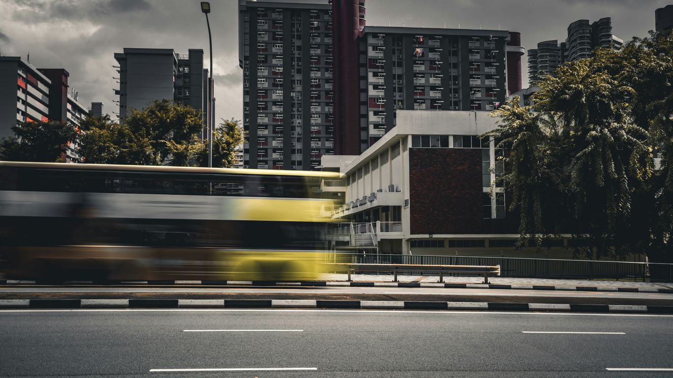
The street is a useful reminder that commemoration and daily life can occupy the same pavement. A queen’s name may be fixed in stone, but the character of the road has always been shaped by residents, worshippers, workers and students moving through Bras Basah and its edges.
7. Queen Street: The street that reflects Singapore’s colonial-era hierarchy
Queen Street also refers to Queen Victoria, rather than to an unnamed or later royal figure. Its location near Victoria Street makes the pairing especially clear, creating a small cluster of imperial names in the central city. Such naming was not accidental: colonial authorities often used roads to honour monarchs, officials, military figures and places connected to Britain.
The street’s social history, however, is more varied than the title implies. It has been associated with churches, schools, businesses and communities that developed around the central districts. The name reflects the official order of the time, while the street’s uses show how urban life was negotiated by people from many backgrounds.
A map can make hierarchy appear natural because every road label is given the same visual weight. On foot, the difference becomes more apparent. Queen Street belongs to a network of names that tells who colonial authorities wished to remember, even as neighbouring buildings and businesses reveal the broader society that actually lived there.
8. North Bridge Road: The route that once crossed the Singapore River
North Bridge Road was named for the bridge that carried the route across the Singapore River. The road linked the northern side of the town with the developing districts to the south, making it a practical connection rather than a tribute to a single person. Its companion, South Bridge Road, completed the logic of the crossing.
Before modern traffic engineering and wide transport corridors, the river was a working boundary. Boats, warehouses, ferries and foot traffic all shaped the experience of crossing it. The bridge made movement easier, but it also joined two areas with distinct patterns of trade, residence and community life.
The name is refreshingly direct. It records infrastructure, and infrastructure often reveals more about a city than grand monuments do. North Bridge Road points to the moment when a waterway became something to cross routinely, helping the settlement knit itself into a larger urban fabric.
9. South Bridge Road: A companion name shaped by the same historic crossing
South Bridge Road takes its name from the southern approach to the same historic crossing over the Singapore River. Together, North Bridge Road and South Bridge Road formed a simple directional pair, helping people navigate a town divided by water. Their names remain a small piece of evidence from an era when the river structured movement through the centre.
The southern side became closely linked with warehouses, markets, religious buildings and immigrant communities. Goods arrived, changed hands and moved inland, while families built institutions around work and worship. The road’s practical name thus sits within a much fuller history of commerce and settlement.
The two roads are best understood together rather than as isolated thoroughfares. Their relationship shows how official naming could be functional, while the life around the route became culturally dense. A bridge may solve a transport problem, but the streets leading to it gather the human consequences of that connection.
10. Beach Road: When the shoreline was much closer to the city
Beach Road preserves a striking clue about Singapore’s changing coastline. When the name took hold, the shore lay much nearer to the road than it does now, and the eastern edge of the town opened towards the sea. Reclamation later pushed the coastline outward, leaving the name to describe a geography that has largely disappeared.
The old shoreline was not an empty view. It was connected with boats, bathing, military activity, recreation and the practical business of a port. As the city expanded, land was created for roads, buildings and infrastructure, changing the relationship between the centre and the water.
That makes Beach Road one of the clearest examples of a name acting as a historical marker. The modern streetscape may feel far from a beach, but the label asks its readers to imagine an earlier edge of town. It also shows how urban growth can preserve language while completely remaking the landscape behind it.
11. Keppel Road: The naval commander behind a major western thoroughfare
Keppel Road is associated with Admiral Sir Henry Keppel, a British naval commander who visited Singapore and became part of the colonial record of the harbour. The road runs through the western side of the central area, close to places transformed by docks, railways, industry and later redevelopment. Its name reflects the maritime importance of the island.
Keppel’s association with Singapore belongs to the age when naval power and commercial shipping were tightly connected. Harbours were strategic spaces as well as workplaces, and their development affected dock labourers, merchants, transport workers and nearby communities. The road’s history therefore reaches beyond the individual named on the sign.

The western approaches can feel thoroughly modern, but the maritime connection remains legible in the route itself. Keppel Road invites a reading of Singapore as a port built through movement: ships offshore, cargo on land and people whose work joined the two.
12. Jalan Besar: The Malay phrase that simply means “big road”
Jalan Besar translates simply as “big road” in Malay. The name is descriptive rather than commemorative, suggesting a substantial route through what was once a less built-up part of the island. Its plainness is part of its charm: not every street needed a governor, monarch or battle to explain its place on the map.
The road became a link between the central city and northern settlements, passing through areas associated with agriculture, industry, housing and commerce. Over time, development made the route busier and more urban, but the Malay name remained. It is a reminder that local descriptions could survive alongside the imported names of colonial administration.
Several features of road naming can be seen in this one phrase: language, function and gradual urban change. A useful way to read Jalan Besar is to ask what counted as “big” when the road was named, and what kinds of movement made that scale visible.
Road names often preserve different kinds of evidence, and a short comparison helps keep them distinct:
| Name type | Example | What it records | Landscape behind it |
|---|---|---|---|
| Descriptive | Jalan Besar | Size or function | A developing route |
| Commemorative | Victoria Street | A person or authority | Colonial civic order |
| Geographic | Beach Road | A natural feature | An altered shoreline |
| Transport-based | North Bridge Road | Infrastructure | A river crossing |
The table shows why no single explanation fits Singapore’s roads. Some names honour power, others describe terrain or infrastructure, and many acquire new meanings through everyday use.
13. Arab Street: Trade, faith and the Arab community around Kampong Glam
Arab Street is closely associated with the Arab community and with Kampong Glam, a district shaped by trade, Islamic institutions and the Malay sultanate’s presence. The name points to a community whose commercial and religious networks connected Singapore to the wider region. It should not be read as a complete label for everyone who lived or worked in the area.
The street and its surroundings developed through textiles, perfumery, food, pilgrimage-related commerce and other forms of trade. Nearby places of worship and royal associations gave the district a strong cultural geography, while shopkeepers and residents made it an active neighbourhood rather than a museum piece. The atmosphere came from repeated daily practices: opening shutters, preparing food, greeting customers and gathering for prayer.
Visitors who look beyond the most photographed façades can see how community memory remains embedded in the district. Singapore Heritage’s Kampong Glam heritage walks take the same broad approach, connecting neighbourhood stories with the places and practices that keep them alive.
14. Tanjong Pagar Road: The “cape of stakes” and Singapore’s fishing past
Tanjong Pagar is commonly explained through a Malay phrase meaning “cape of stakes” or “point of stakes”. One interpretation connects the name with fishing stakes set along the shore, though place-name histories can hold more than one reading. Whatever the exact origin, the phrase directs attention towards a coastal landscape very different from the dense district seen today.
Fishing, shoreline work and small settlements belonged to Tanjong Pagar’s earlier story. The area later changed through port expansion, dock activity, housing and commercial development. As the waterfront was reshaped, the old name remained as a linguistic trace of a time when the cape and its waters were more immediate parts of local life.
The road’s later history is equally layered. Migrant workers, businesses, families and transport networks all contributed to its character, while redevelopment brought new towers and connections. Tanjong Pagar demonstrates how a name can preserve an older ecology even as the neighbourhood becomes a major urban centre.
15. Bukit Timah Road: What the name reveals about hills, tin and the interior
Bukit Timah combines Malay words commonly understood as “tin hill” or “tin-bearing hill”. The name points to the island’s interior terrain and to the mineral resources that attracted attention during the nineteenth century. It also reminds readers that Singapore’s history was not confined to the waterfront.
The road became an important route inland, passing through plantations, forests, estates and later suburban development. Its rise and distance from the early town made it useful for movement into a landscape that was once far less settled. The route’s changing edges show how roads often lead development rather than merely follow it.
Bukit Timah’s name is not a complete geological report, and interpretations of old place names can be debated. Still, it encourages attention to hills, streams, vegetation and extraction. Beneath today’s traffic, the road belongs to a longer story of how the island’s interior was surveyed, cultivated and connected.
16. Eu Tong Sen Street: The businessman and philanthropist behind the name
Eu Tong Sen Street commemorates Eu Tong Sen, a businessman associated with tin mining, property and philanthropy in Singapore and Malaya. The road lies near Chinatown and the Singapore River, where commercial activity brought together merchants, workers, residents and visitors. Its name reflects the role of Chinese entrepreneurs in the growth of the city.
Eu Tong Sen’s public memory is tied not only to business but also to donations and civic support. Like many names attached to urban streets, it can simplify a complicated life into a short label. The surrounding district restores some of the texture, with clan associations, temples, shops and food businesses showing the social worlds that commerce helped sustain.
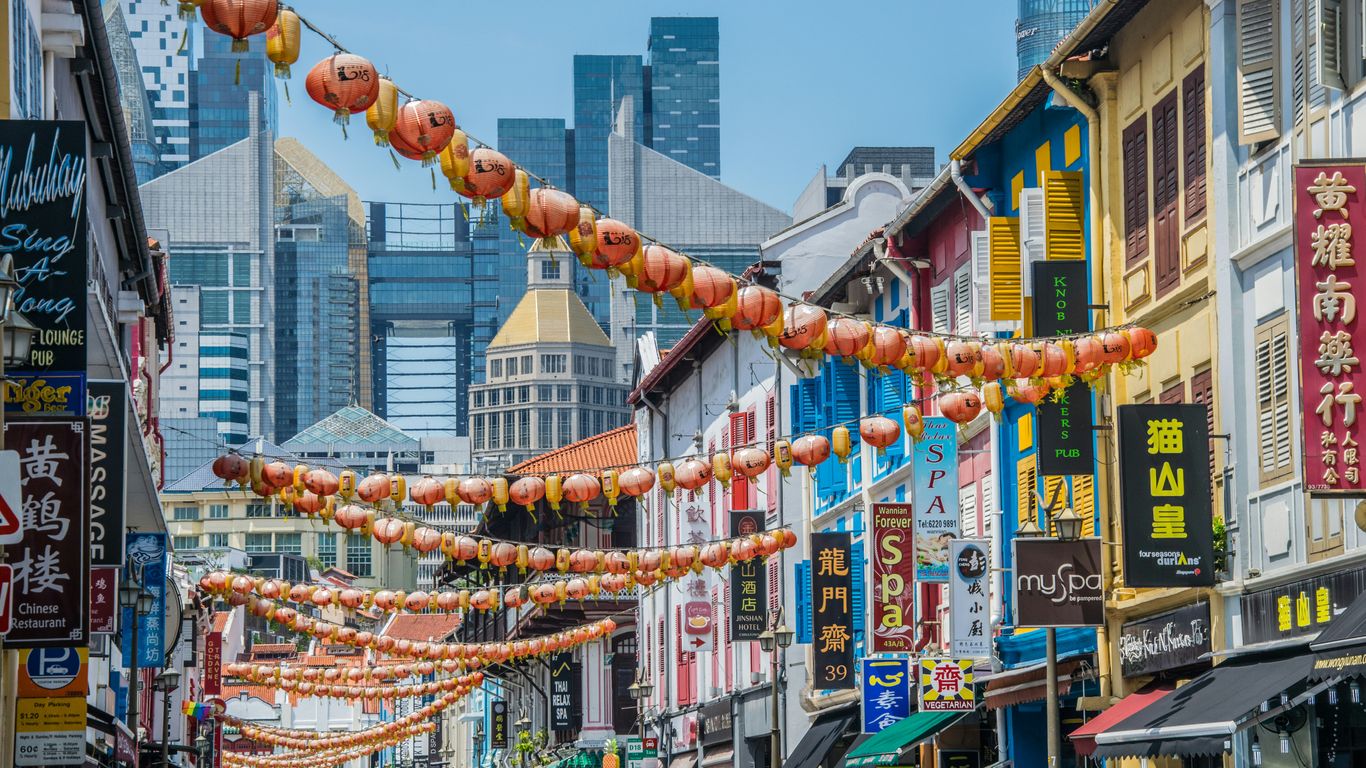
The road also illustrates how urban memory is selective. A prominent individual may receive the name, while thousands of less visible workers remain unnamed. A thoughtful walk through Chinatown can hold both truths at once, noticing the benefactor on the sign and the everyday labour that made the district prosper.
17. Tan Quee Lan Street: A Chinese merchant’s place in Singapore’s urban memory
Tan Quee Lan Street is named after Tan Quee Lan, a Chinese merchant remembered in the central area’s historical landscape. The street sits near Waterloo Street, Victoria Street and Queen Street, where a dense network of colonial and community histories meets. Its name provides a counterpoint to roads commemorating British officials and royalty.
Chinese merchants were involved in trade, property, associations and philanthropy, helping shape the commercial life of nineteenth-century Singapore. Their contributions were often recorded through businesses, schools, temples and community institutions as well as through personal names. Tan Quee Lan Street is therefore part of a wider story of migration and local belonging.
The road is not grand in scale, which makes its survival particularly suggestive. Urban memory does not require a boulevard to endure. Sometimes a short street, a shopfront and a familiar name carry a community’s presence more quietly than the city’s official monuments do.
18. Geylang Road: Untangling the competing theories behind a familiar name
Geylang Road has attracted several explanations, and none should be presented too confidently without acknowledging the uncertainty. The name has been linked to variations in Malay words, regional place references and older spellings recorded by colonial observers. Such changes are common when names move between spoken languages, official documents and maps.
The surrounding area was once associated with plantations and coconut cultivation before becoming a major corridor of settlement and commerce. Malay communities, Chinese businesses, religious institutions, food stalls and later entertainment venues all contributed to its layered identity. The road’s reputation has often overshadowed these ordinary histories.
Its uncertain etymology is not a weakness. It shows that place names are living evidence, shaped by pronunciation, translation and administration. Reading Geylang Road carefully means holding the competing theories alongside the much clearer record of communities making a life along the route.
19. Kallang Road: The river, the community and the name that predates modern Singapore
Kallang Road takes its name from the Kallang area and the Kallang River. “Kallang” is associated with the Orang Kallang, a seafaring community connected with the river and its surrounding waters. The name therefore reaches back beyond the formal colonial street plan, carrying an older relationship between people and the landscape.
The river supported fishing, transport, industry and later large-scale infrastructure. As the city expanded, wetlands and waterways were engineered, filled or redirected, while roads and housing changed the banks. Yet the name continued to mark a place where water had once been central to movement and livelihood.
Kallang Road is best read as a reminder that Singapore’s urban history did not begin with colonial mapping. Rivers, coastal communities and regional networks were already shaping the island. The road’s present-day bustle sits on top of those earlier connections rather than replacing them entirely.
20. Serangoon Road: How an old route became a corridor of migration and commerce
Serangoon Road was an old route leading north-east from the early town towards Serangoon and the interior. It connected the centre with plantations, villages and later expanding settlements. As the route became more urban, it gathered markets, workshops, religious buildings and homes along its edges.
The road is especially associated with Little India, where Indian migration and commerce shaped its visible character. Textiles, spices, goldsmiths, eateries and places of worship formed a lively corridor, but the story also includes municipal workers, transport operators, families and businesses from many communities. Its identity comes from accumulation rather than a single founding moment.
Serangoon Road makes a fitting final stop because it brings the themes together: an old route, changing land use, migration and daily trade. For readers planning to explore on foot, plan a heritage route with time to notice signs, thresholds, smells and working spaces rather than rushing between landmarks. That slower attention is often where the city’s less obvious history begins to speak.
Walk the Stories in Person
Singapore Heritage creates small-group heritage walks and storytelling experiences rooted in neighbourhoods, foodways, objects and everyday practices. Readers who want to move from the map to the street can browse routes guided by people familiar with the places and communities behind them.
Conclusion
Singapore’s street names are small vessels for a large history: plantations became retail districts, shorelines moved, rivers were bridged, and migrant communities made new homes through trade and faith. Read with care, the map becomes less a directory of roads than a record of changing landscapes and lived experience.
Frequently Asked Questions
Why do so many Singapore streets have British names?
Many roads were named during the colonial period after monarchs, officials, military figures and places connected with Britain. Those names remain alongside older Malay names and names linked to local communities, businesses and landscapes.
What is the history behind Orchard Road’s name?
Orchard Road was named for the plantations and orchards that once occupied the area. Nutmeg and other crops were grown there before urban development transformed it into a major commercial district.
Why are North Bridge Road and South Bridge Road named as a pair?
The names refer to the two approaches to a historic bridge across the Singapore River. Together, they describe an important route that connected the northern and southern parts of the early town.
Does Beach Road still lead to the beach?
The shoreline was once much closer to Beach Road than it is today. Land reclamation moved the coast outward, but the name remains as a reminder of the earlier geography.
Which Singapore street names come from Malay?
Examples include Jalan Besar, Bukit Timah, Tanjong Pagar and Kallang. Their meanings and histories relate to roads, hills, coastal features, rivers and communities, although some interpretations remain debated.
Why do some street-name origins have several explanations?
Older names passed through spoken languages, different writing systems and colonial record-keeping. Spellings and pronunciations changed, and later researchers may interpret the surviving evidence differently.
How can visitors learn more from Singapore’s street names?
They can walk slowly, compare nearby names, notice old buildings and observe how people use the area today. Local heritage trails, museums and community-led experiences can add context that a road sign alone cannot provide.
Key Takeaways
Singapore’s older playgrounds were more than places to climb and slide. They were colourful, tactile parts of estate life, and many still carry memories of how neighbourhood childhood once felt.
- Dragon playgrounds turned concrete into imaginative landmarks.
- Pelican and other animal forms made everyday play feel theatrical.
- Sand pits, corridors and void decks supported spontaneous social life.
- Mosaic and terrazzo gave public design a distinctive local character.
- Surviving playgrounds connect present-day families with shared memories.
The rise of old Singapore playgrounds
The story of old singapore playgrounds is closely tied to the growth of Singapore’s public housing estates. As families moved from kampongs and older urban settlements into new towns, childhood began to unfold around shared blocks, paved paths and communal amenities. The playground became one of the most familiar parts of that new landscape. It was close to home, free to use and open to children from many different households.
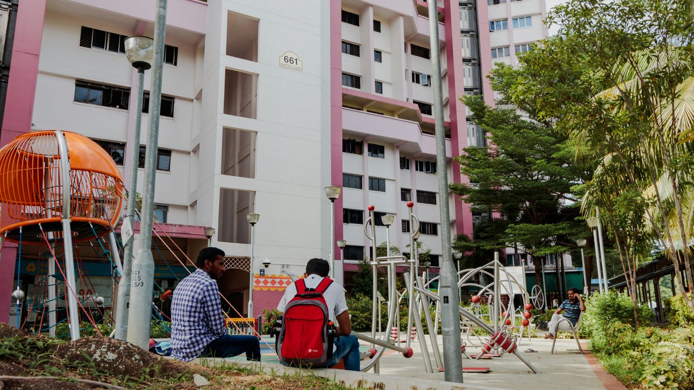
Housing estates and the changing shape of childhood
The new housing estates brought many families into closer physical proximity. A child might live several floors above the ground but still know the neighbours gathered near the sand pit, the auntie watching from a corridor, or the older children racing around the blocks. Playgrounds helped soften the scale of high-rise living by giving children a low, accessible world of their own.
Toa Payoh is a particularly useful place to understand this change. Its development from a rural district of kampongs and swamps into a planned HDB town brought new infrastructure as well as new routines. The story of Toa Payoh shows how housing, resettlement and community ties shaped the town, and the playgrounds belong within that wider story rather than standing apart from it.
Why playgrounds became part of Singapore’s nation-building story
A playground might appear small beside the larger work of building housing, schools and transport. Yet it expressed the same belief in shared public life. Children from different backgrounds could meet there without an appointment, while parents and grandparents built their own informal circles nearby. These spaces made the new estates feel lived in.
Public design also offered a way to give young neighbourhoods a recognisable identity. Instead of repeating anonymous equipment, designers introduced animals, boats, fruit and other forms that encouraged children to see their surroundings with curiosity. The result was practical recreation with a distinctly local imagination.
From practical recreation spaces to neighbourhood landmarks
At first, the playground was simply part of the estate’s amenities. Over time, particular structures became meeting points and directions: near the dragon, behind the pelican, beside the sand pit. Their shapes were easy to remember, even for children who did not yet know the names of the roads around them.
That everyday usefulness helped turn them into landmarks. A playground could be a place to wait for a sibling, cool down after school or spend an hour before dinner. Today, when residents revisit an old estate, the structure often brings back not one grand event but a scatter of ordinary afternoons.
The visual language of public play in the 1970s and 1980s
The playgrounds of the period were bold without being polished. Curved concrete, painted surfaces, terrazzo and ceramic mosaic tiles gave them a handmade visual presence. Their colours could fade under the sun, but the designs remained legible: a dragon was still a dragon, and a pelican’s beak still suggested a slide.
This visual language reflected a confident young city making room for pleasure in its built environment. The structures were not hidden behind elaborate landscaping. They sat among blocks, paths and open ground, asking children to invent the action themselves.
The dragons that became local icons
Among Singapore’s older playgrounds, the dragon is the form that has travelled furthest through memory. Its long body could be read as a climbing route, a tunnel or a bridge, while its head gave the whole structure a story. The design was recognisable across generations, even when individual playgrounds differed in scale, colour or layout.
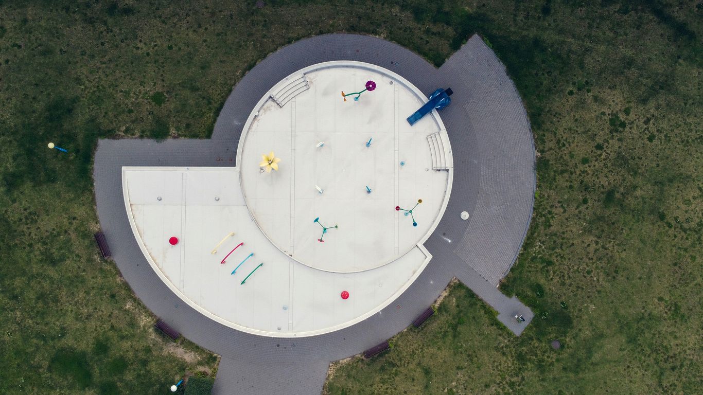
How the dragon playground design captured children’s imaginations
The dragon offered an immediate invitation to pretend. Children did not need instructions to understand that its body could become a path through an imaginary landscape. One child might be the traveller, another the guard at the head, while a younger sibling stayed close to the safer curves below.
Its appeal came partly from being neither entirely realistic nor entirely abstract. The concrete form suggested a creature, but left enough gaps for children to supply the rest. That balance made the playground feel like a permanent prop for stories that changed every afternoon.
Sand pits, concrete curves and climbing routes
The classic dragon arrangement combined several kinds of movement. Children climbed over rounded sections, crawled through openings and used the body’s curves to reach a slide or raised platform. Where sand remained beneath the structure, it also provided a softer surface and a separate world of digging, building and collecting.
The sand pit was social as much as physical. A child who was not ready to climb could still join in with a bucket or a makeshift road. Meanwhile, the older children treated the dragon’s body as a route to master, returning to the same challenge until it felt easy.
The differences between Singapore’s dragon playgrounds
Not every dragon playground looked or worked in exactly the same way. Some were fuller, longer forms, while others were smaller or arranged for younger children. Mosaic patterns, colour schemes, surrounding surfaces and the presence or absence of a sand pit changed the experience from one estate to another.
Those differences matter because memory is usually attached to a particular place. A resident may remember the dragon near a certain block, the roughness of its steps or the view of laundry above it. The shared design created a national image, but local details made each playground personal.
Why the dragon remains a symbol of shared childhood memories
The dragon has endured because it holds several kinds of memory at once. It recalls public housing, children’s independence and the close observation of adults nearby. It also belongs to a period when a neighbourhood amenity could become a piece of civic character without being designed as a landmark.
A useful way to see the surviving structures is through the old dragon playgrounds guide, which places the remaining examples in their estate settings. Their value lies not only in rarity. They show how design, play and everyday Singaporean life once met in the same small patch of ground.
Pelican slides and the imagination of everyday play
The pelican slide belonged to the same broad family of imaginative public structures, but it created a different mood. Its animal shape made the slide itself part of the story, rather than a separate piece of equipment attached to a frame. In an estate filled with repeated blocks, such a form could give children a memorable visual pause.
What made the pelican slide so distinctive
A pelican slide was easy to recognise because the animal’s body and beak suggested how it should be used. The slide’s route became part of the creature’s identity, turning a simple descent into an act of entering, travelling through or emerging from the animal. The design encouraged children to talk about what they were playing on, not merely what they were doing.
Its distinctiveness also came from scale. To a small child, the structure could feel like a large creature settled in the estate. That sense of encounter was central to the old designs: children were not just surrounded by equipment but invited to negotiate a strange, friendly object.
Animal-shaped structures across Singapore’s estates
Animal forms gave neighbourhoods their own small cast of characters. Alongside dragons and pelicans, residents remember elephants, birds and other themed structures, each using familiar images to make play more vivid. These designs were especially effective in places where the blocks and roads followed a broadly planned pattern.
The nostalgic elephant and watermelon playgrounds offer another view of this tradition. Their importance is not simply that they look unusual. They show how a functional estate space could also carry references to animals, food and childhood fantasy.
How children turned fixed designs into open-ended adventures
The designers fixed the concrete in place, but children supplied the rules. A slide could become a waterfall, a dragon’s opening a cave, and the ground around an animal a shoreline or campsite. The same structure supported quiet solitary play in the morning and noisy group games after school.
A few recurring habits often shaped an afternoon:
- Children claimed the highest reachable point before anyone else arrived.
- Younger players used the sand or lower platforms as their own territory.
- Older children invented races around the structure and nearby blocks.
- A familiar adult became the lookout, caller or referee without planning to.
These routines made the playground feel changeable despite its permanent materials. The structure stayed put; the meaning moved with the children.
The tactile appeal of mosaic, concrete and painted surfaces
Old playgrounds were designed to be touched. Hands met warm concrete, small tile joints and painted edges worn smooth by years of use. The surfaces carried heat after a sunny afternoon and held a different coolness when clouds gathered, making the playground part of the sensory life of the estate.
That tactility is one reason photographs cannot fully replace a visit. The colours and patterns may be visible, but not the scale of the curves or the feel of standing beneath a large concrete form. A careful look at mosaic playgrounds can suggest their faded beauty, while the physical places reveal how children once moved through them.
Growing up around the playground
For many residents, the playground was less an occasional destination than part of the daily route home. It sat between school, the lift lobby, the provision shop and dinner. Children could arrive without a booking, and adults could keep an eye on them while continuing a conversation or an errand nearby.
That informality gave the spaces their particular social texture. The playground was public, but it was also known territory, watched by people who recognised the children and noticed when someone new appeared.
After-school rituals and spontaneous neighbourhood games
The afternoon often began with a loose gathering rather than a formal plan. School bags were put down, shoes became dusty and a simple visit stretched longer than expected. Games changed according to who arrived, how hot the day was and whether the sand pit or slide was already occupied.
There was room for repetition. Children returned to the same routes, argued over turns and then resumed play minutes later. The ritual mattered because it gave the day a dependable pause between school and home.
The role of parents, grandparents and older siblings
Adults were present without always directing the action. A grandparent might sit near the edge, a parent might call from a block entrance, and an older sibling might quietly decide which parts were safe for a younger child. Supervision was woven into the setting rather than separated into a dedicated activity.
This arrangement also allowed adults to meet one another. Information about school, work, weather and neighbours travelled through these small gatherings. The playground was therefore an intergenerational space, with children’s movement and adult conversation happening side by side.
Friendships formed across corridors, void decks and sand pits
High-rise living did not automatically create community. Familiarity had to be made through repeated encounters, and playgrounds provided one of the easiest places for that to happen. Children met others from nearby floors, then carried those friendships into corridors, stairwells and the void deck.
The wider history of Singapore is often told through major changes, but the stories of ordinary people help recover these quieter forms of connection. A childhood friendship formed beside a sand pit may seem small, yet such encounters gave a new estate its feeling of belonging.
Play before smartphones and organised enrichment
Before screens and tightly scheduled enrichment filled so much family time, outdoor play could remain pleasantly unplanned. Children learnt to make their own entertainment from what was available: concrete, sand, chalk, a ball and the presence of other children. Boredom was not always solved by an adult; it often became the beginning of a game.
This did not make every afternoon idyllic. There were quarrels, falls, heat and the occasional instruction to go home. Still, the looseness of the experience gave children practice in negotiation and invention, qualities that are easy to miss when play is always organised in advance.
Materials, memories and the character of public design
The old playgrounds were memorable partly because their materials gave them a strong physical character. They were not interchangeable plastic units, and their surfaces changed visibly with use and weather. In that sense, wear was not merely damage; it became another layer of the neighbourhood’s history.
Their construction also reflected the practical demands of an outdoor city. Heat, rain, heavy use and limited space all shaped what could endure. The result was a public design language that felt sturdy, bright and direct.
Mosaic tiles as an enduring decorative signature
Small ceramic tiles gave the playgrounds colour and pattern without requiring elaborate ornament. They could outline a dragon’s body, mark an eye or enliven a plain curve. The mosaic made the structure readable from a distance, but rewarded closer attention with tiny variations in colour and texture.
For residents, particular tiles could become part of the memory. A chipped patch, a faded blue section or a rough edge might be more recognisable than the full design. Such details explain why restoration requires care: replacing everything with a perfect surface can remove the evidence of use that made the place meaningful.
Why concrete suited Singapore’s climate and urban landscape
Concrete allowed designers to form broad curves, openings and raised routes in a material suited to permanent outdoor installation. It could sit directly within an estate, without the visual fragility of a temporary structure. Its weight also gave the playground a sense of permanence that children understood instinctively.
The material was not always gentle. It became hot in strong sun and demanded attention around edges, steps and landings. Yet its limitations were part of the design story. The playgrounds were substantial pieces of the built environment, not objects that could be folded away after use.
Safety, maintenance and the changing standards of play
Standards for playground safety have changed considerably. Surfaces, fall zones, heights and access are now assessed with a level of consistency that older structures did not always have. Some playgrounds have therefore disappeared, while others have been repaired, fenced or adapted for continued use.
The debate is not simply between nostalgia and progress. Children need safe spaces, and public equipment must be maintained responsibly. At the same time, conservation asks whether a structure can retain its identity while meeting current expectations, rather than being replaced until only the theme remains.
How familiar wear and weathering became part of the charm
Weathering gives an old playground a visible biography. Paint fades, tiles loosen, and concrete gathers marks from rain, shoes and years of play. These signs can make a structure seem less attractive by conventional standards, but they also show that it has been part of ordinary life.
The contrast between material and memory is especially clear in small details. A repaired section may be newer than the surrounding surface, yet it belongs to the same continuing story. The charm comes not from pretending the playground has never changed, but from seeing how it has lasted.
Finding the legacy of Singapore’s playgrounds today
The surviving playgrounds are now visited by former residents, curious families, photographers and people who simply remember the shape of a dragon from childhood. They sit within active neighbourhoods rather than behind museum glass. That makes a visit both accessible and delicate: the playground is heritage, but it is also part of someone’s everyday surroundings.
A thoughtful visit looks beyond the familiar photograph. It notices the blocks, footpaths, shops and mature trees around the structure, because those surroundings explain why the playground mattered in the first place.
Old playgrounds that can still be visited
Several older or carefully recreated playgrounds remain across Singapore, although their condition and access can change. Toa Payoh’s dragon is the most widely recognised, while other surviving animal and themed structures offer a less complete but equally valuable picture of estate play. Families planning a visit should check current access and treat the space as a working public amenity.
For a broader route, the heritage walks collection offers ways to explore neighbourhood history through housing, architecture, food and community life. A playground becomes more expressive when it is encountered as part of that wider street-level setting.
What has survived through restoration and relocation
Some structures have survived in their original locations, while others have been moved or restored after redevelopment. Relocation can preserve a recognisable object, but it may separate it from the blocks, routes and neighbours that gave it meaning. Restoration therefore raises a question of context as well as condition.
The most successful preservation keeps enough of the original form and setting for visitors to understand how the playground worked. Even when a site has changed, careful interpretation can connect the remaining structure with the estate’s earlier routines.
Balancing conservation with modern safety needs
Conservation and safety need not be treated as enemies. A restored playground can retain its outline, colours and cultural meaning while receiving discreet improvements where necessary. The difficult part is deciding which changes protect the structure’s use and which changes erase its character.
That decision is best made with attention to residents, children and the people responsible for maintenance. Heritage belongs in active neighbourhoods only when it remains respectful of present needs, not when it is frozen for the sake of an idealised past.
Why these playgrounds still matter to a new generation
A child today may approach a dragon without knowing its history, and that is perfectly fitting. The structure can first be a climbing challenge, then a curious old object, and only later a link to parents’ or grandparents’ memories. Its meaning grows through use and conversation.
Singapore Heritage’s neighbourhood heritage stories take a similar interest in the objects, routes and memories that make ordinary places significant. For residents, the old playgrounds offer a chance to see a familiar estate afresh; for visitors, they provide a gentler entry into the lived history beyond major landmarks. Those who want to plan a heritage walk can continue the story on foot, with attention to the people and places around the playground.
Conclusion
Dragon playgrounds, pelican slides and their weathered companions remain powerful because they joined imagination to ordinary estate life. They were made of concrete and mosaic, but remembered through friendships, family routines and the feeling of having a whole neighbourhood to explore. Preserving them means caring for both the structures and the living communities around them, so that a new generation can make its own memories there.
Frequently Asked Questions
Where can visitors see an old dragon playground in Singapore?
The best-known surviving example is in Toa Payoh, with other dragon-related structures and replicas found in different neighbourhoods. Visitors should check current conditions and access before travelling.
Why were dragon playgrounds built in Singapore?
Dragon playgrounds were designed as imaginative public recreation spaces within housing estates. Their distinctive forms also gave growing neighbourhoods memorable local landmarks.
What materials were used in older Singapore playgrounds?
Many used concrete, terrazzo, ceramic mosaic tiles and painted surfaces. These materials allowed large themed forms to stand outdoors and withstand regular use.
Did every dragon playground look the same?
No. Dragon playgrounds varied in size, layout, colour, mosaic treatment and surrounding features. Some included sand pits or different climbing and sliding arrangements.
What was special about the pelican slide?
The pelican slide combined an animal-shaped structure with the sliding experience itself. Its form encouraged children to treat the equipment as part of an imaginative story.
Why were sand pits common in older playgrounds?
Sand pits provided a flexible play surface for digging, building and quieter games. They also allowed younger children to participate while older children used climbing routes and slides.
Are old playgrounds still suitable for children today?
Some can still be used, while others are mainly appreciated as heritage structures or have been modified. Families should follow signs, observe safety guidance and respect any restricted areas.
Key Takeaways
Toa Payoh’s story is a story of water, work, movement and collective adaptation.
- The name Toa Payoh recalls a landscape once marked by a large swamp.
- Kampongs, farms and small rural businesses shaped everyday life before redevelopment.
- Drainage, roads and resettlement prepared the area for large-scale public housing.
- HDB planning created a self-contained new town with homes, schools, markets and shared spaces.
- Modern Toa Payoh still carries traces of its rural past through memory, food and community life.
1. What the name Toa Payoh reveals about its early landscape
Before the towers, traffic junctions and town-centre shops, Toa Payoh was understood through its ground and water. The area’s name offered a plain description of that setting, while the lives built around it gave the landscape its human meaning. To understand toa payoh history, it helps to begin not with a block number but with the swampy terrain beneath the town.
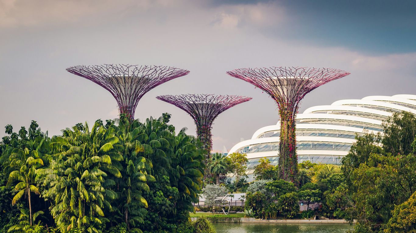
The meaning of “Toa Payoh” and its links to the area’s terrain
“Toa Payoh” is commonly explained as “big swamp”: “Toa” refers to something large in Hokkien, while “payoh” is associated with swamp in Malay. The name is more than a translation exercise. It suggests low-lying ground, standing water and a place whose boundaries were once read through ponds, muddy edges and drainage channels rather than through broad avenues.
Names often preserve an earlier way of seeing. In this case, the old name points towards the physical conditions that influenced settlement, farming and movement. The future new town would be built by changing those conditions, but the name continued to hold the older landscape in view.
From rural fringe to a settled community north of central Singapore
Toa Payoh lay beyond the most crowded parts of the old city, yet it was not an empty wilderness. Families, workers and small businesses occupied the rural fringe, making use of whatever dry ground, road access and water sources were available. A useful wider context can be found in this history of Singapore’s ordinary people, which places kampongs and overlooked workers alongside the better-known events of national history.
The district gradually became a settled community with its own routines. People travelled for work, children attended nearby schools, and neighbours developed practical knowledge of the paths and shortcuts that connected scattered homes. The settlement was modest, but it already had the social texture of a neighbourhood.
Why the district’s history is inseparable from water, soil and drainage
Water affected almost every decision about life in early Toa Payoh. It shaped where homes could stand, how crops were grown, how goods moved and whether a route remained passable after heavy rain. The soil, too, mattered: transforming a wet landscape into a stable urban district required more than drawing streets on a plan.
That physical work can be easy to overlook when the finished town appears orderly. Yet the drains, filled areas and raised roads were part of the town’s earliest infrastructure. Toa Payoh’s transformation was therefore both social and geological, involving the movement of people as well as the reshaping of the ground.
2. Kampongs, farms and everyday life before redevelopment
The pre-HDB landscape was rural without being isolated. Kampongs stood among vegetable plots, ponds and small holdings, and residents made a living through a mixture of cultivation, animal rearing, trading and casual work. Those activities gave the area an everyday rhythm that was very different from the high-rise town that followed.
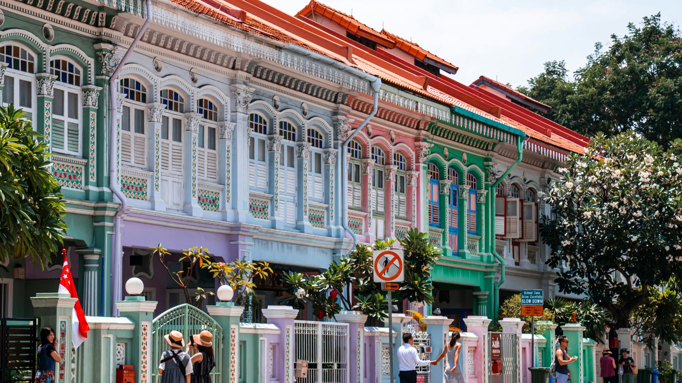
The families who lived and worked around the swamps
Families settled close to the work that sustained them, often building lives around shared paths and familiar neighbours. Homes were not simply private units; they were part of a wider web of relatives, friends and workmates who could lend tools, watch children or help after a storm. The wet ground demanded alertness, but it also encouraged cooperation.
For many residents, the kampong was remembered through ordinary details: a cooking fire, a footbridge, a bicycle leaning against a wall, or a neighbour calling across an open yard. These details matter because they show how a place becomes home before it is formally designated as a town.
Vegetable plots, livestock and small-scale rural industries
Farming was a central part of the area’s older economy. Vegetable plots supplied food to nearby communities, while livestock and other small rural enterprises added to household incomes. Work followed the seasons and the weather, with early starts, muddy hands and constant attention to water.
The landscape supported a range of livelihoods rather than one neat industry. A household might combine farming with transport, repair work or selling food. That mixed economy made the community flexible, even when earnings were uncertain.
Community ties, shared spaces and the practical spirit of kampong life
Shared spaces were woven into the practical life of the kampongs. Paths, clearings and informal gathering places served several purposes, allowing people to meet, work, celebrate and solve immediate problems together. The arrangement was not planned in the modern estate sense, but it produced a strong awareness of who lived nearby.
This was not a romantic world without hardship. Housing could be basic, services limited and access difficult. Still, the community’s habits of mutual help became part of the memory later attached to Toa Payoh, much as the stories of Chinatown’s old shophouses reveal how homes and workplaces could also function as social infrastructure.
3. The swamps and the challenges of living on unstable ground
The swamp was not merely a picturesque feature of old Toa Payoh. It could flood, slow journeys and make construction difficult, especially when rain turned tracks into deep mud. Improving the area meant tackling physical constraints that had shaped local life for decades.

Flooding, muddy paths and the seasonal realities of the wetland landscape
Heavy rain changed the experience of distance. A route that seemed manageable in dry weather could become slippery or submerged, and low-lying homes faced the nuisance of water entering yards and paths. Residents developed local knowledge about safer crossings, timing journeys and protecting household belongings.
These seasonal realities also limited access to education, markets and employment. A town’s future could not rest on informal paths alone. Roads and drains were not glamorous projects, but they determined whether a settlement could support a larger and more secure population.
How roads, drains and transport gradually connected Toa Payoh
Connection came incrementally. Existing routes were improved, drainage was extended and public transport made it easier for people to move between the rural district and the wider city. Each improvement reduced the sense that the swampy fringe was beyond the everyday reach of central Singapore.
Transport also changed opportunity. Workers could travel more reliably, goods could be carried further and services could reach more households. Infrastructure did not erase the old landscape immediately, but it made a different scale of settlement possible.
The tension between preserving a rural way of life and improving living conditions
Redevelopment carried a genuine promise of better housing and services, but it also threatened familiar places and established livelihoods. The decision was not simply between old and new buildings. It involved the loss of working landscapes, neighbours, routines and landmarks that had never appeared on formal maps.
A practical way to understand the change is to hold both truths together:
- The kampongs offered close social ties and detailed local knowledge.
- Rural housing and access could be insecure or uncomfortable.
- New infrastructure improved movement, sanitation and public services.
- Clearance disrupted livelihoods and separated established communities.
The resulting history is neither a simple tale of progress nor a straightforward lament for what disappeared. It is a record of trade-offs made under pressure.
4. Why Toa Payoh became a priority for public housing
By the middle of the twentieth century, Singapore faced an urgent housing problem. Many people lived in crowded city districts or informal settlements, while the growing population needed homes with dependable water, sanitation and transport. Toa Payoh’s open, centrally placed land made it a significant opportunity for a new approach.
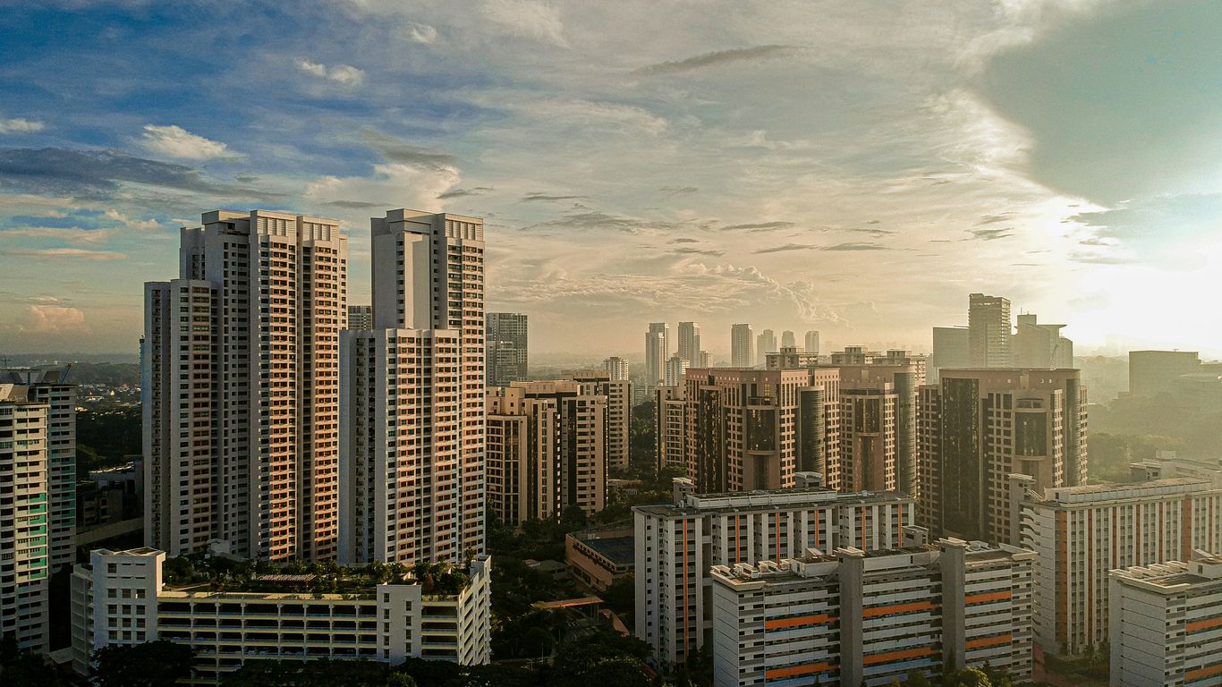
Singapore’s housing shortage and the limits of overcrowded city districts
Overcrowding affected health, privacy and family life. Rooms were shared, buildings were densely packed, and public facilities struggled to keep pace. The need was not for a handful of replacement homes but for entire neighbourhoods that could support daily life at scale.
Toa Payoh offered room for that ambition. Its distance from the old city was manageable, while its undeveloped areas allowed planners to think in terms of roads, housing clusters and public amenities together. The town would become one of the clearest early expressions of this approach.
Land clearance, resettlement and the disruption of established kampongs
Clearance made construction possible, but it came at a human cost. Residents of kampongs and other settlements had to move, and the change could unsettle work, schooling, social networks and family arrangements. Compensation and rehousing addressed some practical needs, yet they could not reproduce every relationship tied to a particular path or plot.
The process also changed the meaning of land. Areas once valued for cultivation or household enterprise were reassigned to roads, blocks and civic facilities. The new town was designed for a larger population, but its foundations lay in places that had already been lived in and worked.
The planning decisions that made Toa Payoh suitable for a new town
Toa Payoh’s location, available land and potential connections made it suitable for comprehensive planning. Rather than adding homes one by one, planners could organise a town with housing, transport, schools, markets and open spaces in relation to one another. This self-contained model helped residents meet many daily needs close to home.
The broad planning logic can be seen in the contrast between the old and new settlement patterns:
| Feature | Earlier Toa Payoh | Planned new town |
|---|---|---|
| Housing | Scattered homes and kampongs | High-rise blocks in organised estates |
| Movement | Informal paths and rural roads | Drains, roads, buses and later rail connections |
| Livelihoods | Farms, livestock and small enterprises | Residential, commercial and institutional activity |
| Services | Uneven and locally improvised | Schools, markets and amenities planned nearby |
The table does not make the transition soundless or smooth. It shows instead why Toa Payoh was valuable to public-housing planners: the area could be remade as a functioning urban district while retaining a strong connection to the wider city.
5. Building Toa Payoh New Town in the 1960s and 1970s
Construction altered the skyline first, then the daily habits of residents. Blocks rose where huts, ponds and plots had stood, and families moved into homes with more regular services and clearer connections to town facilities. The scale of the work was striking because the new town was built not as a single building project but as a complete urban environment.
The arrival of HDB blocks and a new high-rise way of living
The Housing and Development Board, established in 1960, drove the public-housing programme that reshaped Toa Payoh. The town became an early major example of high-rise living, bringing households into flats arranged around shared circulation, lifts and common ground. For residents arriving from more crowded or informal housing, the change could feel both liberating and unfamiliar.
High-rise living altered neighbourly contact. People no longer met only along a kampong path or at a doorway; they encountered one another in stairwells, lifts, corridors, playgrounds and the spaces beneath blocks. The architecture created new forms of proximity, even as it removed the older rural setting.
Designing schools, markets, playgrounds and services within walking distance
A new town had to work at the pace of ordinary life. Children needed schools, families needed food markets and workers needed transport, while older residents needed places to sit, meet and manage errands without long journeys. These facilities gave the blocks a civic setting rather than leaving them as isolated towers.
The arrangement also helped turn unfamiliar estates into recognisable neighbourhoods. A market became a meeting point; a school anchored family routines; a playground gave children a territory of their own. Planning mattered, but the meaning of each place came from repeated use.
Balancing large-scale construction with Toa Payoh’s existing landscape and communities
The construction programme had to overcome swampy ground and reorganise existing communities at the same time. Roads, drains and building platforms were part of one immense act of adjustment. The finished estate looked orderly, but that order depended on years of engineering, clearance and negotiation.
The result was not a clean break from the past. Former residents carried memories into the flats, while new arrivals developed their own stories around the town centre, bus routes and shared facilities. Toa Payoh’s high-rise identity was therefore made by people as much as by concrete.
6. How residents made the new town their own
A planned estate becomes a neighbourhood only through use. Residents gave Toa Payoh character by turning facilities into meeting places, adapting shared areas to the rhythms of family life and creating memories that planners could not specify in advance. Food, conversation and repeated encounters softened the newness of the blocks.
Hawker centres, coffee shops and markets as places of connection
Markets and eating places gathered different households around familiar routines. A coffee shop could hold an early-morning conversation, while a hawker centre brought together workers, schoolchildren and families at different points in the day. These were not decorative additions to the town; they were social infrastructure.
Singapore’s wider hawker tradition shows how food spaces can become a shared dining room as well as a place to eat. The history of Singapore’s hawker culture helps place Toa Payoh’s food centres within that larger story of urban planning, migration and everyday sociability.
Void decks, playgrounds and common spaces in everyday neighbourhood life
The void deck became a flexible threshold between home and street. It offered shade, shelter and room for encounters, while playgrounds gave children a place to test independence within a familiar estate. Residents learned which corners were quiet, which benches caught the breeze and where neighbours were likely to appear.
These spaces also allowed the town to accommodate different generations. Older people could remain close to home, parents could keep an eye on children, and teenagers could gather without needing a formal venue. The architecture’s most lasting social effects often came from these ordinary, shared margins.
The changing experience of growing up in Toa Payoh’s early HDB estates
For children growing up in the early estates, Toa Payoh was a world of lifts, corridors, playgrounds, school routes and shopfronts. The town was dense, but it was also legible: familiar adults watched out for one another, and small errands became opportunities for independence. Memories of growing up there often combine the excitement of a modern town with affection for its rougher, earlier years.
That attention to lived experience is central to Singapore Heritage, whose researched stories connect neighbourhoods with foodways, objects, old trades and walking itineraries. A walk through Toa Payoh, approached patiently, can similarly begin with a block or market and open into a much longer history.
7. Toa Payoh history and the legacy of a transformed landscape
Modern Toa Payoh can appear fully urban, yet its earlier geography has not vanished entirely. It survives in names, memories, routes, fragments of open space and the stories told by residents who remember the change. The town is also significant because it demonstrates how public housing became a framework for nation-building and everyday belonging.
What remains of the kampongs and swamps in the modern town
Most residents no longer encounter the swamp as an obstacle in the old sense, but water and ground remain part of the town’s background. Drainage channels, planted spaces and the arrangement of roads hint at the work required to make the land habitable for a dense population. Oral memories add what the physical traces cannot show: where families lived, what was grown and which paths once mattered.
The modern landscape should therefore be read in layers. Its blocks and amenities belong to one period, while memories of farms, ponds and kampongs belong to another. Neither layer is complete on its own.
The district’s role in shaping Singapore’s public-housing model
Toa Payoh helped demonstrate the possibilities of a self-contained new town. Housing was planned alongside transport, education, food, recreation and commercial services, creating a model that could be adapted elsewhere. Its importance lies not only in the number of flats built but in the idea that a housing estate could support a full social life.
A broader timeline of Singapore’s turning points shows how housing, infrastructure and education were bound up with the country’s wider transformation. Toa Payoh belongs within that national story, while still retaining the particular memories of its residents.
Why Toa Payoh still represents both rapid nation-building and local memory
Toa Payoh holds two narratives at once. It represents the speed and confidence of a young state solving an urgent housing crisis, but it also recalls the people and places displaced by that solution. The tension is precisely what makes the district so compelling: progress is visible in concrete, while loss and belonging are carried through memory.
Singapore Heritage’s small-group heritage walks and storytelling experiences are rooted in neighbourhoods, foodways, objects, places and everyday practices. That approach suits Toa Payoh, where the past is best understood not as a frozen monument but through the ordinary details that continue to connect people with place. Readers who want to explore heritage walks can carry that same attentive spirit into the town’s streets and shared spaces.
CTA: Walk the Stories
To see Singapore through lived neighbourhood histories, explore Singapore Heritage’s small-group heritage walks and story-led experiences, where familiar places can open into deeper local memory.
Conclusion
Toa Payoh was transformed from a swampy rural district into a pioneering new town, but its history did not end when the HDB blocks rose; it continued through the routines, relationships and memories that made the planned estate feel like home.
Frequently Asked Questions
What does “Toa Payoh” mean?
“Toa Payoh” is commonly understood as “big swamp”, combining a Hokkien word associated with something large and a Malay term linked to swamp or wetland.
What was Toa Payoh like before public housing?
It was a rural landscape of kampongs, vegetable plots, ponds, huts and small-scale livelihoods, with families living and working around areas of wet and unstable ground.
Why was Toa Payoh chosen for redevelopment?
Its location, available land and potential for improved roads and drainage made it suitable for comprehensive planning during Singapore’s severe housing shortage.
When did Toa Payoh New Town begin to develop?
Major public-housing development began in the 1960s, following the establishment of the Housing and Development Board in 1960, and continued through the 1970s.
How did redevelopment affect kampong residents?
Redevelopment provided access to more formal housing and services, but it also required resettlement and disrupted established livelihoods, neighbours and familiar landscapes.
What facilities helped make the new town self-contained?
Schools, markets, playgrounds, transport connections, eating places and common spaces were planned alongside housing so that many daily needs could be met close to home.
Why is Toa Payoh’s history still relevant?
The district shows how Singapore’s public-housing programme changed the physical landscape while also revealing the human costs, adaptations and community memories behind that transformation.
Key Takeaways
Queenstown remains one of Singapore’s clearest examples of how housing, planning and community life grew together.
- Queenstown was Singapore’s first satellite town, developed in response to a serious post-war housing shortage.
- Its early estates combined flats with schools, healthcare, shops, transport and open spaces.
- Markets, hawker centres, cinemas and community institutions gave the new town a daily rhythm.
- Redevelopment has changed the landscape, while older blocks and memories continue to anchor its identity.
- A walk through Queenstown reveals Singapore’s wider story through ordinary homes, streets and routines.
Queenstown before the satellite town
Before the towers and broad roads, Queenstown was a rural corner of Singapore shaped by villages, farms, streams and smallholdings. The district’s later identity was built over an older landscape rather than on an empty site. To understand Queenstown Singapore history, it helps to begin with the people and places that came before public housing.
The villages and rural settlements that came first
The area included kampongs and rural settlements such as Boh Beh Kang, a name commonly associated with the local landscape and its waterways. Families lived in modest houses, tended plots of land and relied on close neighbourhood ties. The daily scene was quieter and more dispersed than the planned estate that would follow, with paths and streams shaping movement through the area.
This kind of ordinary settlement belongs to the wider story of Singapore’s everyday history, where infrastructure and migration altered routines long before the modern skyline appeared. Queenstown’s transformation was therefore not simply architectural; it also involved the relocation and reorganisation of established communities.
Singapore’s post-war housing crisis
After the Second World War, Singapore faced overcrowding, poor housing conditions and a rapidly growing population. Many families lived in cramped rooms or informal settlements, while demand for safe, affordable homes far exceeded supply. Housing became a practical necessity and a central concern of public policy.
The pressure was visible in the contrast between the city centre’s dense quarters and the looser rural edges. A new approach was needed: housing had to be produced at scale, but it also had to support schools, transport, health services and the routines of family life.
Why the area was chosen for large-scale development
Queenstown offered space close enough to the central city to remain connected, yet open enough for comprehensive planning. Its position near established roads made it suitable for new routes and public transport, while the available land allowed planners to arrange housing in groups rather than as isolated buildings.
The choice also reflected the practical geography of post-war Singapore. A satellite town could take pressure off the centre while giving residents access to a more complete neighbourhood. That balance between distance and connection would become one of Queenstown’s defining qualities.
The meaning behind the name Queenstown
Queenstown was named in 1953 to mark the coronation of Queen Elizabeth II. The name gave the new development an official identity as it began to emerge from its rural setting. It also fixed the estate within the political language of the period, when Singapore was still a British colony.
Over time, however, residents made the name their own. Queenstown ceased to be merely an administrative label and became shorthand for particular blocks, schools, food stalls, playing fields and friendships. Place names gain their deepest meaning through repeated use in everyday life.
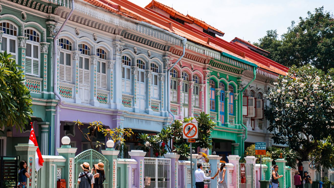
The birth of Singapore’s first satellite town
Queenstown was conceived as more than a collection of flats. It was an experiment in building a new kind of urban community beyond the crowded centre, with homes and services planned together. The first phases set patterns that would influence public housing across Singapore for decades.
The Singapore Improvement Trust’s early housing plans
The Singapore Improvement Trust, or SIT, began developing housing in Queenstown before the Housing and Development Board was established. Its work formed part of an earlier public response to overcrowding, introducing planned blocks and more reliable services to families who had often lived in difficult conditions.
The early estates were not identical to the later HDB town, but they helped establish the area as a testing ground for public housing. Their layouts, construction methods and relationship to roads offered lessons that could be applied on a much larger scale.
The transition from SIT to the Housing and Development Board
In 1960, the Housing and Development Board replaced the SIT and took on a far broader building programme. The change came at a moment when speed and volume mattered: Singapore needed many more homes, and the new board had the mandate to deliver them.
Queenstown became one of the places where that ambition could be seen clearly. The town’s growing estates reflected a shift from limited improvement schemes to coordinated national housing, with standardised construction supporting rapid delivery.
How Queenstown was designed as a self-contained community
A self-contained town was intended to reduce the need for residents to travel across the island for basic services. Housing was arranged alongside schools, clinics, shops, places of worship, recreation grounds and community facilities. The result was a neighbourhood where a child’s school, a parent’s market and an elderly resident’s clinic might all sit within familiar walking distance.
That planning principle also gave Queenstown a social centre of gravity. Corridors, void decks, playgrounds and shopfronts became informal meeting places, allowing private family life to overlap with shared neighbourhood routines.
The first estates around Stirling Road and Commonwealth Avenue
Stirling Road and Commonwealth Avenue became important early axes of development. Blocks rose beside newly improved roads, and estates such as Princess Margaret Estate helped establish Queenstown’s reputation as a pioneer town. The buildings were practical, but their spacing and access to light and air also shaped how residents experienced home.
The town’s first generation of estates can still be read as a record of changing confidence. Early buildings answered an urgent housing need; later additions expressed a more settled idea of what a complete public town might contain.
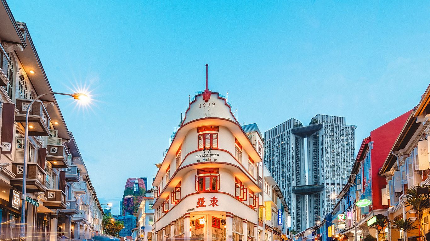
Planning a new way of urban living
Queenstown changed the physical scale of domestic life. Families who had known kampong houses, rented rooms or crowded shophouses moved into flats with formal services, numbered addresses and shared facilities. The town’s plan brought together the practical systems that make a neighbourhood work.
High-rise flats and modern family homes
For many residents, the flat represented security and modernity: a permanent home with water, electricity and a clearer sense of privacy. Different block types and flat sizes accommodated households at various stages of life, while taller buildings made efficient use of limited land.
The architecture was never only about height. Verandas, windows, breezeways and generous spaces between blocks helped adapt the buildings to Singapore’s tropical climate. As Queenstown’s pioneering architecture shows, these details are part of the estate’s social history as much as its visual character.
Schools, clinics and shops within walking distance
The neighbourhood plan worked because daily needs were not treated as afterthoughts. Schools served children close to home, clinics provided accessible care, and small shops supplied groceries and household necessities. These facilities turned a residential development into a lived town.
The pattern can be summarised simply:
- Schools gave children a familiar daily route.
- Clinics brought basic healthcare closer to families.
- Shops and markets supported ordinary household routines.
- Community facilities created places for meeting and organising.
These destinations also produced repeated encounters. A walk to buy bread, collect medicine or attend class could become part of the social fabric, linking households that might otherwise have remained strangers.
Roads, public transport and connections to central Singapore
Queenstown’s location made connectivity central to its success. Commonwealth Avenue, Queensway and surrounding roads tied the estate to the city and to other developing districts. Public transport allowed residents to reach work, school and commerce beyond the town, even as local facilities reduced the need for constant travel.
Later rail connections strengthened that relationship with the wider island. Yet the original planning idea remained visible: a satellite town should be connected to the centre without depending entirely on it.
The role of open spaces and shared amenities
Open space gave the new density room to breathe. Playing fields, small parks, courtyards and landscaped edges offered children somewhere to run and adults somewhere to pause. Shared amenities softened the boundary between the flat and the wider estate.
They also carried an important social function. Residents encountered one another in spaces that were neither fully private nor formally commercial, and those encounters helped turn a planned settlement into a community with its own habits and memories.
Everyday life in early Queenstown
The history of a satellite town is best understood through its routines. Moving day, the morning market, a school bell, a bus ride and an evening beneath the block all reveal how planning became personal. Queenstown’s residents gave the estate its character through the ways they used and remembered it.
Moving from kampongs into new flats
Moving into a flat could feel liberating and unsettling at once. Families gained better services and more secure housing, but they also had to adjust to shared staircases, lifts, corridors and neighbours living close by. Sounds travelled, children made friends quickly, and domestic life became more visibly part of a larger building.
The transition changed household habits too. Cooking, washing and entertaining moved into a more compact setting, while the estate outside the front door became an extension of family life. For older residents, the move often carried memories of what had been left behind as well as hopes for the future.
Markets, hawker centres and neighbourhood commerce
Food shops, markets and hawker centres supplied more than meals. They were places where residents exchanged news, recognised familiar faces and measured the pace of the morning. The sounds of chopping, frying and conversation made commerce feel close to home.
Singapore’s wider hawker culture and shared dining spaces help explain why such places matter beyond their menus. In Queenstown, foodways connected generations: a dish could preserve a family preference, a stall could become a landmark, and a regular breakfast could anchor a week.
Schools, clubs and community institutions
Schools and clubs gave the young town its organised life. They offered education, sport, performance and opportunities for residents to meet beyond the immediate household. Community institutions also helped newcomers form relationships in an estate where many families were learning how to live alongside one another.
Libraries, associations and activity groups created a sense of belonging that housing alone could not provide. Their importance was often quiet and cumulative, built through lessons attended, games played and conversations repeated over many years.
The experiences of Queenstown’s first generations of residents
The first generations experienced Queenstown as both a national project and a personal home. They saw empty land become streets, watched neighbours arrive from different parts of Singapore and raised children in a town that was still acquiring its landmarks. Their memories are varied: pride in a first proper home, affection for a favourite stall, frustration with growing crowds, and sadness when familiar blocks disappeared.
That range of feeling matters. A neighbourhood’s heritage is not a single official story but a collection of lived accounts, much like the stories of ordinary Singaporeans preserved through family memories and community history.
Landmarks that tell Queenstown’s story
Queenstown’s landmarks are not all grand monuments. Some are working places, some have vanished, and others survive as recognisable blocks or names on a map. Together they show how healthcare, entertainment, food, reading and housing became part of the town’s identity.
Queenstown Polyclinic and the growth of public healthcare
Queenstown Polyclinic represents the way public healthcare became embedded in the new estate. A nearby clinic meant that families could seek care without crossing the island, making health services part of the ordinary geography of home, school and work.
Its significance lies in that everyday accessibility. Public healthcare was experienced not as an abstract national achievement but as a waiting room, a familiar route and a service relied on by several generations.
The former Queenstown Cinema and neighbourhood entertainment
The former Queenstown Cinema recalls a time when entertainment was woven into the neighbourhood rather than concentrated in large commercial complexes. A cinema offered an evening destination for families, young people and couples, and its presence gave the estate another shared reference point.
Even after such venues close, their names remain in conversation. Residents remember queues, films, meeting places and the particular excitement of going out locally for the night.
Tanglin Halt Food Centre and the culture of local food
Tanglin Halt Food Centre became closely associated with the food culture of the estate. Its stalls and surrounding activity show how hawker centres function as practical kitchens, social rooms and repositories of taste. Residents return not only for a meal but for a familiar rhythm and a connection to earlier years.
The objects of food culture matter as well: enamel cups, tiled tables, order calls and handwritten notes can hold as much memory as a building. That is why kopitiam objects and memories offer such a useful way to read Singapore’s everyday heritage.
Libraries, community centres and public gathering places
Libraries and community centres extended the town’s public life beyond shopping and housing. They offered rooms for classes, reading, meetings and performances, creating a civic layer within the estate. These places helped residents develop interests and relationships that crossed age and block.
A gathering place does not need to be monumental to be significant. Its value grows through repeated use, especially when it gives children, families and older residents reasons to share the same local space.
Housing blocks as examples of Singapore’s architectural history
Queenstown’s blocks document the changing language of public housing. Their forms reflect different periods of construction, from early low-rise and slab blocks to taller buildings with distinctive proportions and circulation spaces. Some became instantly recognisable through colour, shape or the way they met the surrounding landscape.
For visitors, the buildings reward slow observation. A staircase, façade, void deck or sheltered walkway can reveal how architects and residents negotiated climate, privacy and community in a dense city.
Queenstown’s transformation over the decades
No estate remains fixed. Queenstown has absorbed new homes, transport links, services and generations of residents while losing parts of its earlier fabric. The challenge has been to renew a working town without erasing the evidence of how it began.
Redevelopment and the changing shape of the estate
Redevelopment has brought newer flats, refreshed public spaces and different patterns of density. Areas that once consisted of compact blocks and open fields now include contemporary housing and carefully designed pedestrian routes. The change reflects both ageing buildings and shifting expectations of urban life.
For residents, redevelopment is never merely a planning exercise. It can mean better lifts, larger facilities and improved accessibility, but it can also alter views, walking routes and the familiar scale of the neighbourhood.
The Selective En bloc Redevelopment Scheme and its impact
The Selective En bloc Redevelopment Scheme, introduced in the 1990s, allowed selected older blocks to be replaced while residents were offered new homes nearby. In Queenstown, the scheme accelerated renewal and changed the appearance of several parts of the estate.
Its impact was practical and emotional. Relocation could bring improved housing, yet the demolition of a block also removed a physical setting where family histories, neighbourly habits and childhood memories had accumulated.
New housing at Dawson, Alexandra and Margaret Drive
Newer developments around Dawson, Alexandra and Margaret Drive show how Queenstown continues to be planned for contemporary needs. Higher-density housing, landscaped routes and updated amenities have extended the town’s residential role while linking it to workplaces, parks and transport.
These areas sit beside older estates rather than existing in isolation. Their relationship creates a layered townscape in which different ideas of public housing can be read within a short walk.
The loss and preservation of older buildings
Some older buildings have disappeared, while others have gained recognition for their architectural or social value. Preservation is not always about freezing a neighbourhood; it can also involve recording stories, retaining distinctive structures and allowing new uses to emerge.
The most thoughtful approach keeps residents in view. A conserved façade means more when its history is connected to the people who lived, worked and gathered there, rather than treated as a decorative object detached from its community.
Queenstown’s heritage and enduring legacy
Queenstown’s importance reaches beyond the claim of being first. It demonstrates how a housing estate can become a social landscape, where policy is translated into kitchens, corridors, playgrounds and shared meals. Its story also shows that urban heritage is constantly negotiated between renewal and remembrance.
What makes Queenstown significant in Singapore’s history
Queenstown was an early test of the idea that public housing could form a complete town. Its development brought together large-scale construction, local services, transport and community facilities at a time when Singapore was confronting urgent housing needs.
The estate therefore sits at the meeting point of national history and private memory. The broad story belongs to Singapore, but its meaning is carried by residents who remember particular blocks, routes, shops and neighbours.
Heritage trails and places visitors can still explore
Visitors can explore Queenstown through its remaining estates, food centres, roads, public buildings and changing skyline. A heritage walk works best when it follows the relationship between places rather than treating each landmark as an isolated stop. The Queenstown pioneer town trail offers one route into that layered history.
Singapore Heritage’s small-group heritage walks take a similar story-led approach, connecting streets and buildings with the people and practices that made them meaningful. The experience is less about collecting sights than noticing how a town is lived.
Stories of residents, memories and community identity
Resident stories give Queenstown its warmth. They include accounts of moving into a first flat, learning a route by bus, buying breakfast at Tanglin Halt or meeting friends beneath a block. Some memories are joyful, others complicated, especially when relocation or redevelopment changed a familiar setting.
Singapore Heritage also creates story-led heritage experiences and researched gifts rooted in neighbourhoods, foodways and everyday practices. That approach respects the fact that heritage is carried by people, makers and communities, not only by official plaques.
How the first satellite town continues to evolve
Queenstown continues to change as new residents arrive and older generations pass on their recollections. New housing and public spaces sit alongside older blocks, while food stalls, schools and familiar routes keep renewing the estate’s social life. The town’s identity is therefore cumulative rather than preserved in one untouched form.
Its lasting lesson is simple: successful urban history is found in the connection between design and daily use. Queenstown remains worth exploring because its streets show how a national housing project became a lived neighbourhood.
Conclusion
Queenstown’s story is the story of Singapore learning to build not only homes, but communities. Its blocks, markets, clinics, schools and memories reveal how ordinary life gave meaning to an ambitious plan, and why the first satellite town still matters today.
Frequently Asked Questions
Why is Queenstown called Singapore’s first satellite town?
Queenstown is regarded as Singapore’s first satellite town because it was planned as a substantial residential community outside the central city, with housing and essential services developed together.
When did Queenstown begin to develop?
Major development began in the 1950s, with early work associated with the Singapore Improvement Trust followed by the much larger public housing programme of the Housing and Development Board.
What was Queenstown like before public housing?
Before the estates were built, the area contained rural settlements, kampongs, farms and smallholdings, including communities associated with Boh Beh Kang.
Which places are associated with Queenstown’s heritage?
Important places include early housing estates, Tanglin Halt Food Centre, Queenstown Polyclinic, former entertainment venues, community facilities and distinctive older housing blocks.
How did redevelopment affect Queenstown?
Redevelopment introduced newer homes and facilities, but it also led to the demolition or relocation of some older blocks, changing familiar landscapes and community routines.
Can visitors explore Queenstown on foot?
Yes. Visitors can walk between older estates, food centres, public buildings, open spaces and newer developments, although routes and access arrangements should be checked before setting out.
Why is Queenstown important to Singapore’s wider history?
Queenstown shows how Singapore used public housing and town planning to respond to post-war overcrowding while creating neighbourhoods where services, transport and community life could develop together.
Explore Queenstown With Stories
Readers can discover more through a small-group Singapore Heritage walk, where local streets, foodways and resident memories provide a slower, more human way into Queenstown’s past. Those who prefer to begin independently can plan a heritage walk and continue exploring at their own pace.
Key Takeaways
Tanjong Pagar Railway Station is remembered not only as a handsome building, but as a place where Singapore’s connections with the Malay Peninsula became part of ordinary life.
- The station opened in 1932 as the southern terminus of the Federated Malay States Railways.
- Its Art Deco design carries symbols of agriculture, commerce, transport and industry.
- Trains connected Singapore with Kuala Lumpur and destinations farther north.
- The 2011 closure ended a distinctive cross-border railway arrangement.
- The conserved station remains a powerful place for remembering movement, work and farewell.
The beginnings of Tanjong Pagar Railway Station
The story of Tanjong Pagar Railway Station begins with a practical need: Singapore’s port was expanding, and the island needed a dependable land connection to the Malay Peninsula. The railway brought people and goods into the city while tying the southern harbour to towns and plantations farther north. Its terminus was therefore more than a transport facility. It was a statement about Singapore’s place within a wider regional system.
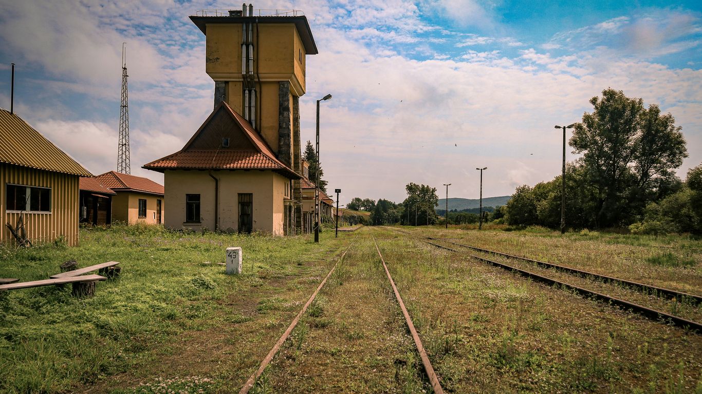
Why Singapore needed a railway terminus
By the early twentieth century, Singapore was a major port, but ships alone could not move every person or cargo inland. A railway route offered a quicker overland link to the peninsula, connecting the harbour economy with agricultural districts, tin-mining centres and growing towns. A proper terminus at the southern end of the island gave that network a visible civic address.
The location near Keppel Road and the docks also made logistical sense. Goods could be transferred between ships, warehouses and trains without crossing the whole city. For passengers, the terminus marked the beginning or end of a long journey north.
The station’s opening in 1932
Tanjong Pagar Railway Station opened in 1932, after several years of construction on reclaimed land. Its arrival gave Singapore a substantial railway gateway, with a monumental façade that stood apart from the more utilitarian buildings around the port. The building was designed to be seen, entered and remembered.
The opening belonged to the final period of British colonial rule, when infrastructure was often presented as evidence of administrative reach and economic progress. Yet the station’s history would soon become larger than that official story, shaped by the passengers, railway workers and families who passed through it.
The role of the Federated Malay States Railways
The initials FMSR on the façade refer to the Federated Malay States Railways, the railway authority associated with the network that served the peninsula and Singapore. Tanjong Pagar was built as the southern terminus of that system, making the building a physical expression of a railway geography that crossed political and administrative boundaries.
The railway was not simply a line between two points. It was a network of stations, sidings, workshops, port facilities and working routines. The grand terminal at Keppel Road represented the public face of that much larger operation.
Tanjong Pagar’s place in Singapore’s growing port district
The station belonged to a busy working district where dock labour, shipping, warehouses and transport overlapped. Its proximity to the harbour meant that the movement seen there was not limited to travellers with suitcases. Crates, mail, luggage and commercial goods all formed part of the railway’s daily rhythm.
That relationship between infrastructure and neighbourhood remains central to understanding the building. A history of Singapore’s changing infrastructure helps place the terminus within the island’s longer transformation from trading settlement to modern city. Tanjong Pagar was both a destination and a working hinge between land and sea.
Reading the station’s architecture and symbolism
The building’s architecture is unusually expressive for a railway terminus. Its broad front, strong horizontal lines and carefully placed sculpture give it the air of a civic monument, while the platforms and operational spaces behind it served very practical needs. A visitor can read the station as both a public image and a workplace.
The details reward slow attention. Reliefs, murals, lettering and stonework tell a story about the values that the railway wished to project, even as the lived experience inside the station was more varied and human than the official symbols suggest.

The grand façade and its civic ambitions
The façade uses the language of Art Deco: symmetry, geometric emphasis and a sense of controlled movement. The large FMSR initials sit high above the entrance, making the railway authority unmistakable to anyone approaching from Keppel Road. The scale gives the station a ceremonial quality, as though every departure belonged to a larger public undertaking.
That grandeur was not accidental. A terminus was an arrival point for visitors and an outward-facing symbol of order, connection and modern transport. Its architecture announced that the railway was central to the economic life of the port.
The murals depicting Malaya’s landscapes and industries
Inside, murals depict the landscapes and industries associated with Malaya, including agriculture, mining and other forms of production. They turn a passenger hall into a visual map of the territory served by the railway. The images suggest that the line carried not only passengers but also the resources and labour that sustained the region.
The four marble reliefs beneath the initials are commonly read as allegories of Agriculture, Commerce, Transport and Industry. Together, they make the station’s message plain: the railway was being presented as a force connecting production, trade and movement.
A compact way to read those symbols is to place them beside the station’s daily functions:
- Agriculture points towards the goods and landscapes of the peninsula.
- Commerce reflects the port, markets and exchange that sustained Singapore.
- Transport names the railway’s role in joining separate places.
- Industry evokes the machinery, labour and resources behind the journey.
The list is neat, but the history was not. Behind these polished images were workers, unequal colonial structures and communities whose lives were affected by the railway in ways the murals could not show.
The station hall, platforms and passenger experience
The station hall was the threshold between city and journey. Passengers bought tickets, waited with their luggage, met arriving relatives and navigated the formalities of travel before moving towards the platforms. The platforms themselves belonged to a different register: more open, noisy and closely tied to the practical business of trains.
Photographs of the station often draw attention to its arches and decorative surfaces, but the passenger experience depended just as much on sound and timing. A whistle, a porter’s movement or the arrival of a train could change the atmosphere in seconds.
How the building reflected its colonial-era context
Tanjong Pagar Railway Station reflects a colonial era in which infrastructure, trade and authority were closely bound together. Its symbols celebrate the productive wealth of Malaya and the efficiency of the railway, while leaving much of the social cost and human inequality outside the frame. Reading the building today requires holding those two truths together.
The station is therefore best understood neither as a simple relic of empire nor as a neutral piece of transport architecture. Its beauty is real, and so is the complicated history embedded in the reasons it was built.
Tanjong Pagar railway station history through everyday journeys
The most affecting account of the station is often found at human scale. People came to work, trade, visit relatives, study, migrate or begin a holiday. They waited beneath the high roof, checked their tickets and watched the platform with the particular patience that long-distance travel demands.
This everyday dimension is why the tanjong pagar railway station history continues to resonate. The building carried regional connections, but those connections were experienced through small acts: a packed bag, a hurried goodbye, a parcel handed across a barrier.

Commuters, traders and long-distance travellers
The station served different kinds of travellers at once. Some journeys were routine, made by people whose work or family life crossed the border. Others were commercial, with traders and port workers moving alongside passengers travelling for less predictable reasons.
The terminus also gave long-distance travel a distinctive shape. A trip to Kuala Lumpur or farther north was not an abstract line on a map; it was a sequence of stations, meals, conversations and changing views from the carriage window.
Train journeys between Singapore and the Malay Peninsula
For much of its working life, the station offered a direct rail connection between Singapore and the Malay Peninsula. Trains carried passengers through a landscape that shifted from the dense southern city to rural settlements, plantations and larger urban centres. The journey made the peninsula feel connected by experience, not merely by geography.
The railway also gave families a reliable way to maintain relationships across the border. A station can be remembered as a monument, but it was first a place where people set off to see someone, deliver something or return home.
Departures, arrivals and the rituals of farewell
Departures created their own rituals. Relatives lingered until the last possible moment, while passengers checked their belongings and found their seats. Arrivals brought a different kind of anticipation: faces searched the platform, and a familiar figure emerged from the flow of travellers.
Those gestures were ordinary, which is precisely why they matter. They placed emotion inside an institutional building and made the station part of countless private histories. The stories of Singapore’s heritage approach offers a useful reminder that places are sustained by objects, routes and memories as much as by official dates.
Stories preserved in photographs and personal memories
Photographs preserve the shape of the building, but personal memories often preserve its atmosphere. Former passengers recall waiting, eating, carrying children and navigating customs; railway workers remember timetables, uniforms and the disciplined movement of trains. Each account adds texture that architecture alone cannot provide.
A photograph can show who stood in front of the façade on one afternoon. Memory may explain why that afternoon was never forgotten. Together, they turn the station from a static landmark into a living archive of movement.
The railway connection between Singapore and Malaysia
Tanjong Pagar’s history cannot be separated from the political relationship between Singapore and Malaysia. The station was part of a railway system managed from across the border, and its land arrangements remained unusual even after Singapore became independent. That made the terminus both useful infrastructure and a reminder of unfinished historical agreements.
The cross-border connection continued because it served practical needs. At the same time, customs, land ownership and sovereignty created complications that were rarely visible to a passenger simply trying to catch a train.
How the line linked Singapore with Kuala Lumpur and beyond
The railway connected Singapore with Kuala Lumpur and other destinations across the peninsula. For passengers, the route offered a continuous journey north; for commerce, it joined Singapore’s port with inland markets and production areas. The line helped make the border a point of passage rather than an absolute interruption.
The station’s importance can be felt in the way it gathered several scales of travel together. A person could arrive from a nearby street, board a train bound for Kuala Lumpur and become part of a regional network within minutes.
The railway’s importance after independence
After Singapore’s independence in 1965, the railway remained significant despite the new national boundary. Trains continued to carry passengers and goods, and the station retained its role as a southern terminus. Its continued operation showed how older infrastructure could outlast the political arrangements that created it.
It also meant that the station carried a particular historical tension. Singapore was an independent country, yet a major railway connection still operated through an arrangement linked to Malaysia. Everyday travel made that relationship tangible.
Why the station remained connected to Malaysia’s rail network
The station remained connected because the railway network itself crossed the border and because the established route was valuable to passengers and trade. The operational logic was straightforward even when the legal and political context was not. Trains, tracks and timetables do not change as quickly as national boundaries.
For travellers, the arrangement became part of the station’s identity. Tanjong Pagar was a Singapore landmark that also functioned as the southern gateway of a Malaysian railway system. That dual character made it unlike almost any other station in the city.
The political and practical complications of shared railway land
The railway land created one of the most unusual parts of the station’s history. Malaysia’s railway authority retained rights connected with the land and tracks in Singapore, producing a complicated relationship between ownership, sovereignty and daily operation. Customs procedures added another layer, as passengers passed through formal border controls at the terminus.
The arrangement was workable, but never simple. A heritage account of the station’s cross-border role explains why the building became such a revealing place to observe the relationship between the two countries. Its tracks were practical, yet they also carried the weight of history.
The final departure and the end of an era
The closure of Tanjong Pagar Railway Station in 2011 was not just the removal of a transport service. It ended a familiar route and altered the meaning of the building, which moved from daily use into the realm of heritage. For former passengers and railway workers, the change was felt through the loss of routines as much as through the disappearance of trains.
The final years were watched with particular tenderness. People returned to photograph the façade, walk the platforms and remember journeys that had once seemed unremarkable.
The 2011 agreement that changed the railway route
An agreement reached in 2010 between Singapore and Malaysia changed the future of the railway route. The arrangement led to the end of train services to Tanjong Pagar and the relocation of the Singapore terminus to Woodlands. The decision resolved long-standing issues around the railway land while bringing the historic route through the city to a close.
The change was practical and political at once. It reflected the need to manage land and transport differently, but it also closed a chapter in the shared history of Singapore and Malaysia.
The last train from Tanjong Pagar
The last train departed from Tanjong Pagar on 30 June 2011, with the station ceasing operations at the end of that day. The departure drew former passengers, railway enthusiasts, photographers and people who simply wanted to be present. A working terminus became, almost overnight, a place of recollection.
The final journey was significant because it was both public and deeply personal. Some people were saying goodbye to a railway line; others were saying goodbye to a building that had formed part of family life.
What the closure meant to former passengers and railway workers
For former passengers, closure meant losing a familiar starting point and the particular atmosphere of rail travel from Keppel Road. For workers, it meant the end of routines built around trains, platforms, signals and schedules. The station’s emotional force came from this overlap between a large institutional change and the disruption of many smaller lives.
The memories surrounding the station’s final days show why heritage cannot be reduced to architectural survival. A preserved building can remain standing while the patterns of work and movement that gave it meaning have gone.
From functioning terminus to heritage landmark
Once trains stopped running, the station entered a new phase. Its façade and interior could be considered as protected heritage, while the wider site was drawn into plans for changing transport and redevelopment. The building no longer organised journeys, but it continued to organise memories of them.
That shift is common in cities, though rarely painless. A station becomes a landmark when its practical purpose ends, yet its strongest meanings often come from the years when it was busy and imperfectly ordinary.
Preserving Tanjong Pagar Railway Station today
Tanjong Pagar Railway Station remains valuable because it holds several histories in one place: colonial infrastructure, regional transport, cross-border politics, port work and family memory. Conservation protects the physical evidence, but interpretation must also keep the human stories visible. The station’s future depends on both.
It sits within a wider conversation about how Singapore changes without losing its ability to remember. The question is not whether a historic building should remain frozen, but how new uses can respect the reasons people care about it.
The station’s conservation and protected features
The station was gazetted as a national monument in 2011, shortly before its railway operations ended. Its Art Deco façade, murals, reliefs, lettering and principal interior spaces are among the features that give the building its distinctive identity. Conservation allows these details to remain legible rather than treating them as decorative background.
The station is best approached slowly. Stone, painted surfaces and carved allegories reveal different layers of the building’s purpose, while the empty platforms suggest the scale of the journeys that once began there.
Balancing heritage with redevelopment
Redevelopment around a conserved building creates a careful balance. New public uses can bring life back to a site, but they should not overwhelm the building’s proportions or erase its relationship with the railway corridor. The most convincing adaptation allows visitors to sense both the old function and the new one.
A heritage walking guide to Singapore offers a broader way to think about this balance: buildings, streets and everyday activity are connected, and a monument makes more sense when read within its surrounding routes. Tanjong Pagar’s future should retain that sense of connection.
What remains of the wider railway corridor
The station was only one part of the former railway route. Tracks, bridges, cuttings and alignments extended northwards, leaving traces that have become meaningful in their own right. The Rail Corridor allows parts of that larger infrastructure story to be encountered as landscape rather than as a functioning railway.
What remains is necessarily incomplete. Some sections have changed, while others retain a stronger physical impression of the former line. Together, they help explain that the station once belonged to a much longer journey.
Why the station still matters to Singapore’s memory of movement
The station matters because movement is part of Singapore’s history. Ports, ferries, buses, roads and railways have shaped where people worked, lived and met one another. Tanjong Pagar gathers those themes into a single building, giving them a human scale through the memory of departure and return.
That is also why Singapore Heritage’s story-led walks and researched gifts focus on places, objects and everyday practices rather than monuments alone. A visit can begin with the station’s architecture and continue through the Rail Corridor heritage routes, where the old connection is understood as part of a living city. The station’s lasting lesson is simple: infrastructure becomes heritage when people remember what it allowed them to do.
Conclusion
Tanjong Pagar Railway Station was built to move people and goods, but its deepest legacy lies in the relationships formed around those journeys. The trains have gone, the route has changed and the port district continues to evolve, yet the station still gives Singapore a place to consider connection, separation and return. Those who want to encounter such histories through local stories can book a heritage walk and continue the conversation beyond the monument.
Frequently Asked Questions
When did Tanjong Pagar Railway Station open?
Tanjong Pagar Railway Station opened in 1932 as the southern terminus of the Federated Malay States Railways.
Where was Tanjong Pagar Railway Station located?
The former station stood on Keppel Road, close to Singapore’s historic port and docklands.
What destinations did trains from the station serve?
The railway connected Singapore with Kuala Lumpur and other destinations across the Malay Peninsula, including places farther north.
Why was the station important to Singapore?
It linked the port city with the peninsula’s people, goods and industries, making regional travel and trade more direct.
What do the FMSR initials mean?
FMSR stands for Federated Malay States Railways, the railway authority associated with the network that served the peninsula and Singapore.
When did the last train leave Tanjong Pagar?
The last train departed on 30 June 2011, after which railway operations moved to Woodlands.
Can the station still be visited?
The conserved building is used for heritage-related access and events at selected times, subject to current arrangements and permissions.
Key Takeaways
Tiong Bahru’s story reaches well beyond its present-day cafés and polished façades.
- The name Tiong Bahru recalls the area’s former burial grounds and rural edge.
- The Singapore Improvement Trust estate introduced a distinctive response to overcrowding and poor housing.
- Curved blocks, balconies, staircases and open circulation shaped everyday life.
- Markets and hawker stalls became part of the neighbourhood’s social memory.
- Conservation now sits alongside questions about tourism, affordability and who gets to define heritage.
The landscape before the estate
Before the flats, Tiong Bahru occupied a shifting edge between Singapore’s growing town and its less-developed southern hinterland. Burial grounds, plantations, paths and small settlements formed a landscape quite unlike the compact estate seen today. The name itself preserves a clue to that earlier geography, while later roads and buildings show how quickly the city moved around it. Anyone tracing Singapore’s ordinary lives will find that such edges often reveal as much as grand civic buildings.
The meaning of “Tiong Bahru” and its early rural setting
“Tiong Bahru” is commonly understood as “new cemetery”, joining a Hokkien reference to a tomb or burial place with the Malay word bahru, meaning new. The name points to a time when the area was known through its landscape rather than its housing blocks. It also carries the layered language of Singapore, where place names often preserve encounters between communities. That mixture makes the name a small but eloquent starting point for understanding tiong bahru history.
Burial grounds, plantations and the area’s pre-war geography
The land included burial grounds and cultivated areas before large-scale housing arrived. One remembered cemetery was associated with Heng San Teng, and the surrounding terrain was less formally arranged than the streets that would later define the estate. Paths connected scattered livelihoods, while the slopes and vegetation gave the area a more rural character. Much of that physical setting has disappeared, but the old geography remains legible in the names, alignments and stories attached to the neighbourhood.
How Singapore’s expanding city changed the neighbourhood
As Singapore’s population increased, the distinction between town and outskirts became harder to maintain. Roads, sanitation concerns and pressure for planned housing brought areas once considered peripheral into the city’s development story. Tiong Bahru was well placed for this transition, close enough to central districts to matter but spacious enough for a new kind of estate. Its transformation was therefore not accidental; it reflected a wider attempt to reorganise urban life.
The people and livelihoods that preceded public housing
The residents and workers who came before the estate were part of a modest, working landscape rather than a leisure district. Cultivation, small trading, domestic work and the management of burial grounds all belonged to the area’s earlier rhythm. Their traces are less visible than the later blocks, which is why neighbourhood history must be read through recollection as well as surviving structures. The absence of a shopfront or house does not mean that no community existed there.
Why Tiong Bahru became a landmark housing experiment
Tiong Bahru became significant because it represented a deliberate response to housing conditions that the older city struggled to manage. The Singapore Improvement Trust planned buildings, roads and open areas as part of one settlement rather than allowing homes to grow piecemeal. The result was still imperfect and socially selective, but it introduced a new visual and spatial language. Its importance lies in both the ambition of the scheme and the ordinary routines that eventually filled it.
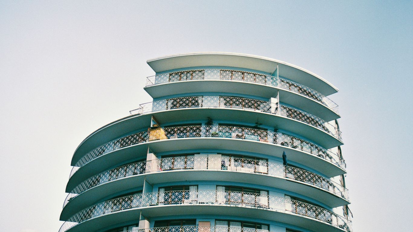
The Singapore Improvement Trust and the drive for better housing
The Singapore Improvement Trust, established under the colonial administration, was tasked with improving housing and urban conditions. Its work emerged from concerns about overcrowding, sanitation and the limitations of dense shophouse living. Tiong Bahru offered room to test low-rise flats with more generous planning and healthier circulation. The estate should therefore be understood not simply as a collection of attractive buildings, but as an early attempt to make housing a matter of public planning.
The estate’s development in the 1930s
The main pre-war estate took shape during the 1930s, with blocks built in stages rather than appearing all at once. Their scale was low by later public-housing standards, and their arrangement created a recognisable neighbourhood rather than a wall of continuous development. Early residents experienced a setting that was planned but not entirely anonymous. The blocks, roads and shared spaces gradually acquired meaning through repeated use.
Planning for light, ventilation and communal life
The estate’s planning responded to the tropical climate and to the social needs of households living close together. Windows, balconies, open corridors and spacing between blocks helped air and daylight reach homes. Communal circulation also made chance encounters part of daily life, whether residents were carrying groceries or pausing to talk. These details show how climate shaped domestic life as much as architectural fashion did.
What made Tiong Bahru different from the shophouse districts
Shophouses combined home, work and commerce within a narrow urban frontage, while Tiong Bahru separated many of those functions into a planned estate. The blocks were set back, lower and more visibly shaped by concerns about airflow and open space. That difference did not erase community; it relocated community into corridors, stairwells, markets and nearby shops. A useful comparison can be found in this account of old shophouse life, where shared domestic and commercial space worked differently.
Reading Tiong Bahru through its architecture
Tiong Bahru’s architecture rewards a slow walk. Its forms are often associated with Art Moderne or streamlined modernism, yet the buildings also belong to a distinctly tropical and local setting. Rounded corners, horizontal lines and low roofs meet practical features such as staircases, balconies and breezeways. The estate’s appearance is memorable not because it is frozen in one style, but because several intentions remain visible at once.
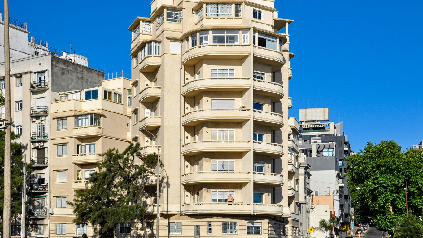
Streamlined modernism in the curved blocks
The curved blocks soften the visual authority of large buildings and help create a sense of movement along the streets. Long horizontal bands, rounded ends and flat roofs give the estate its familiar silhouette. These features were modern in their period, but they were never detached from function: shade, circulation and ventilation mattered alongside appearance. The architecture is best read as an arrangement of practical choices with a strong visual identity.
Five-foot ways, staircases and shared corridors
Shared circulation gave residents repeated contact with neighbours. Staircases were not merely routes between floors; they were places where children waited, adults exchanged news and household tasks briefly met public life. Corridors offered a threshold between the privacy of the flat and the wider estate. Their significance is easy to miss when viewed only from the street, yet they held much of the social texture of the housing experiment.
Air wells, balconies and other responses to the tropical climate
Air wells and balconies helped bring light and air into buildings while giving residents small extensions of domestic space. Such features also created visual connections between households, allowing the weather and the activity of neighbours to enter everyday awareness. The architecture did not promise complete separation from the outside world. Instead, it made a carefully negotiated relationship between shelter, shade and shared life.
How later additions altered the original visual character
Post-war construction, redevelopment and infrastructure changed the balance of the original estate. Newer blocks introduced different heights, materials and patterns of movement, while commercial changes altered the streetscape at ground level. The older buildings remain legible, but they now sit within a denser and more varied urban setting. This layered quality is part of the neighbourhood’s reality, not a flaw to be edited away; the Art Deco estate guide offers another route into those architectural details.
Markets, food and the everyday neighbourhood
A housing estate becomes a neighbourhood through repeated acts of provision: buying vegetables, collecting breakfast, greeting a familiar stallholder and carrying food home. Tiong Bahru Market has long helped organise those routines, even as its building and surroundings have changed. Food here is not a decorative afterthought to architecture. It is a record of migration, work, taste and the practical negotiations of urban life.
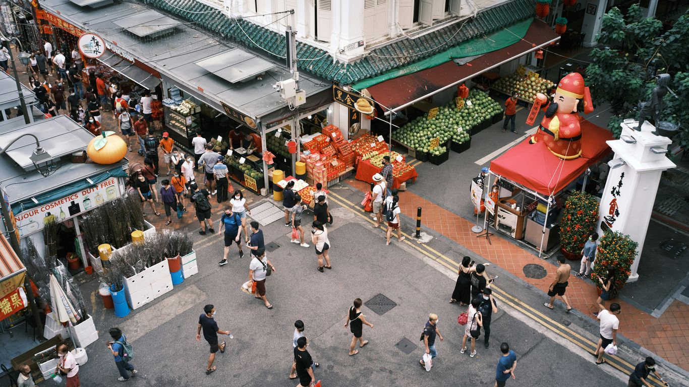
The role of Tiong Bahru Market in daily routines
A market gives a planned estate a daily centre of gravity. Residents can meet household needs close to home, while hawkers and vendors create a reason to linger beyond the brief exchange of money and goods. The market’s importance comes from this dependable repetition rather than from any single famous dish. Its sounds, smells and informal greetings help turn a group of flats into a place with a shared rhythm.
Hawker food as a record of migration and taste
Hawker food carries the movement of people across Singapore and the region. Recipes adapt to available ingredients, changing customers and the skills brought by individual cooks. Dishes associated with Tiong Bahru, including lor mee, chwee kueh and Hokkien mee, belong to this living process rather than to a fixed museum display. To understand the food is to notice labour, apprenticeship and the preferences of generations of customers.
Provision shops, wet markets and small-scale commerce
Small shops made the estate workable between larger shopping trips. A provision shop, coffee stall or wet-market counter supplied not only goods but also local knowledge: which household needed help, which ingredient was in season and when a familiar customer had not appeared. These businesses operated as informal information networks. The material culture of such places can be explored through kopitiam objects, where cups, tables and order slips become evidence of working history.
The neighbourhood’s everyday economy can be sketched through a few recurring forms of exchange:
- Fresh food bought in small quantities for the day.
- Breakfast and drinks shared before work or school.
- Informal credit and recognition between regular customers and shopkeepers.
- Repairs, errands and small services handled close to home.
These activities mattered because they reduced distance and increased familiarity. They also made the market district a place where different generations could encounter one another without needing a formal community programme.
How residents used the estate’s streets and communal spaces
Residents used streets and open areas flexibly, adapting them to weather, age and occasion. Children found room for play, older people paused in shaded corners and families moved between flats, shops and market stalls in routes that became habitual. The estate’s communal life was often quiet and practical. Its strength lay in being woven into ordinary days rather than performed for visitors.
Wartime disruption and post-war change
War interrupted the steady formation of the estate and unsettled the routines that made it feel secure. The Japanese Occupation brought fear, shortages and displacement, while the post-war years brought renewed pressure for homes and services. Tiong Bahru did not simply return to its pre-war condition. Residents rebuilt routines within a city that was changing socially, economically and physically.
The Japanese Occupation and its impact on local life
The Japanese Occupation affected food supplies, work, movement and family life across Singapore, including established housing areas. Residents had to negotiate scarcity and uncertainty, often relying on relatives and neighbours when formal systems were strained. Buildings that had been designed as symbols of improvement became settings for wartime survival. Their walls could shelter people, but they could not preserve the earlier assumptions of stability.
Returning residents and the rebuilding of routines
After the war, returning residents faced damaged livelihoods and altered households. Re-establishing routines meant finding food, work, schooling and familiar social ties, sometimes under difficult conditions. Markets and local shops were especially important because they restored practical connections quickly. Recovery was therefore measured in ordinary acts: a meal prepared, a child sent to school or a neighbour recognised again on the stairs.
New housing pressures after the Second World War
Singapore’s housing shortage grew more acute after the war, and older estates could not meet every demand. Additional flats and later developments changed the scale and composition of Tiong Bahru. The estate became less of a limited experiment and more of one part of a wider housing system. Its post-war history belongs to the story of expansion as much as to the preservation of its earliest blocks.
How the estate evolved as Singapore modernised
As transport, employment and public services developed, Tiong Bahru was drawn more tightly into the metropolitan network. New roads and housing forms altered how residents moved and where they shopped, while older buildings continued to anchor memory. Modernisation did not remove the estate’s past, but it made that past harder to see without attention. The neighbourhood’s character now comes from the meeting of inherited form and continuing use.
Memories held by residents
Buildings can show where people lived, but residents can explain how those places felt. Memories of Tiong Bahru often centre on routes, voices and small permissions: which corridor was safe for play, whose door was open and where a school run paused. Such recollections complicate the neat story of architecture. They reveal a neighbourhood made through relationships as much as through planning.
Childhood, school runs and informal play
For many residents, childhood was organised by short journeys through the estate. A staircase, covered walkway or market corner could become part of a daily map understood long before a child knew the official street names. Play was often informal, shaped by the spaces available rather than by purpose-built facilities. These memories give scale to the blocks, showing how children experienced them from below, between errands and school.
Family networks across blocks and corridors
Families often built networks that extended beyond one flat. Relatives lived nearby, neighbours watched children and domestic tasks moved between households when help was needed. Corridors supported this proximity without making every relationship formal. The estate’s closeness could be comforting, though it could also make privacy a continual negotiation.
Religious spaces, clubs and neighbourhood institutions
Religious places, schools, associations and informal clubs gave residents additional points of belonging. They connected the housing estate to wider cultural and family networks, while local institutions offered occasions for service, celebration and support. Their stories may not appear in architectural descriptions, yet they shaped who met whom and how trust was built. Community life was distributed across many modest locations.
What oral histories reveal that buildings cannot
Oral histories preserve timing, feeling and disagreement. One resident may remember a corridor as lively, while another recalls it as crowded; one family may describe the market as a daily meeting place, while another remembers it mainly as work. These differences are valuable because they resist turning the estate into a single nostalgic image. Singapore Heritage’s community memory work reflects the wider value of consent, credit and access when everyday stories are collected.
From public housing estate to heritage neighbourhood
Tiong Bahru is now widely recognised for its early housing and distinctive architecture, but heritage status has not brought the story to a neat close. Conservation protects important buildings while new businesses and visitors alter how the streets are used and imagined. The neighbourhood remains a home first, with heritage activity taking place around residents’ ordinary needs. That tension is not a side issue; it is central to the estate’s present meaning.
Conservation and the recognition of Tiong Bahru’s architectural value
Conservation drew attention to the estate’s low-rise blocks, curved forms and planning history. It helped ensure that buildings associated with an early phase of public housing would not be treated as disposable simply because newer construction was possible. Recognition also encouraged closer attention to details that residents had long taken for granted. Yet architectural protection works best when it sits alongside care for the people and activities that give those buildings life.
The arrival of independent shops and creative businesses
Independent shops and creative businesses brought new customers and a different visual vocabulary to the estate. Some introduced fresh uses for old commercial units, while others relied on the atmosphere created by the surviving architecture. Their arrival added energy, but it also changed expectations about what the neighbourhood was for. A place once defined mainly by residents’ routines became increasingly legible to outsiders as a destination.
How cafés reshaped the estate’s public image
Cafés helped make Tiong Bahru shorthand for a certain kind of urban cool, especially from the mid-2000s onwards. Their menus, interiors and photography circulated the estate far beyond its immediate streets. That image is only one layer of the neighbourhood, and it can obscure the market workers, long-term tenants and older businesses that sustained it. A walk should therefore include living neighbourhood stories, not only the most photographed façades.
Balancing living heritage with tourism and gentrification
Tourism can bring attention and income, but it can also place pressure on rents, privacy and everyday use. Visitors who slow down, buy from local businesses and avoid treating residential spaces as scenery are more likely to support a living neighbourhood. The balance requires listening to residents rather than assuming that visibility is always beneficial. Singapore Heritage’s heritage walks invite that more attentive kind of encounter, where stories remain connected to place and people.
Explore Tiong Bahru Differently
A guided, story-led walk can add the voices, foodways and small details that a self-guided circuit may miss. Singapore Heritage offers heritage tours across Singapore, including routes shaped around neighbourhood history and everyday community life; readers can book a heritage walk when they want to encounter Tiong Bahru with more context.
Conclusion
Tiong Bahru’s history is held in more than its curved blocks: it lives in market routines, wartime recollections, family networks and the continuing negotiation between home and destination. The cafés are part of that story, but they are not its beginning or its whole. To understand the estate is to notice how planning becomes lived experience, and how memory keeps changing with the neighbourhood itself.
Frequently Asked Questions
What does “Tiong Bahru” mean?
The name is commonly understood as “new cemetery”, combining a Hokkien reference to a tomb or cemetery with the Malay word bahru, meaning new.
Why is Tiong Bahru historically important?
It is significant for its early planned housing, its association with the Singapore Improvement Trust and its distinctive pre-war architecture.
When was the main Tiong Bahru estate built?
The principal early estate was developed during the 1930s, with buildings completed in stages before the Second World War.
What architectural features are associated with Tiong Bahru?
Visitors commonly notice rounded corners, horizontal lines, flat roofs, balconies, open circulation and low-rise blocks shaped partly by the tropical climate.
Why is Tiong Bahru Market important?
The market supports daily shopping and eating while preserving forms of hawker and small-scale commerce that help define neighbourhood life.
How did the Second World War affect Tiong Bahru?
The Japanese Occupation disrupted food supplies, work, movement and family routines, while the post-war period brought rebuilding and increased housing pressure.
Is Tiong Bahru still a residential neighbourhood?
Yes. Although cafés, shops and visitors have changed its public image, the estate remains a lived residential area with long-term residents and everyday local routines.